Estimated Value: $499,954 - $800,000
--
Bed
--
Bath
--
Sq Ft
6,186
Sq Ft Lot
About This Home
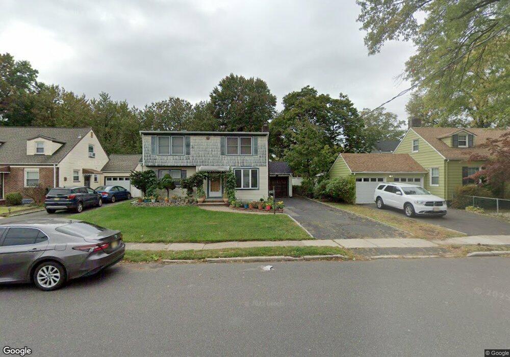
This home is located at 2656 Burns Place, Union, NJ 07083 and is currently estimated at $631,489. 2656 Burns Place is a home located in Union County with nearby schools including Battle Hill Elementary School, Burnet Middle School, and Union High School.
Ownership History
Date
Name
Owned For
Owner Type
Purchase Details
Closed on
Oct 9, 2009
Sold by
Keith Patricia
Bought by
Amin Jemin and Amin Barindra
Current Estimated Value
Home Financials for this Owner
Home Financials are based on the most recent Mortgage that was taken out on this home.
Original Mortgage
$299,000
Outstanding Balance
$194,252
Interest Rate
5.14%
Mortgage Type
New Conventional
Estimated Equity
$437,237
Purchase Details
Closed on
Jul 23, 1996
Sold by
Somma Antonio and Somma Theresa
Bought by
Keith Thomas and Smith Patricia
Create a Home Valuation Report for This Property
The Home Valuation Report is an in-depth analysis detailing your home's value as well as a comparison with similar homes in the area
Home Values in the Area
Average Home Value in this Area
Purchase History
| Date | Buyer | Sale Price | Title Company |
|---|---|---|---|
| Amin Jemin | $374,000 | Commonwealth Land Title Insu | |
| Keith Thomas | $189,000 | -- |
Source: Public Records
Mortgage History
| Date | Status | Borrower | Loan Amount |
|---|---|---|---|
| Open | Amin Jemin | $299,000 |
Source: Public Records
Tax History Compared to Growth
Tax History
| Year | Tax Paid | Tax Assessment Tax Assessment Total Assessment is a certain percentage of the fair market value that is determined by local assessors to be the total taxable value of land and additions on the property. | Land | Improvement |
|---|---|---|---|---|
| 2025 | $11,958 | $53,500 | $20,600 | $32,900 |
| 2024 | $11,593 | $53,500 | $20,600 | $32,900 |
| 2023 | $11,593 | $53,500 | $20,600 | $32,900 |
| 2022 | $11,190 | $53,500 | $20,600 | $32,900 |
| 2021 | $10,919 | $53,500 | $20,600 | $32,900 |
| 2020 | $10,701 | $53,500 | $20,600 | $32,900 |
| 2019 | $10,557 | $53,500 | $20,600 | $32,900 |
| 2018 | $10,377 | $53,500 | $20,600 | $32,900 |
| 2017 | $10,224 | $53,500 | $20,600 | $32,900 |
| 2016 | $9,975 | $53,500 | $20,600 | $32,900 |
| 2015 | $9,809 | $53,500 | $20,600 | $32,900 |
| 2014 | $9,589 | $53,500 | $20,600 | $32,900 |
Source: Public Records
Map
Nearby Homes
- 2641 Burns Place
- 2615 Burns Place
- 2 Bashford-B Unit B
- 8 Bashford Ave Unit 8
- 2620 Eleanor Terrace
- 2636 Frederick Terrace
- 1071 Battle Hill Terrace
- 980 Moessner Ave
- 2505 Girard Place
- 1042 Battle Hill Terrace
- 2785 Larchmont Rd
- 960 Moessner Ave
- 2535 Standish Ave
- 1066 Mayfair Rd
- 1114 Elker Rd
- 1080 Gruber Ave
- 1239 Rony Rd
- 2510 Crane Place
- 1163 Burnet Ave
- 1214 Carlton Terrace
- 2650 Burns Place
- 1079 Liberty Ave
- 1085 Liberty Ave
- 2646 Burns Place
- 1073 Liberty Ave
- 1069 Liberty Ave
- 2655 Burns Place
- 2651 Burns Place
- 2659 Burns Place
- 2647 Burns Place
- 1095 Liberty Ave
- 1065 Liberty Ave
- 2638 Burns Place
- 2702 Carol Rd
- 2643 Burns Place
- 1058 Creger Ave
- 1059 Liberty Ave
- 1084 Liberty Ave
- 1080 Liberty Ave
- 2634 Burns Place