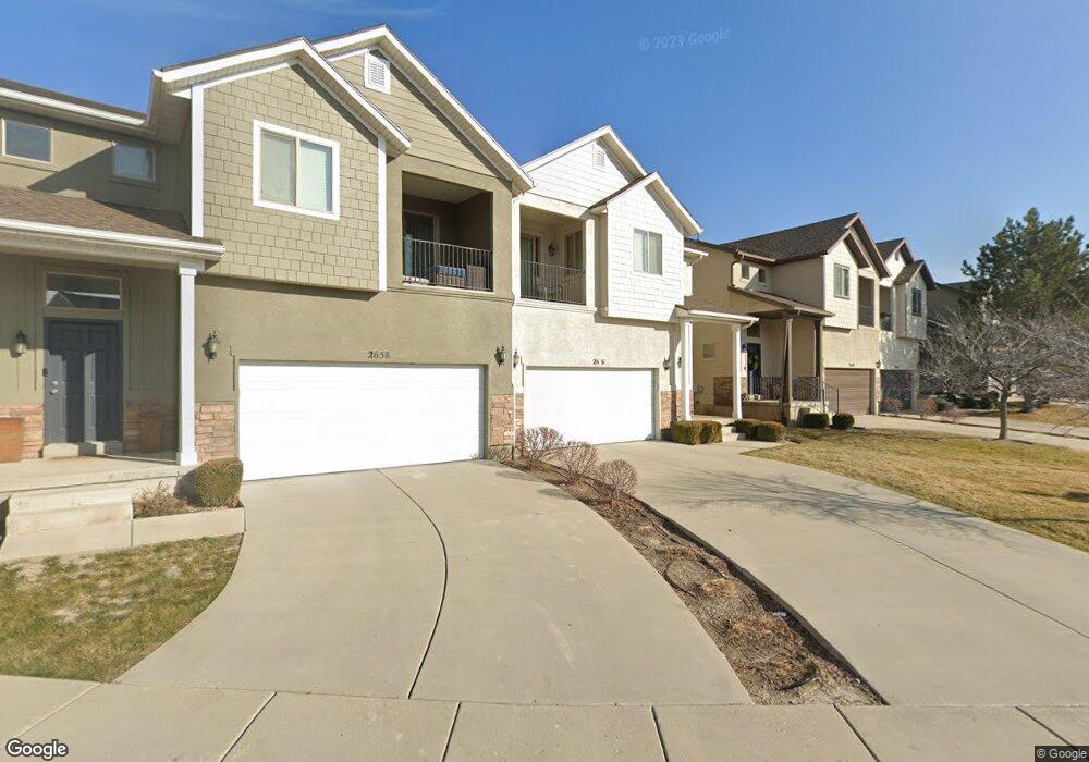
2656 N Cypress Way Unit 19 Lehi, UT 84043
Thanksgiving NeighborhoodEstimated Value: $463,000 - $514,606
3
Beds
4
Baths
2,650
Sq Ft
$181/Sq Ft
Est. Value
About This Home
This home is located at 2656 N Cypress Way Unit 19, Lehi, UT 84043 and is currently estimated at $479,652, approximately $181 per square foot. 2656 N Cypress Way Unit 19 is a home located in Utah County with nearby schools including Liberty Hills Elementary School, Skyridge High School, and Ascent Academies of Utah - Lehi Campus.
Ownership History
Date
Name
Owned For
Owner Type
Purchase Details
Closed on
Apr 1, 2014
Sold by
Baxter Carl
Bought by
Baxter Carl and Baxter Michelle
Current Estimated Value
Purchase Details
Closed on
Apr 6, 2007
Sold by
Thanksgiving Ridge Llc
Bought by
Mcconnell Misty
Home Financials for this Owner
Home Financials are based on the most recent Mortgage that was taken out on this home.
Original Mortgage
$214,700
Outstanding Balance
$130,170
Interest Rate
6.2%
Mortgage Type
New Conventional
Estimated Equity
$349,482
Purchase Details
Closed on
Apr 4, 2007
Sold by
G & J Construction Inc
Bought by
Thanksgiving Ridge Llc
Home Financials for this Owner
Home Financials are based on the most recent Mortgage that was taken out on this home.
Original Mortgage
$214,700
Outstanding Balance
$130,170
Interest Rate
6.2%
Mortgage Type
New Conventional
Estimated Equity
$349,482
Create a Home Valuation Report for This Property
The Home Valuation Report is an in-depth analysis detailing your home's value as well as a comparison with similar homes in the area
Home Values in the Area
Average Home Value in this Area
Purchase History
| Date | Buyer | Sale Price | Title Company |
|---|---|---|---|
| Baxter Carl | -- | Accommodation | |
| Mcconnell Misty | -- | Affiliated First Title Comp | |
| Thanksgiving Ridge Llc | -- | Affiliated First Title Comp |
Source: Public Records
Mortgage History
| Date | Status | Borrower | Loan Amount |
|---|---|---|---|
| Open | Mcconnell Misty | $214,700 | |
| Closed | Thanksgiving Ridge Llc | $40,200 |
Source: Public Records
Tax History Compared to Growth
Tax History
| Year | Tax Paid | Tax Assessment Tax Assessment Total Assessment is a certain percentage of the fair market value that is determined by local assessors to be the total taxable value of land and additions on the property. | Land | Improvement |
|---|---|---|---|---|
| 2025 | $2,231 | $248,655 | $66,500 | $385,600 |
| 2024 | $2,231 | $261,030 | $0 | $0 |
| 2023 | $2,027 | $257,510 | $0 | $0 |
| 2022 | $1,843 | $227,040 | $0 | $0 |
| 2021 | $1,732 | $322,500 | $83,000 | $239,500 |
| 2020 | $1,701 | $313,100 | $83,000 | $230,100 |
| 2019 | $1,494 | $285,900 | $83,000 | $202,900 |
| 2018 | $1,580 | $285,900 | $83,000 | $202,900 |
| 2017 | $1,532 | $147,345 | $0 | $0 |
| 2016 | $1,414 | $126,170 | $0 | $0 |
| 2015 | $1,415 | $119,900 | $0 | $0 |
| 2014 | $1,254 | $105,600 | $0 | $0 |
Source: Public Records
Map
Nearby Homes
- 2673 N Double Eagle Dr
- 2464 W 2250 N
- 2669 N Turnberry Ct
- 2189 N 2600 W
- 2886 Desert Forest Ln
- 2196 N 2350 W
- 2419 N 3130 W
- 3199 W 2450 N
- 3217 W 2450 N
- 3301 Cramden Dr
- 2424 N Lazy j Ln
- 2384 N Lazy j Ln
- 2399 N 3370 W
- 1968 N 2040 W Unit 40
- 1969 N 2040 St W
- 2013 N 2040 W
- 1990 N 2040 W
- 1990 N 2040 W Unit 41
- Huntington Plan at Pioneer Meadows
- Silver Lake Plan at Pioneer Meadows
- 2656 N Cypress Way
- 2658 N Cypress Way
- 2658 N Cypress Way Unit 18
- 2640 N Cypress Way
- 2640 N Cypress Way Unit 20
- 2638 N Cypress Way
- 2638 N Cypress Way Unit 21
- 2661 N Elm Dr
- 2661 N Elm Dr Unit 32
- 2679 N Elm Dr
- 2679 N Elm Dr Unit 33
- 2659 N Elm Dr
- 2659 N Elm Dr Unit 31
- 2681 N Elm Dr
- 2657 N Elm Dr Unit 30
- 2630 N Cypress Way
- 2630 N Cypress Way Unit 22
- 2637 N Elm Dr
- 2637 N Elm Dr Unit 29
- 2628 N Cypress Way