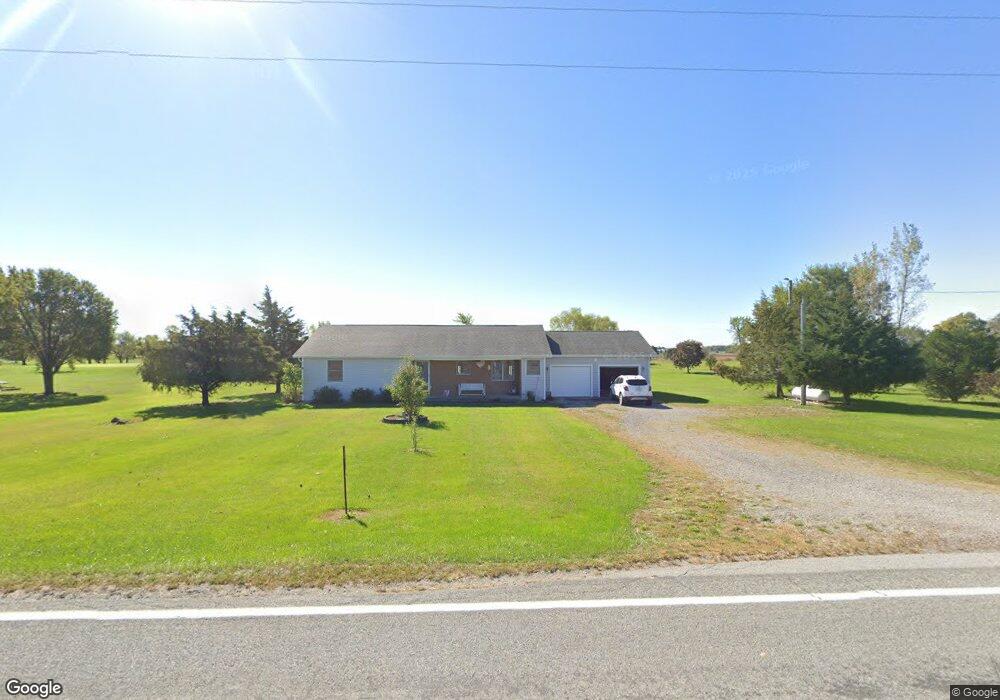
26562 State Route 67 Waynesfield, OH 45896
Estimated Value: $249,000 - $320,000
2
Beds
2
Baths
1,385
Sq Ft
$203/Sq Ft
Est. Value
About This Home
This home is located at 26562 State Route 67, Waynesfield, OH 45896 and is currently estimated at $281,001, approximately $202 per square foot. 26562 State Route 67 is a home located in Auglaize County with nearby schools including Waynesfield-Goshen Local Elementary School and Waynesfield-Goshen Local High School.
Ownership History
Date
Name
Owned For
Owner Type
Purchase Details
Closed on
Mar 28, 2019
Sold by
Linn Paul A
Bought by
Linn Ruth Ann
Current Estimated Value
Purchase Details
Closed on
Jun 21, 1995
Bought by
Linn Paul A and Ruth Ann
Create a Home Valuation Report for This Property
The Home Valuation Report is an in-depth analysis detailing your home's value as well as a comparison with similar homes in the area
Home Values in the Area
Average Home Value in this Area
Purchase History
| Date | Buyer | Sale Price | Title Company |
|---|---|---|---|
| Linn Ruth Ann | -- | None Available | |
| Linn Paul A | $6,000 | -- |
Source: Public Records
Tax History Compared to Growth
Tax History
| Year | Tax Paid | Tax Assessment Tax Assessment Total Assessment is a certain percentage of the fair market value that is determined by local assessors to be the total taxable value of land and additions on the property. | Land | Improvement |
|---|---|---|---|---|
| 2024 | $4,745 | $75,440 | $6,760 | $68,680 |
| 2023 | $2,314 | $75,440 | $6,760 | $68,680 |
| 2022 | $1,775 | $51,660 | $6,140 | $45,520 |
| 2021 | $1,764 | $51,660 | $6,140 | $45,520 |
| 2020 | $1,735 | $51,664 | $6,143 | $45,521 |
| 2019 | $1,356 | $43,050 | $5,117 | $37,933 |
| 2018 | $1,320 | $43,050 | $5,117 | $37,933 |
| 2017 | $1,316 | $43,050 | $5,117 | $37,933 |
| 2016 | $1,205 | $41,147 | $4,876 | $36,271 |
| 2015 | $1,204 | $41,147 | $4,876 | $36,271 |
| 2014 | $1,206 | $41,147 | $4,876 | $36,271 |
| 2013 | $1,338 | $41,147 | $4,876 | $36,271 |
Source: Public Records
Map
Nearby Homes
- 25836 Ohio 67
- 202 W Mulberry St
- 105 Guthrie St
- 8150 Amherst Rd
- 22275 Buckland Holden Rd
- 5065 Amherst Rd
- 0 Ohio 235
- 20630 State Route 67
- 13793 Ohio 235 Unit 75
- 11352 N Township Road 88
- 12102 Shannon Dr Unit 89
- 12015 Holly Dr
- 11524 Powhatan Path
- 11496 Powhatan Path
- 11579 Cooper Ave
- 11588 Blackhawk Path
- 13501 Eagle Path
- 11773 Sunview Ave
- 11372 Kickapoo Path
- 11161 Macalpine Way
- 26622 State Route 67
- 26534 State Route 67
- 26531 State Route 67
- 26414 State Route 67
- 26770 State Route 67
- 26938 State Route 67
- 16895 Pepple Rd
- 16849 Pepple Rd
- 16791 Pepple Rd
- 16755 Pepple Rd
- 16718 Pepple Rd
- 27128 Ohio 67
- 16557 Pepple Rd
- 16730 State Route 196
- 27251 State Route 67
- 16547 State Route 196
- 27388 State Route 67
- 26685 Focht Rd
- 25702 State Route 67
- 17806 Moyer Rd