Estimated Value: $449,979 - $493,000
4
Beds
2
Baths
2,245
Sq Ft
$208/Sq Ft
Est. Value
About This Home
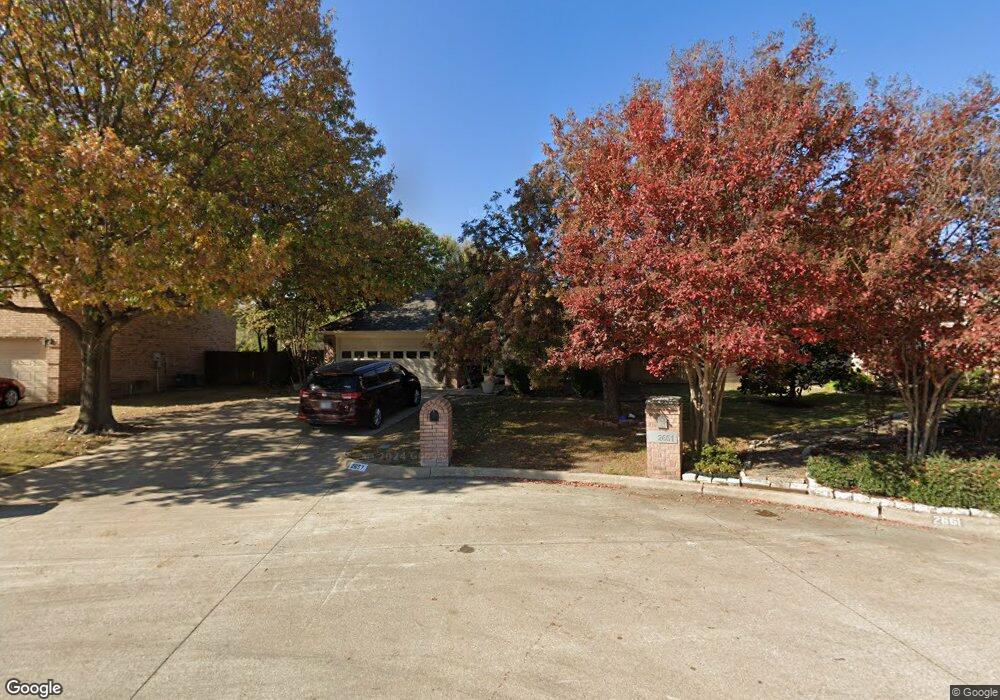
This home is located at 2657 Bent Tree Dr, Hurst, TX 76054 and is currently estimated at $467,995, approximately $208 per square foot. 2657 Bent Tree Dr is a home located in Tarrant County with nearby schools including Walker Creek Elementary School, Smithfield Middle School, and Birdville High School.
Ownership History
Date
Name
Owned For
Owner Type
Purchase Details
Closed on
Mar 18, 2020
Sold by
Crabb Lawrence W
Bought by
Kalmoe Russell A
Current Estimated Value
Home Financials for this Owner
Home Financials are based on the most recent Mortgage that was taken out on this home.
Original Mortgage
$309,700
Outstanding Balance
$273,761
Interest Rate
3.4%
Mortgage Type
Unknown
Estimated Equity
$194,234
Purchase Details
Closed on
Jul 9, 2007
Sold by
Crabb Jerry P and Crabb Krist L
Bought by
Crabb Lawrence W
Home Financials for this Owner
Home Financials are based on the most recent Mortgage that was taken out on this home.
Original Mortgage
$185,250
Interest Rate
6.41%
Mortgage Type
Purchase Money Mortgage
Purchase Details
Closed on
Aug 27, 2001
Sold by
Newman Lewis E and Newman Karen L
Bought by
Crabb Jerry P and Crabb Krist L
Home Financials for this Owner
Home Financials are based on the most recent Mortgage that was taken out on this home.
Original Mortgage
$170,900
Interest Rate
9.12%
Purchase Details
Closed on
Mar 25, 1999
Sold by
Pyron Thomas Spalding
Bought by
Newman Lewis E and Newman Karen L
Home Financials for this Owner
Home Financials are based on the most recent Mortgage that was taken out on this home.
Original Mortgage
$129,600
Interest Rate
6.82%
Purchase Details
Closed on
Oct 25, 1996
Sold by
Dissmore Enterprises Inc
Bought by
Pyron Thomas Spalding
Home Financials for this Owner
Home Financials are based on the most recent Mortgage that was taken out on this home.
Original Mortgage
$121,500
Interest Rate
8.15%
Purchase Details
Closed on
Apr 2, 1996
Sold by
Herman Smith & Co Ltd
Bought by
Dissmore Enterprises Inc
Home Financials for this Owner
Home Financials are based on the most recent Mortgage that was taken out on this home.
Original Mortgage
$94,400
Interest Rate
7.42%
Mortgage Type
Construction
Create a Home Valuation Report for This Property
The Home Valuation Report is an in-depth analysis detailing your home's value as well as a comparison with similar homes in the area
Home Values in the Area
Average Home Value in this Area
Purchase History
| Date | Buyer | Sale Price | Title Company |
|---|---|---|---|
| Kalmoe Russell A | -- | None Available | |
| Crabb Lawrence W | -- | Commonwealth Land | |
| Crabb Jerry P | -- | -- | |
| Newman Lewis E | -- | -- | |
| Pyron Thomas Spalding | -- | Safeco Land Title | |
| Dissmore Enterprises Inc | -- | Safeco Land Title |
Source: Public Records
Mortgage History
| Date | Status | Borrower | Loan Amount |
|---|---|---|---|
| Open | Kalmoe Russell A | $309,700 | |
| Previous Owner | Crabb Lawrence W | $185,250 | |
| Previous Owner | Crabb Jerry P | $170,900 | |
| Previous Owner | Newman Lewis E | $129,600 | |
| Previous Owner | Pyron Thomas Spalding | $121,500 | |
| Previous Owner | Dissmore Enterprises Inc | $94,400 | |
| Closed | Newman Lewis E | $24,300 | |
| Closed | Crabb Jerry P | $9,495 |
Source: Public Records
Tax History
| Year | Tax Paid | Tax Assessment Tax Assessment Total Assessment is a certain percentage of the fair market value that is determined by local assessors to be the total taxable value of land and additions on the property. | Land | Improvement |
|---|---|---|---|---|
| 2025 | $7,115 | $400,000 | $65,000 | $335,000 |
| 2024 | $7,115 | $400,000 | $65,000 | $335,000 |
| 2023 | $8,314 | $387,398 | $65,000 | $322,398 |
| 2022 | $8,177 | $330,728 | $45,000 | $285,728 |
| 2021 | $8,560 | $330,000 | $45,000 | $285,000 |
| 2020 | $6,553 | $255,000 | $45,000 | $210,000 |
| 2019 | $6,702 | $255,000 | $45,000 | $210,000 |
| 2018 | $6,444 | $245,155 | $45,000 | $200,155 |
| 2017 | $6,568 | $246,119 | $45,000 | $201,119 |
| 2016 | $6,381 | $239,130 | $40,000 | $199,130 |
| 2015 | $5,786 | $215,700 | $25,000 | $190,700 |
| 2014 | $5,786 | $215,700 | $25,000 | $190,700 |
Source: Public Records
Map
Nearby Homes
- 748 Regency Dr
- 712 Springhill Dr
- 2741 Naples Dr
- 2620 Brookridge Dr
- 753 Toni Dr
- 2244 Hurstview Dr
- 500 Quail Cove Ct
- 2221 Farrington Ln
- 505 Springhill Dr
- 6400 Rogers Dr
- 2838 Summerdale Dr
- 6350 Rogers Dr
- 2925 Ridgewood Dr
- 2157 Lookout Ct
- 9120 Nob Hill Dr
- 8920 Martin Dr
- 2201 Mountainview Dr
- 6704 Nob Hill Ct
- 6708 Nob Hill Ct
- 617 Indian Trail
- 2653 Bent Tree Dr
- 2661 Bent Tree Dr
- 708 Highstar Ct
- 712 Highstar Ct
- 704 Highstar Ct
- 700 Highstar Ct
- 2688 Bent Tree Dr
- 716 Highstar Ct
- 2684 Bent Tree Dr
- 2680 Bent Tree Dr
- 700 Martin Rd
- 2701 Fox Glenn Ct
- 2676 Bent Tree Dr
- 704 Martin Rd
- 2672 Bent Tree Dr
- 705 Highstar Ct
- 709 Highstar Ct
- 720 Highstar Ct
- 701 Highstar Ct
- 2705 Fox Glenn Ct
Your Personal Tour Guide
Ask me questions while you tour the home.