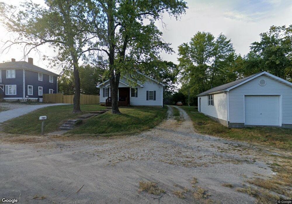
2657 Highway 100 Gray Summit, MO 63039
Estimated Value: $188,984 - $222,000
2
Beds
1
Bath
1,152
Sq Ft
$182/Sq Ft
Est. Value
About This Home
This home is located at 2657 Highway 100, Gray Summit, MO 63039 and is currently estimated at $209,246, approximately $181 per square foot. 2657 Highway 100 is a home located in Franklin County with nearby schools including Pacific High School and St Bridget Elementary School.
Ownership History
Date
Name
Owned For
Owner Type
Purchase Details
Closed on
Apr 4, 2022
Sold by
Hopper Ronald L and Hopper Sawn M
Bought by
Hopper Ronald Lee
Current Estimated Value
Home Financials for this Owner
Home Financials are based on the most recent Mortgage that was taken out on this home.
Original Mortgage
$123,500
Outstanding Balance
$116,135
Interest Rate
4.67%
Mortgage Type
New Conventional
Estimated Equity
$93,111
Purchase Details
Closed on
Dec 28, 2012
Sold by
Hopper Sandra K and Hopper Sandy K
Bought by
Hopper Sandra K
Home Financials for this Owner
Home Financials are based on the most recent Mortgage that was taken out on this home.
Original Mortgage
$95,645
Interest Rate
3.34%
Mortgage Type
FHA
Create a Home Valuation Report for This Property
The Home Valuation Report is an in-depth analysis detailing your home's value as well as a comparison with similar homes in the area
Home Values in the Area
Average Home Value in this Area
Purchase History
We collect this data history from publicly available records. To have your information removed, we recommend requesting removal directly through your county’s website.
| Date | Buyer | Sale Price | Title Company |
|---|---|---|---|
| Hopper Ronald Lee | -- | None Listed On Document | |
| Hopper Sandra K | -- | Clear Title Group |
Source: Public Records
Mortgage History
We collect this data history from publicly available records. To have your information removed, we recommend requesting removal directly through your county’s website.
| Date | Status | Borrower | Loan Amount |
|---|---|---|---|
| Open | Hopper Ronald Lee | $123,500 | |
| Previous Owner | Hopper Sandra K | $95,645 |
Source: Public Records
Tax History
| Year | Tax Paid | Tax Assessment Tax Assessment Total Assessment is a certain percentage of the fair market value that is determined by local assessors to be the total taxable value of land and additions on the property. | Land | Improvement |
|---|---|---|---|---|
| 2025 | $1,683 | $21,837 | $0 | $0 |
| 2024 | $1,683 | $21,322 | $0 | $0 |
| 2023 | $1,585 | $21,322 | $0 | $0 |
| 2022 | $1,210 | $18,704 | $0 | $0 |
| 2021 | $1,219 | $18,704 | $0 | $0 |
| 2020 | $1,174 | $17,205 | $0 | $0 |
| 2019 | $1,173 | $17,205 | $0 | $0 |
| 2018 | $1,119 | $16,162 | $0 | $0 |
| 2017 | $1,116 | $16,162 | $0 | $0 |
| 2016 | $1,126 | $16,200 | $0 | $0 |
| 2015 | $1,037 | $16,200 | $0 | $0 |
| 2014 | $1,037 | $16,412 | $0 | $0 |
Source: Public Records
Map
Nearby Homes
- 2215 Pine Lake Loop
- 344 Olympic Dr
- 1654 Missouri Ave
- 35, 36 Missouri Ave
- 993 Eastridge Dr
- 1003 Mitchell Way
- 409 Puetz Ln
- 430 Wilderness Trail
- 315 Puetz Ln
- 410 Oak Dr
- 1829 Ridge Ln
- 660 Iron Horse Trail
- 667 #9 Highlands Rd
- 668 #12 Highlands Ct Ct
- 652 Ct
- 64 Cedar Ridge Dr
- 2161 Young Rd
- 6827 Eagles Landing Ct
- 5270 Overview Dr
- 122 Winter Wheat Trail
- 2661 Highway 100
- 0 Hogan Rd Unit 80045495
- 0 Hogan & Washington Corner Unit 20050726
- 0 N Hogan Rd Unit 11027053
- 0 Hogan Rd Unit 12012681
- 0 Hogan Rd Unit 12035877
- 0 Hogan (N Service Outer Rd) Rd Unit 12042795
- 0 Hogan (N Service Outer Rd) Rd Unit 14018074
- 0 Hogan Rd Unit 90057292
- 0 Hogan (N Service Outer Rd) Rd Unit 13044385
- 0 Hogan Rd & Eastridge Unit 15028707
- 0 Hogan Rd & Eastridge Unit 16018823
- 187 Fire Tree Ln
- 189 Fire Tree Ln
- 2662 Highway 100
- 2658 Highway 100
- 2645 Highway 100
- 2639 Highway 100
- 196 Fire Tree Ln
- 3790 Highway Mm
Your Personal Tour Guide
Ask me questions while you tour the home.