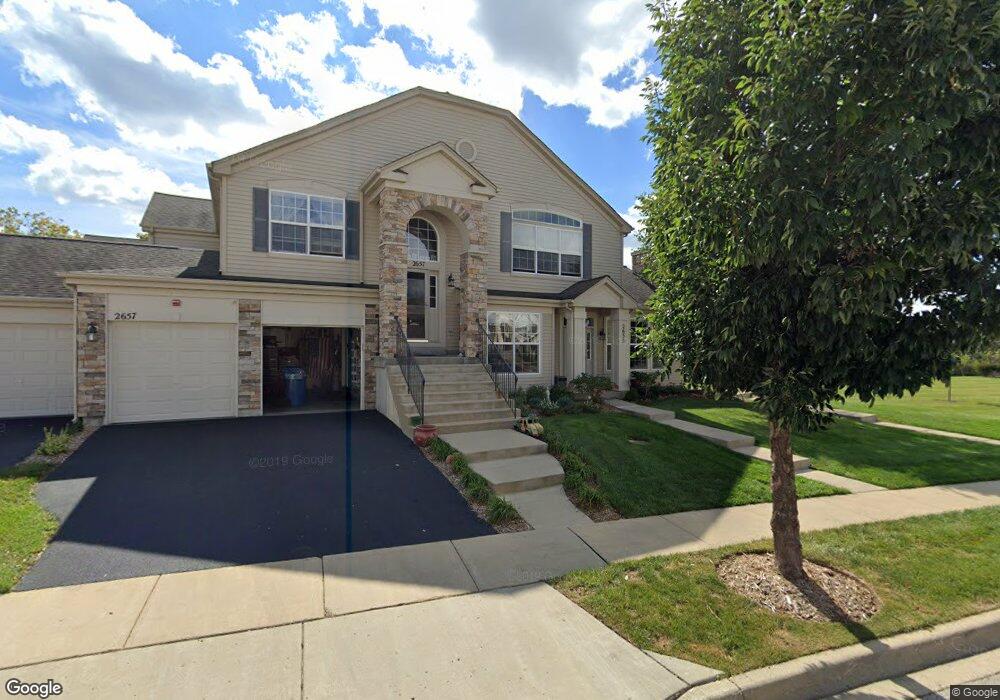
2657 Maple Cir Unit 4 West Dundee, IL 60118
Estimated Value: $308,506 - $396,000
2
Beds
--
Bath
1,985
Sq Ft
$175/Sq Ft
Est. Value
About This Home
This home is located at 2657 Maple Cir Unit 4, West Dundee, IL 60118 and is currently estimated at $347,877, approximately $175 per square foot. 2657 Maple Cir Unit 4 is a home located in Kane County with nearby schools including Dundee Highlands Elementary School, Dundee Middle School, and Harry D Jacobs High School.
Ownership History
Date
Name
Owned For
Owner Type
Purchase Details
Closed on
Feb 7, 2005
Sold by
Grand Pointe Meadows Llc
Bought by
Kolleng Edward H and Kolleng Rebecca A
Current Estimated Value
Home Financials for this Owner
Home Financials are based on the most recent Mortgage that was taken out on this home.
Original Mortgage
$213,092
Outstanding Balance
$108,525
Interest Rate
5.78%
Mortgage Type
New Conventional
Estimated Equity
$239,352
Create a Home Valuation Report for This Property
The Home Valuation Report is an in-depth analysis detailing your home's value as well as a comparison with similar homes in the area
Home Values in the Area
Average Home Value in this Area
Purchase History
| Date | Buyer | Sale Price | Title Company |
|---|---|---|---|
| Kolleng Edward H | $266,500 | Ticor Title Insurance Co |
Source: Public Records
Mortgage History
| Date | Status | Borrower | Loan Amount |
|---|---|---|---|
| Open | Kolleng Edward H | $213,092 | |
| Closed | Kolleng Edward H | $26,636 |
Source: Public Records
Tax History
| Year | Tax Paid | Tax Assessment Tax Assessment Total Assessment is a certain percentage of the fair market value that is determined by local assessors to be the total taxable value of land and additions on the property. | Land | Improvement |
|---|---|---|---|---|
| 2024 | $5,078 | $87,021 | $8,371 | $78,650 |
| 2023 | $5,331 | $78,299 | $7,532 | $70,767 |
| 2022 | $5,560 | $74,107 | $7,532 | $66,575 |
| 2021 | $5,780 | $69,972 | $7,112 | $62,860 |
| 2020 | $5,670 | $68,399 | $6,952 | $61,447 |
| 2019 | $5,478 | $64,932 | $6,600 | $58,332 |
| 2018 | $4,955 | $57,951 | $6,469 | $51,482 |
| 2017 | $5,039 | $57,653 | $6,051 | $51,602 |
| 2016 | $5,129 | $55,822 | $5,859 | $49,963 |
| 2015 | -- | $49,995 | $5,490 | $44,505 |
| 2014 | -- | $48,614 | $5,338 | $43,276 |
| 2013 | -- | $53,426 | $5,501 | $47,925 |
Source: Public Records
Map
Nearby Homes
- 1358 Karen Dr
- 2727 Acorn Ct Unit 4
- 2725 Acorn Ct Unit 3
- 1403 Karen Dr
- 1146 Pember Cir Unit 2
- 1107 Pember Cir Unit 2
- 36W340 Huntley Rd
- 2660 Chesire Ct
- 1601 Higgins Rd
- 2737 Winton Ct
- 817 Lindsay Ln
- 809 Lindsay Ln
- 815 Lindsay Ln
- 850 Tartans Dr
- 1811 W Main St
- 6850 Huntley Rd
- lot 009 Huntley Rd
- 8007 Sierra Woods Ln Unit 8007
- 822 Lindsay Ln
- 816 Lindsay Ln
- 2655 Maple Cir Unit 3
- 2653 Maple Cir Unit 2
- 2655 Maple Cir Unit 2655
- 2651 Maple Cir Unit 1
- 2635 Maple Cir
- 2633 Maple Cir Unit 2
- 2637 Maple Cir Unit 4
- 2616 Maple Cir Unit 3
- 2612 Maple Cir Unit 1
- 2614 Maple Cir Unit 2
- 2675 Maple Cir Unit 3
- 2671 Maple Cir Unit 1
- 2673 Maple Cir Unit 2
- 2677 Maple Cir Unit 4
- 2677 Maple Cir Unit 2677
- 2622 Maple Cir Unit 1
- 2628 Maple Cir Unit 4
- 2624 Maple Cir Unit 2
- 2626 Maple Cir Unit 3
- 2597 Oak Dr Unit 3
Your Personal Tour Guide
Ask me questions while you tour the home.