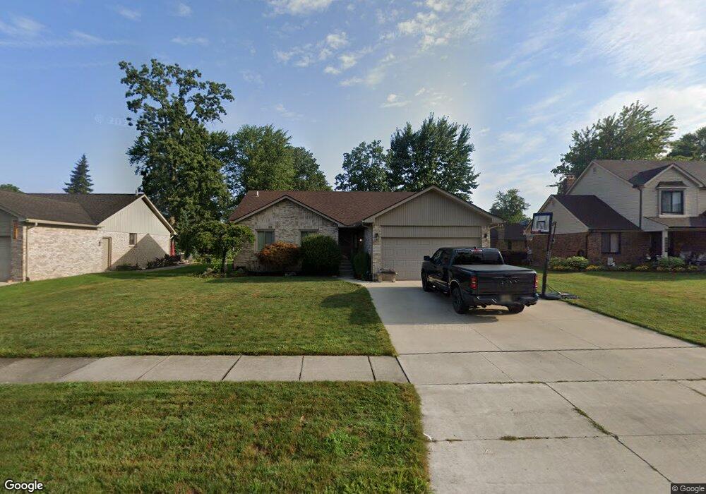
26579 Birchcrest Dr Chesterfield, MI 48051
Estimated Value: $296,243 - $353,000
--
Bed
1
Bath
1,539
Sq Ft
$213/Sq Ft
Est. Value
About This Home
This home is located at 26579 Birchcrest Dr, Chesterfield, MI 48051 and is currently estimated at $328,561, approximately $213 per square foot. 26579 Birchcrest Dr is a home located in Macomb County with nearby schools including Green Elementary School, L'Anse Creuse Middle School - North, and L'Anse Creuse High School - North.
Ownership History
Date
Name
Owned For
Owner Type
Purchase Details
Closed on
Jan 17, 2006
Sold by
Zarzycki Scott V
Bought by
Zarzycki Scott V and Zarzycki Kimberly K
Current Estimated Value
Home Financials for this Owner
Home Financials are based on the most recent Mortgage that was taken out on this home.
Original Mortgage
$173,150
Interest Rate
6.62%
Mortgage Type
Fannie Mae Freddie Mac
Create a Home Valuation Report for This Property
The Home Valuation Report is an in-depth analysis detailing your home's value as well as a comparison with similar homes in the area
Home Values in the Area
Average Home Value in this Area
Purchase History
| Date | Buyer | Sale Price | Title Company |
|---|---|---|---|
| Zarzycki Scott V | -- | None Available | |
| Zarzycki Scott V | $216,480 | None Available |
Source: Public Records
Mortgage History
| Date | Status | Borrower | Loan Amount |
|---|---|---|---|
| Previous Owner | Zarzycki Scott V | $173,150 | |
| Previous Owner | Zarzycki Scott V | $43,300 |
Source: Public Records
Tax History Compared to Growth
Tax History
| Year | Tax Paid | Tax Assessment Tax Assessment Total Assessment is a certain percentage of the fair market value that is determined by local assessors to be the total taxable value of land and additions on the property. | Land | Improvement |
|---|---|---|---|---|
| 2025 | $3,003 | $145,100 | $0 | $0 |
| 2024 | $2,056 | $136,300 | $0 | $0 |
| 2023 | $1,950 | $126,600 | $0 | $0 |
| 2022 | $2,717 | $119,000 | $0 | $0 |
| 2021 | $2,643 | $109,700 | $0 | $0 |
| 2020 | $1,790 | $105,000 | $0 | $0 |
| 2019 | $2,397 | $99,300 | $0 | $0 |
| 2018 | $2,576 | $98,200 | $13,500 | $84,700 |
| 2017 | $2,543 | $90,850 | $13,550 | $77,300 |
| 2016 | $2,397 | $90,850 | $0 | $0 |
| 2015 | $1,024 | $84,300 | $0 | $0 |
| 2014 | $1,024 | $73,950 | $13,550 | $60,400 |
| 2012 | -- | $0 | $0 | $0 |
Source: Public Records
Map
Nearby Homes
- 26607 Birchcrest Dr
- 47608 Ramblewood Dr
- 53283 Woodland Dr
- 53179 Woodland Dr
- 53197 Woodland Dr
- 53184 Woodland Dr
- 26207 Fairwood Dr
- 26331 Wacker Dr
- 26161 Birchcrest Dr
- 26112 Birchcrest Dr
- 47579 Valleybrook Dr
- 48270 Applegrove Ln
- 48075 Meadow Ln
- 48358 Applegrove Ln Unit 31, Building 8
- 26123 Joanne Smith Ln
- 48382 Applegrove Ln Unit 8
- 48341 Applegrove Ln Unit 11
- 48365 Applegrove Ln Unit 14
- 48381 Applegrove Ln Unit 16
- 48530 Gratiot Ave
- 26551 Birchcrest Dr
- 47801 Westbrook Ct
- 26635 Birchcrest Dr
- 26523 Birchcrest Dr
- 47772 Westbrook Ct
- 47774 Applewood Dr
- 26582 Birchcrest Dr
- 26554 Birchcrest Dr
- 26610 Birchcrest Dr
- 47802 Applewood Dr
- 26663 Birchcrest Dr
- 26526 Birchcrest Dr
- 26638 Birchcrest Dr
- 47800 Westbrook Ct
- 47829 Westbrook Ct
- 26449 Birchcrest Dr
- 47830 Applewood Dr
- 26666 Birchcrest Dr
- 26555 Fairwood Dr
- 26583 Fairwood Dr