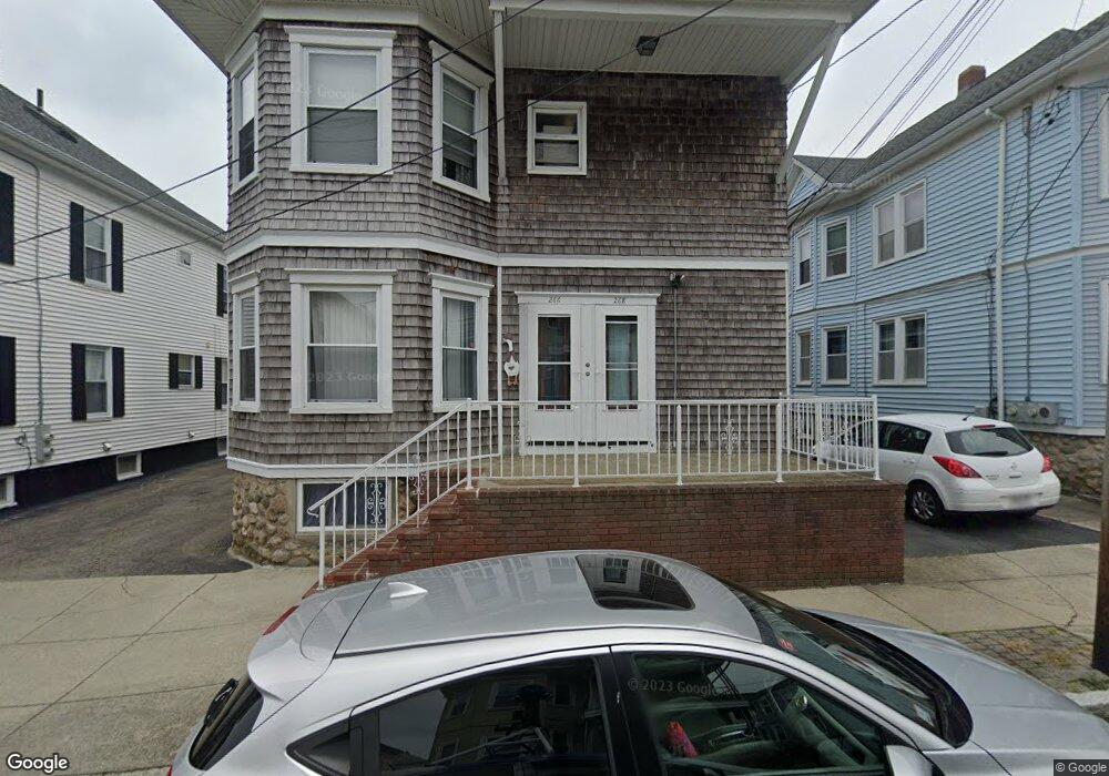
266 Bates St Unit 268 New Bedford, MA 02745
Acushnet Station NeighborhoodEstimated Value: $470,837 - $576,000
6
Beds
2
Baths
2,596
Sq Ft
$208/Sq Ft
Est. Value
About This Home
This home is located at 266 Bates St Unit 268, New Bedford, MA 02745 and is currently estimated at $538,959, approximately $207 per square foot. 266 Bates St Unit 268 is a home located in Bristol County with nearby schools including Abraham Lincoln Elementary School, Normandin Middle School, and New Bedford High School.
Ownership History
Date
Name
Owned For
Owner Type
Purchase Details
Closed on
Jan 4, 1993
Sold by
Paine Howard F and Paine Maria I
Bought by
Dagemea Manuel P and Dagemea Maria F
Current Estimated Value
Home Financials for this Owner
Home Financials are based on the most recent Mortgage that was taken out on this home.
Original Mortgage
$94,800
Interest Rate
8.32%
Mortgage Type
Purchase Money Mortgage
Create a Home Valuation Report for This Property
The Home Valuation Report is an in-depth analysis detailing your home's value as well as a comparison with similar homes in the area
Home Values in the Area
Average Home Value in this Area
Purchase History
| Date | Buyer | Sale Price | Title Company |
|---|---|---|---|
| Dagemea Manuel P | $118,500 | -- | |
| Dagemea Manuel P | $118,500 | -- |
Source: Public Records
Mortgage History
| Date | Status | Borrower | Loan Amount |
|---|---|---|---|
| Closed | Dagemea Manuel P | $94,800 | |
| Previous Owner | Dagemea Manuel P | $82,200 |
Source: Public Records
Tax History Compared to Growth
Tax History
| Year | Tax Paid | Tax Assessment Tax Assessment Total Assessment is a certain percentage of the fair market value that is determined by local assessors to be the total taxable value of land and additions on the property. | Land | Improvement |
|---|---|---|---|---|
| 2025 | $4,899 | $433,200 | $97,900 | $335,300 |
| 2024 | $4,354 | $362,800 | $94,700 | $268,100 |
| 2023 | $3,993 | $279,400 | $79,600 | $199,800 |
| 2022 | $3,635 | $233,900 | $75,800 | $158,100 |
| 2021 | $3,647 | $233,900 | $75,800 | $158,100 |
| 2020 | $3,704 | $229,200 | $77,400 | $151,800 |
| 2019 | $3,620 | $219,800 | $77,400 | $142,400 |
| 2018 | $3,713 | $223,300 | $77,400 | $145,900 |
| 2017 | $3,233 | $193,700 | $71,000 | $122,700 |
| 2016 | $3,054 | $185,200 | $67,900 | $117,300 |
| 2015 | $2,850 | $181,200 | $67,900 | $113,300 |
| 2014 | $2,732 | $180,200 | $66,300 | $113,900 |
Source: Public Records
Map
Nearby Homes
- 40 Glennon St Unit 42
- 209-211 Eugenia St
- 135-137 Query St
- 250-252 Shaw St
- 228 Eugenia St
- 162 Princeton St
- 113 Eugenia St
- 203-205 Tinkham St
- 208 Princeton St
- 125 +135 Tinkham St
- 1840 1846 Acushnet Ave
- 128 Nash Rd
- 223 225 Prinston
- 42 Princeton St
- 42 Query St
- 18 Edison St
- 301 Davis St
- 219 Hathaway St
- 363 Earle St
- 1566-1570 Acushnet Ave
- 270 Bates St Unit 272
- 262 Bates St Unit 264
- 270-272 Bates St
- 75 Glennon St
- 71 Glennon St
- 79 Glennon St
- 274 Bates St Unit 276
- 256 Bates St Unit 258
- 267 Bates St Unit 269
- 67 Glennon St Unit 69
- 83 Glennon St
- 273 Bates St
- 261 Bates St Unit 265
- 257-259 Bates St
- 278 Bates St Unit 280
- 275 Bates St
- 27 Arlington St
- 257 Bates St Unit 259
- 85 Glennon St Unit 87
- 17 Arlington St Unit 19