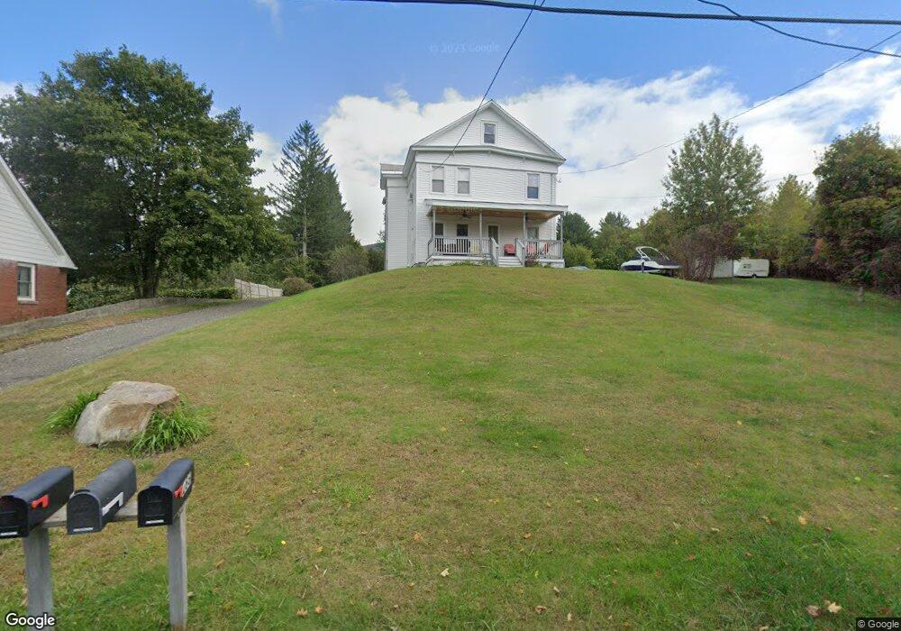
266 Kemp Ave North Adams, MA 01247
Estimated Value: $214,000 - $325,000
5
Beds
3
Baths
2,272
Sq Ft
$121/Sq Ft
Est. Value
About This Home
This home is located at 266 Kemp Ave, North Adams, MA 01247 and is currently estimated at $274,850, approximately $120 per square foot. 266 Kemp Ave is a home located in Berkshire County with nearby schools including Colegrove Park Elementary School and Drury High School.
Ownership History
Date
Name
Owned For
Owner Type
Purchase Details
Closed on
Jul 30, 2008
Sold by
Petri John M
Bought by
Ab Rt and Petri
Current Estimated Value
Purchase Details
Closed on
Feb 20, 2008
Sold by
Garland Glen and Us Bk
Bought by
Us Bk
Purchase Details
Closed on
Oct 13, 2006
Sold by
Abuisi Anthony T and Comstock Lucinda S
Bought by
Garland Glen
Home Financials for this Owner
Home Financials are based on the most recent Mortgage that was taken out on this home.
Original Mortgage
$128,800
Interest Rate
6.47%
Mortgage Type
Purchase Money Mortgage
Purchase Details
Closed on
May 13, 1994
Sold by
Hansen Carl T and Hansen Robert A
Bought by
Comstock Lucinda S and Abuisi Anthony T
Create a Home Valuation Report for This Property
The Home Valuation Report is an in-depth analysis detailing your home's value as well as a comparison with similar homes in the area
Home Values in the Area
Average Home Value in this Area
Purchase History
| Date | Buyer | Sale Price | Title Company |
|---|---|---|---|
| Ab Rt | -- | -- | |
| Ab Rt | -- | -- | |
| Petri John M | $129,000 | -- | |
| Us Bk | $104,000 | -- | |
| Us Bk | $104,000 | -- | |
| Garland Glen | $161,000 | -- | |
| Garland Glen | $161,000 | -- | |
| Comstock Lucinda S | $94,000 | -- | |
| Comstock Lucinda S | $94,000 | -- |
Source: Public Records
Mortgage History
| Date | Status | Borrower | Loan Amount |
|---|---|---|---|
| Open | Comstock Lucinda S | $142,400 | |
| Previous Owner | Garland Glen | $128,800 |
Source: Public Records
Tax History Compared to Growth
Tax History
| Year | Tax Paid | Tax Assessment Tax Assessment Total Assessment is a certain percentage of the fair market value that is determined by local assessors to be the total taxable value of land and additions on the property. | Land | Improvement |
|---|---|---|---|---|
| 2025 | $3,536 | $211,600 | $49,400 | $162,200 |
| 2024 | $3,320 | $193,700 | $45,200 | $148,500 |
| 2023 | $2,979 | $168,600 | $45,200 | $123,400 |
| 2022 | $3,122 | $168,500 | $45,200 | $123,300 |
| 2021 | $2,903 | $156,000 | $41,900 | $114,100 |
| 2020 | $2,882 | $154,800 | $39,900 | $114,900 |
| 2019 | $2,834 | $148,300 | $37,600 | $110,700 |
| 2018 | $2,803 | $152,500 | $40,400 | $112,100 |
| 2017 | $2,668 | $151,000 | $40,000 | $111,000 |
| 2016 | $2,309 | $132,800 | $40,000 | $92,800 |
| 2015 | $2,216 | $132,800 | $40,000 | $92,800 |
Source: Public Records
Map
Nearby Homes
- 235 Kemp Ave
- 54 Pine Hill Terrace
- 30 Dover St
- 31 Dover St
- 209 Corinth St
- 388 Ashland St Unit 1
- 100 Autumn Dr
- 0 Ashland St Unit 245228
- 11-15 Perry St
- 0 Mohawk Trail
- 74 Washington Ave
- 667 & 669 E Main St
- 299 E Main St
- 15 Murray Ave
- 10 Miner St
- 50 Gallup St
- 380 Union St
- 921 Mohawk Trail
- 83 Walker St
- 111 Johnson St