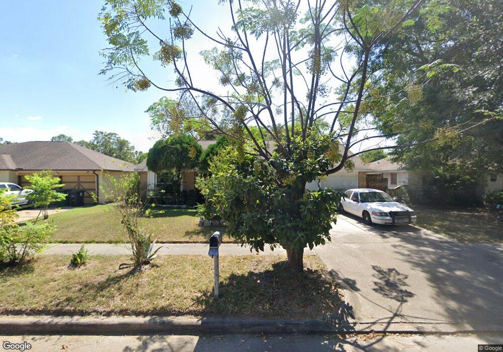
266 La Fonda Dr Houston, TX 77060
Greenspoint NeighborhoodEstimated Value: $196,000 - $225,000
3
Beds
2
Baths
1,648
Sq Ft
$127/Sq Ft
Est. Value
About This Home
This home is located at 266 La Fonda Dr, Houston, TX 77060 and is currently estimated at $209,886, approximately $127 per square foot. 266 La Fonda Dr is a home located in Harris County with nearby schools including Hinojosa EC/PK/K, Thompson Elementary School, and Stovall Middle School.
Ownership History
Date
Name
Owned For
Owner Type
Purchase Details
Closed on
Dec 20, 2003
Sold by
Jimenez Rodolfo and Salazar Miguel
Bought by
Hernandez Margarita
Current Estimated Value
Purchase Details
Closed on
Sep 28, 1995
Sold by
Patel Chandrakant and Patel Kalpana C
Bought by
Jimenez Rodolfo and Salazar Miguel
Home Financials for this Owner
Home Financials are based on the most recent Mortgage that was taken out on this home.
Original Mortgage
$47,400
Interest Rate
7.84%
Create a Home Valuation Report for This Property
The Home Valuation Report is an in-depth analysis detailing your home's value as well as a comparison with similar homes in the area
Home Values in the Area
Average Home Value in this Area
Purchase History
| Date | Buyer | Sale Price | Title Company |
|---|---|---|---|
| Hernandez Margarita | -- | -- | |
| Jimenez Rodolfo | -- | First American Title |
Source: Public Records
Mortgage History
| Date | Status | Borrower | Loan Amount |
|---|---|---|---|
| Previous Owner | Jimenez Rodolfo | $47,400 |
Source: Public Records
Tax History Compared to Growth
Tax History
| Year | Tax Paid | Tax Assessment Tax Assessment Total Assessment is a certain percentage of the fair market value that is determined by local assessors to be the total taxable value of land and additions on the property. | Land | Improvement |
|---|---|---|---|---|
| 2025 | $7 | $210,938 | $33,963 | $176,975 |
| 2024 | $7 | $211,163 | $33,963 | $177,200 |
| 2023 | $7 | $212,644 | $34,650 | $177,994 |
| 2022 | $3,160 | $179,795 | $34,650 | $145,145 |
| 2021 | $3,009 | $167,019 | $12,600 | $154,419 |
| 2020 | $2,712 | $111,620 | $12,600 | $99,020 |
| 2019 | $2,585 | $106,828 | $12,600 | $94,228 |
| 2018 | $242 | $96,381 | $12,600 | $83,781 |
| 2017 | $2,048 | $96,381 | $12,600 | $83,781 |
| 2016 | $1,862 | $80,578 | $12,600 | $67,978 |
| 2015 | $553 | $80,037 | $12,600 | $67,437 |
| 2014 | $553 | $67,779 | $12,600 | $55,179 |
Source: Public Records
Map
Nearby Homes
- 251 Goodson Dr
- 319 La Fonda Dr
- 15150 Dogwood Tree St
- 15242 Dogwood Tree St
- 15123 Kaler Rd
- 15114 Kaler Rd
- 129 Casa Grande Dr Unit 129
- 307 Sulky Trail St
- 15003 Elkins Rd
- 231 San Fernando Dr
- 15806 Sulky Trail Ct
- 155 Coach Lamp Ln
- 15114 Wellman Ln
- 135 Mill Stream Ln
- 255 Mcfarland Rd
- 522 Hollyvale Dr
- 151 West Rd
- 14929 Henry Rd
- 530 Branding Iron Ln
- 715 Branding Iron Ln
- 262 La Fonda Dr
- 270 La Fonda Dr
- 283 Casa Grande Dr
- 285 Casa Grande Dr
- 258 La Fonda Dr
- 281 Casa Grande Dr
- 274 La Fonda Dr
- 287 Casa Grande Dr
- 267 La Fonda Dr
- 279 Casa Grande Dr
- 263 La Fonda Dr
- 254 La Fonda Dr
- 289 Casa Grande Dr
- 259 La Fonda Dr
- 275 La Fonda Dr
- 278 La Fonda Dr
- 277 Casa Grande Dr
- 255 La Fonda Dr
- 291 Casa Grande Dr
- 250 La Fonda Dr