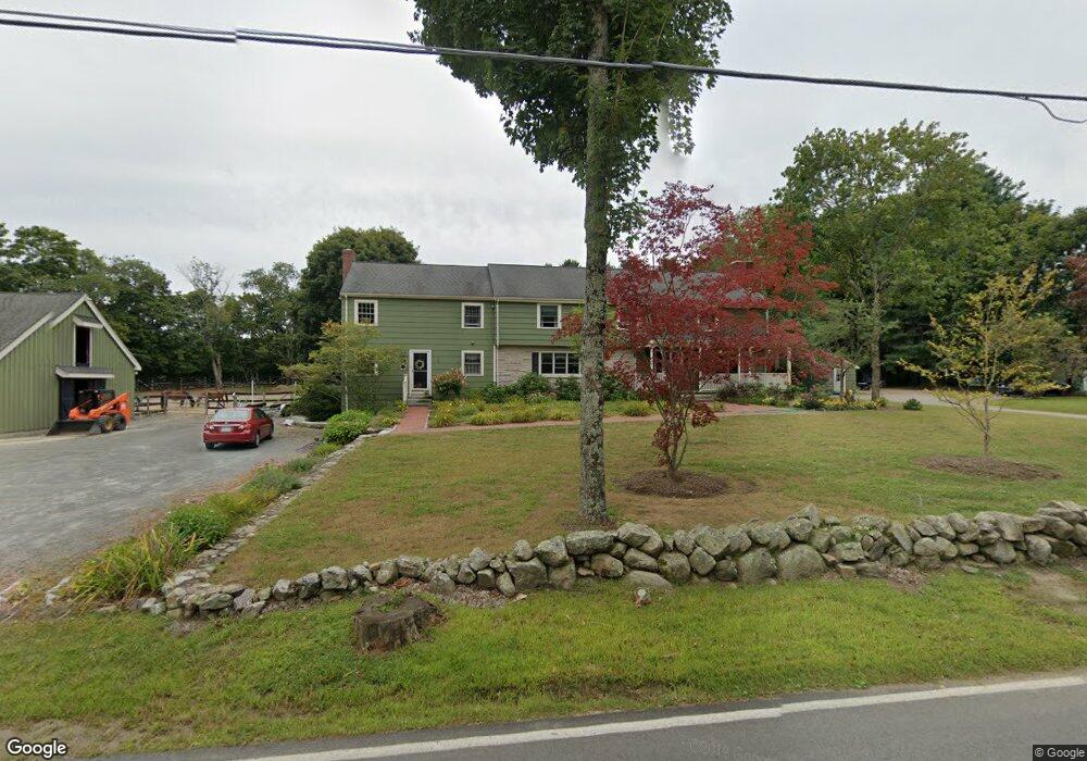
266 Lincoln Rd Walpole, MA 02081
Estimated Value: $1,088,667 - $1,302,000
5
Beds
4
Baths
4,052
Sq Ft
$287/Sq Ft
Est. Value
About This Home
This home is located at 266 Lincoln Rd, Walpole, MA 02081 and is currently estimated at $1,163,417, approximately $287 per square foot. 266 Lincoln Rd is a home located in Norfolk County with nearby schools including Elm Street School, Eleanor N. Johnson Middle School, and Walpole High School.
Ownership History
Date
Name
Owned For
Owner Type
Purchase Details
Closed on
Dec 8, 2023
Sold by
Shea John J and Shea Jayne E
Bought by
Shea Rt and Shea
Current Estimated Value
Purchase Details
Closed on
Sep 4, 2007
Sold by
Shea Kathleen A
Bought by
Shea Jayne and Shea John J
Purchase Details
Closed on
May 7, 2004
Sold by
Shea Kathleen
Bought by
Shea Jayne and Shea John J
Purchase Details
Closed on
Jun 27, 2002
Sold by
Rossi Velma J
Bought by
Shea John J and Shea Jayne
Home Financials for this Owner
Home Financials are based on the most recent Mortgage that was taken out on this home.
Original Mortgage
$332,500
Interest Rate
6.92%
Mortgage Type
Purchase Money Mortgage
Create a Home Valuation Report for This Property
The Home Valuation Report is an in-depth analysis detailing your home's value as well as a comparison with similar homes in the area
Home Values in the Area
Average Home Value in this Area
Purchase History
| Date | Buyer | Sale Price | Title Company |
|---|---|---|---|
| Shea Rt | -- | None Available | |
| Shea Rt | -- | None Available | |
| Shea Jayne | -- | -- | |
| Shea Jayne | -- | -- | |
| Shea John J | $475,000 | -- | |
| Shea Jayne | -- | -- | |
| Shea Jayne | -- | -- | |
| Shea John J | $475,000 | -- |
Source: Public Records
Mortgage History
| Date | Status | Borrower | Loan Amount |
|---|---|---|---|
| Previous Owner | Shea John J | $355,000 | |
| Previous Owner | Shea John J | $332,500 | |
| Previous Owner | Shea John J | $82,000 |
Source: Public Records
Tax History Compared to Growth
Tax History
| Year | Tax Paid | Tax Assessment Tax Assessment Total Assessment is a certain percentage of the fair market value that is determined by local assessors to be the total taxable value of land and additions on the property. | Land | Improvement |
|---|---|---|---|---|
| 2025 | $12,038 | $938,300 | $324,500 | $613,800 |
| 2024 | $11,614 | $878,500 | $312,800 | $565,700 |
| 2023 | $10,941 | $787,700 | $272,700 | $515,000 |
| 2022 | $10,212 | $706,200 | $251,800 | $454,400 |
| 2021 | $10,004 | $674,100 | $237,100 | $437,000 |
| 2020 | $9,387 | $626,200 | $224,500 | $401,700 |
| 2019 | $9,142 | $605,400 | $217,100 | $388,300 |
| 2018 | $9,283 | $607,900 | $207,500 | $400,400 |
| 2017 | $9,019 | $588,300 | $200,100 | $388,200 |
| 2016 | $8,774 | $563,900 | $194,900 | $369,000 |
| 2015 | $8,582 | $546,600 | $187,000 | $359,600 |
| 2014 | $8,175 | $518,700 | $187,000 | $331,700 |
Source: Public Records
Map
Nearby Homes
- 195 Lincoln Rd
- 43 Chandler Ave
- 14 Tiger Terrace Unit 29
- 533 Lincoln Rd
- 74 Granite St
- 12 Timberline Dr Unit 28
- 13 Sandtrap Cir Unit 14
- 11 Sandtrap Cir Unit 15
- 20 Sandtrap Cir Unit 4
- 18 Sandtrap Cir Unit 3
- 17 Sandtrap Cir Unit 12
- 15 Sandtrap Cir Unit 13
- 31 Sandtrap Cir Unit 5
- 10 Sandtrap Cir Unit 2
- 16 Magpie Cir Unit 16
- 9 Lakewood Dr
- 16 Stop River Rd
- 137 Clear Pond Dr
- 13 Stop River Rd
- 127 Clear Pond Dr
- 9 Breezewood Ln
- 256 Lincoln Rd
- 300 Lincoln Rd
- 263 Lincoln Rd
- 291 Lincoln Rd
- 8 Breezewood Ln
- 7 Breezewood Ln
- 6 Breezewood Ln
- LOT 0 Kingsbury St
- 0 Kingsbury St
- 5 Breezewood Ln
- 320 Lincoln Rd
- 319 Lincoln Rd
- 4 Breezewood Ln
- 235 Lincoln Rd
- 3 Breezewood Ln
- 330 Lincoln Rd
- 2 Breezewood Ln
- 15 Plain St
- 19 Plain St