Estimated Value: $157,000 - $320,000
Studio
2
Baths
2,408
Sq Ft
$108/Sq Ft
Est. Value
About This Home
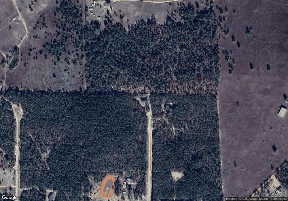
This home is located at 266 Sam Dr, Mauk, GA 31058 and is currently estimated at $260,192, approximately $108 per square foot. 266 Sam Dr is a home located in Marion County with nearby schools including L.K. Moss Elementary School and Marion County Middle/High School.
Ownership History
Date
Name
Owned For
Owner Type
Purchase Details
Closed on
Oct 25, 2024
Sold by
Jones Michael A
Bought by
Eleven Diverse Llc
Current Estimated Value
Purchase Details
Closed on
Apr 26, 2024
Sold by
Eleven Diverse Llc
Bought by
Jones Michael A
Home Financials for this Owner
Home Financials are based on the most recent Mortgage that was taken out on this home.
Original Mortgage
$146,000
Interest Rate
7.02%
Mortgage Type
New Conventional
Purchase Details
Closed on
Oct 23, 2023
Sold by
Jones Michael A
Bought by
Eleven Diverse Llc
Purchase Details
Closed on
May 5, 2023
Sold by
Eleven Diverse Llc
Bought by
Jones Michael A
Purchase Details
Closed on
Mar 15, 2023
Sold by
Jones Michael A
Bought by
Eleven Diverse Llc
Purchase Details
Closed on
May 25, 1994
Bought by
Jones Michael Anthon
Create a Home Valuation Report for This Property
The Home Valuation Report is an in-depth analysis detailing your home's value as well as a comparison with similar homes in the area
Purchase History
| Date | Buyer | Sale Price | Title Company |
|---|---|---|---|
| Eleven Diverse Llc | -- | -- | |
| Jones Michael A | -- | -- | |
| Jones Michael A | -- | -- | |
| Eleven Diverse Llc | -- | -- | |
| Jones Michael A | -- | -- | |
| Eleven Diverse Llc | -- | -- | |
| Jones Michael Anthon | $12,600 | -- |
Source: Public Records
Mortgage History
| Date | Status | Borrower | Loan Amount |
|---|---|---|---|
| Previous Owner | Jones Michael A | $146,000 |
Source: Public Records
Tax History
| Year | Tax Paid | Tax Assessment Tax Assessment Total Assessment is a certain percentage of the fair market value that is determined by local assessors to be the total taxable value of land and additions on the property. | Land | Improvement |
|---|---|---|---|---|
| 2024 | $1,934 | $83,239 | $9,450 | $73,789 |
| 2023 | $1,915 | $82,579 | $9,450 | $73,129 |
| 2022 | $1,850 | $79,408 | $9,450 | $69,958 |
| 2021 | $1,839 | $79,408 | $9,450 | $69,958 |
| 2020 | $1,852 | $79,408 | $9,450 | $69,958 |
| 2019 | $1,846 | $79,408 | $9,450 | $69,958 |
| 2018 | $1,848 | $79,408 | $9,450 | $69,958 |
| 2017 | $1,847 | $79,408 | $9,450 | $69,958 |
| 2016 | $1,818 | $79,408 | $9,450 | $69,958 |
| 2015 | -- | $79,408 | $9,450 | $69,958 |
| 2014 | -- | $79,408 | $9,450 | $69,958 |
| 2013 | -- | $79,408 | $9,450 | $69,958 |
Source: Public Records
Map
Nearby Homes
- 245 Dog Track Rd
- 0 Hunter Dr Unit 10679629
- 000 Hunter Dr
- 0 Pineknot Rd
- 111 Sunnyside Dr
- 000 Bridle Path Ln
- 115 Watermelon Ln
- 656 Bridle Path Ln
- 0 Fuller Rd Unit 22846458
- 2450 Fort Perry Rd
- 65 Saddle Trail
- 221 Flamingo Dr
- 79 Governors Dr
- 1300 Dr Brooks Rd
- 62 Brannon Montgomery Rd
- 375 Village Ln
- 322 Moores Chapel Rd
- 0 Brannon Montgomery Rd Unit 10453495
- 0 Brannon Montgomery Rd Unit 25510431
- 0 Miller Rd Unit 10319190
- 216 Dog Track Rd
- 270 Allen Dr
- 141 Sam Dr
- 720 Woody Stubbs Rd
- 756 Woody Stubbs Rd
- 267 Allen Dr
- 616 Fort Perry Rd
- 574 Fort Perry Rd
- 840 Woody Stubbs Rd
- 432 Fort Perry Rd
- 370 Fort Perry Rd
- 148 Whispering Pines Rd
- 234 Oakland Rd
- 90 Allen Dr
- 117 Allen Dr
- 151 Allen Dr
- 119 Whispering Pines Rd
- 70 Allen Dr
- 976 Woody Stubbs Rd
- 782 Fort Perry Rd
