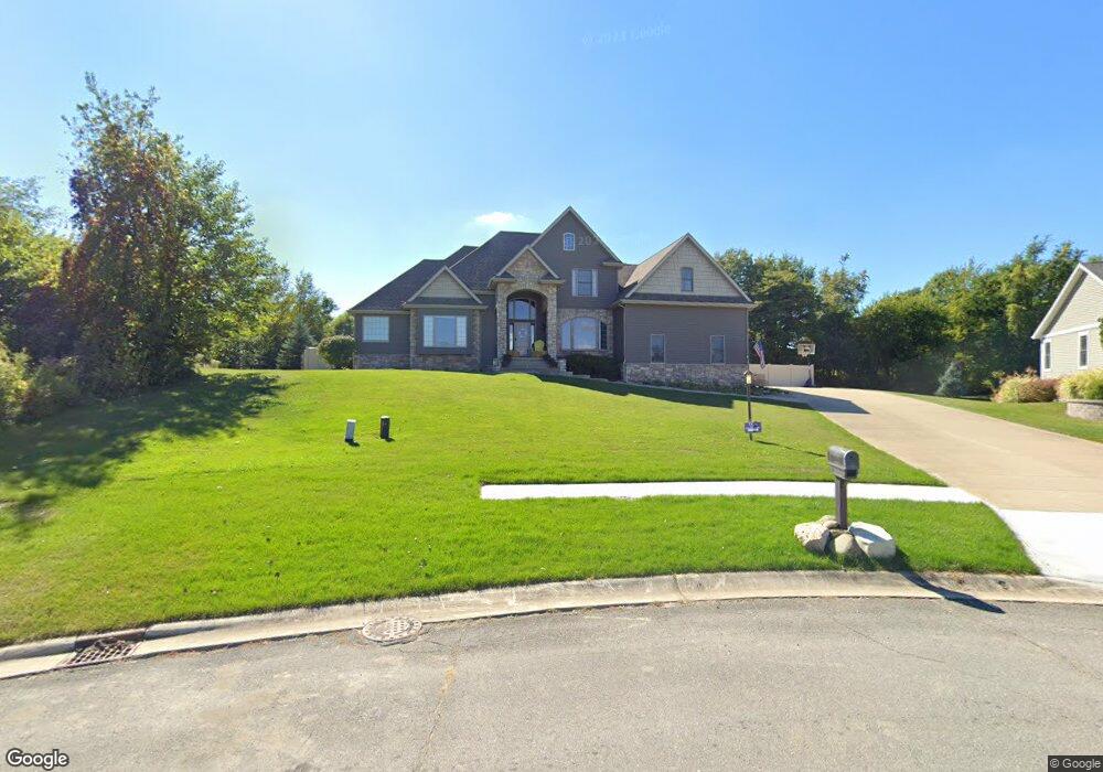
266 Westport Rd Valparaiso, IN 46385
Porter County NeighborhoodEstimated Value: $502,000 - $599,000
3
Beds
3
Baths
2,679
Sq Ft
$207/Sq Ft
Est. Value
About This Home
This home is located at 266 Westport Rd, Valparaiso, IN 46385 and is currently estimated at $554,341, approximately $206 per square foot. 266 Westport Rd is a home located in Porter County with nearby schools including Ben Franklin Middle School and Valparaiso High School.
Ownership History
Date
Name
Owned For
Owner Type
Purchase Details
Closed on
May 3, 2021
Sold by
Dyniewski Stanley E and Dyniewski Nancy K
Bought by
Baltz Kara R and Baltz Griffin D
Current Estimated Value
Home Financials for this Owner
Home Financials are based on the most recent Mortgage that was taken out on this home.
Original Mortgage
$384,000
Outstanding Balance
$348,000
Interest Rate
3.1%
Mortgage Type
New Conventional
Estimated Equity
$206,341
Purchase Details
Closed on
Nov 2, 2005
Sold by
Duneland Development Group Llc
Bought by
Dyniewski Stanley E and Dyniewski Nancy K
Create a Home Valuation Report for This Property
The Home Valuation Report is an in-depth analysis detailing your home's value as well as a comparison with similar homes in the area
Home Values in the Area
Average Home Value in this Area
Purchase History
| Date | Buyer | Sale Price | Title Company |
|---|---|---|---|
| Baltz Kara R | -- | Chicago Title Company Llc | |
| Dyniewski Stanley E | -- | Chicago Title Insurance Comp |
Source: Public Records
Mortgage History
| Date | Status | Borrower | Loan Amount |
|---|---|---|---|
| Open | Baltz Kara R | $384,000 |
Source: Public Records
Tax History Compared to Growth
Tax History
| Year | Tax Paid | Tax Assessment Tax Assessment Total Assessment is a certain percentage of the fair market value that is determined by local assessors to be the total taxable value of land and additions on the property. | Land | Improvement |
|---|---|---|---|---|
| 2024 | $5,118 | $571,700 | $67,800 | $503,900 |
| 2023 | $5,047 | $544,100 | $63,400 | $480,700 |
| 2022 | $5,047 | $498,600 | $63,400 | $435,200 |
| 2021 | $4,869 | $440,000 | $63,400 | $376,600 |
| 2020 | $4,735 | $417,400 | $57,600 | $359,800 |
| 2019 | $4,716 | $403,200 | $57,600 | $345,600 |
| 2018 | $4,603 | $392,100 | $57,600 | $334,500 |
| 2017 | $4,632 | $402,400 | $57,600 | $344,800 |
| 2016 | $4,346 | $399,600 | $54,900 | $344,700 |
| 2014 | $3,642 | $393,800 | $53,300 | $340,500 |
| 2013 | -- | $369,900 | $53,300 | $316,600 |
Source: Public Records
Map
Nearby Homes
- 265 Westport Rd
- 274 Westport Rd
- 97 Scotscraig Dr
- 83 Scotscraig Dr
- 77 Sanctuary Dr
- 65 Sanctuary Dr
- 63 Sanctuary Dr
- 61 Sanctuary Dr
- 59 Sanctuary Dr
- 65 Larwick Cir
- 59 Larwick Cir
- 281 Larwick Cir
- 110 Wheatridge Rd
- 49 Larwick Cir
- 47 Larwick Cir
- 45 Larwick Cir
- 68 Braemar Dr
- 66 Braemar Dr
- 161 N Winterberry Dr
- 54 Braemar Dr
- 268 Westport Rd
- 262 Westport Rd
- 270 Westport Rd
- 263 Westport Rd
- 272 Westport Rd
- 267 Westport Rd
- 258 Westport Rd
- 269 Westport Rd
- 276 W 100 N
- 278 W 100 N
- 256 Westport Rd
- 25-x Westport Rd
- 93 Scotscraig Dr
- 91 Scotscraig Dr
- 259 Westport Rd
- 95 Scotscraig Dr
- 89 Scotscraig Dr
- 87 Scotscraig Dr
- 254 Westport Rd
- 99 Scotscraig Dr