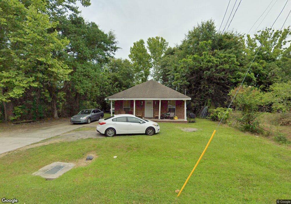
2660 Carter Ave Mobile, AL 36617
Neely NeighborhoodEstimated Value: $70,000 - $135,000
Studio
--
Bath
1,247
Sq Ft
$81/Sq Ft
Est. Value
About This Home
This home is located at 2660 Carter Ave, Mobile, AL 36617 and is currently estimated at $100,550, approximately $80 per square foot. 2660 Carter Ave is a home with nearby schools including Chastang-Fournier K-8 School, Mattie T Blount High School, and Trinity Lutheran Elementary School.
Ownership History
Date
Name
Owned For
Owner Type
Purchase Details
Closed on
Sep 30, 2011
Sold by
Bay Area Women Coalition Inc
Bought by
Prince Keosha R
Current Estimated Value
Home Financials for this Owner
Home Financials are based on the most recent Mortgage that was taken out on this home.
Original Mortgage
$93,000
Outstanding Balance
$63,343
Interest Rate
4.3%
Mortgage Type
New Conventional
Estimated Equity
$37,207
Purchase Details
Closed on
May 19, 2010
Sold by
Kennedy Geraldine
Bought by
Bay Area Women Coalition Inc
Purchase Details
Closed on
Aug 20, 2003
Sold by
Parnell Dauphne Shunta and Jackson Mattie B
Bought by
Kennedy Geraldine
Create a Home Valuation Report for This Property
The Home Valuation Report is an in-depth analysis detailing your home's value as well as a comparison with similar homes in the area
Home Values in the Area
Average Home Value in this Area
Purchase History
| Date | Buyer | Sale Price | Title Company |
|---|---|---|---|
| Prince Keosha R | $100,000 | Slt | |
| Bay Area Women Coalition Inc | $4,000 | Reli Inc | |
| Kennedy Geraldine | $50,000 | -- |
Source: Public Records
Mortgage History
| Date | Status | Borrower | Loan Amount |
|---|---|---|---|
| Open | Prince Keosha R | $93,000 |
Source: Public Records
Tax History
| Year | Tax Paid | Tax Assessment Tax Assessment Total Assessment is a certain percentage of the fair market value that is determined by local assessors to be the total taxable value of land and additions on the property. | Land | Improvement |
|---|---|---|---|---|
| 2025 | $463 | $14,260 | $800 | $13,460 |
| 2024 | $463 | $14,560 | $800 | $13,760 |
| 2023 | $457 | $14,080 | $800 | $13,280 |
| 2022 | $452 | $14,240 | $800 | $13,440 |
| 2021 | $402 | $7,380 | $500 | $6,880 |
| 2020 | $412 | $7,540 | $500 | $7,040 |
| 2019 | $428 | $7,800 | $0 | $0 |
| 2018 | $433 | $7,880 | $0 | $0 |
| 2017 | $444 | $8,040 | $0 | $0 |
| 2016 | $447 | $8,100 | $0 | $0 |
| 2013 | $397 | $7,300 | $0 | $0 |
Source: Public Records
Map
Nearby Homes
- 2815 Banks Ave
- 1811 Butler St
- 2621 Berkley Ave
- 3009 Banks Ave
- 1320 Jessie St
- 1203 Next St
- 1824 Nitson St
- 2352 Linda Dr
- 400 Short St Charles
- 1010 Barbara Dr
- 6632 Monarch Cir
- 721 Gilbert St
- 626 Percy Ave
- 941 Avenue H
- 1734 S Atmore Ave
- 0 W Prichard Ave Unit 7677800
- 0 W Prichard Ave Unit 7678472
- 2464 Oakleigh Dr
- 515 Gilbert St
- 1659 Hand Ave
Your Personal Tour Guide
Ask me questions while you tour the home.