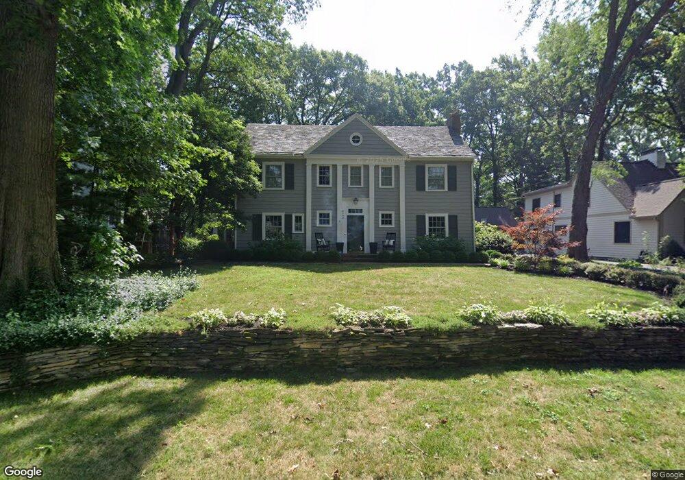
2662 Henthorn Rd Columbus, OH 43221
Estimated Value: $916,000 - $1,423,000
5
Beds
3
Baths
3,481
Sq Ft
$322/Sq Ft
Est. Value
About This Home
This home is located at 2662 Henthorn Rd, Columbus, OH 43221 and is currently estimated at $1,119,298, approximately $321 per square foot. 2662 Henthorn Rd is a home located in Franklin County with nearby schools including Tremont Elementary School, Jones Middle School, and Upper Arlington High School.
Ownership History
Date
Name
Owned For
Owner Type
Purchase Details
Closed on
May 9, 2012
Sold by
Wenger Mark S and Wenger Cynthia H
Bought by
Vacchiano Aric S and Vacchiano April F
Current Estimated Value
Home Financials for this Owner
Home Financials are based on the most recent Mortgage that was taken out on this home.
Original Mortgage
$105,000
Outstanding Balance
$74,511
Interest Rate
4.5%
Mortgage Type
Adjustable Rate Mortgage/ARM
Estimated Equity
$1,044,787
Purchase Details
Closed on
Mar 27, 1987
Bought by
Wenger Mark S
Create a Home Valuation Report for This Property
The Home Valuation Report is an in-depth analysis detailing your home's value as well as a comparison with similar homes in the area
Home Values in the Area
Average Home Value in this Area
Purchase History
| Date | Buyer | Sale Price | Title Company |
|---|---|---|---|
| Vacchiano Aric S | $580,000 | Taton Title | |
| Wenger Mark S | $143,000 | -- |
Source: Public Records
Mortgage History
| Date | Status | Borrower | Loan Amount |
|---|---|---|---|
| Open | Vacchiano Aric S | $105,000 |
Source: Public Records
Tax History Compared to Growth
Tax History
| Year | Tax Paid | Tax Assessment Tax Assessment Total Assessment is a certain percentage of the fair market value that is determined by local assessors to be the total taxable value of land and additions on the property. | Land | Improvement |
|---|---|---|---|---|
| 2024 | $14,988 | $258,900 | $102,060 | $156,840 |
| 2023 | $14,803 | $258,900 | $102,060 | $156,840 |
| 2022 | $14,887 | $213,050 | $66,780 | $146,270 |
| 2021 | $13,179 | $213,050 | $66,780 | $146,270 |
| 2020 | $13,062 | $213,050 | $66,780 | $146,270 |
| 2019 | $12,077 | $174,160 | $66,780 | $107,380 |
| 2018 | $11,721 | $174,160 | $66,780 | $107,380 |
| 2017 | $11,984 | $174,160 | $66,780 | $107,380 |
| 2016 | $11,444 | $173,080 | $61,290 | $111,790 |
| 2015 | $11,434 | $173,080 | $61,290 | $111,790 |
| 2014 | $11,447 | $173,080 | $61,290 | $111,790 |
| 2013 | $5,467 | $157,360 | $55,720 | $101,640 |
Source: Public Records
Map
Nearby Homes
- 2593 Coventry Rd
- 2615 Northwest Blvd
- 2569 Chester Rd
- 2648 Chester Rd
- 1909 Inchcliff Rd
- 2585 Westmont Blvd
- 2063 Westover Rd
- 3015 Welsford Rd
- 1887-1891 Kentwell Rd
- 1932 Suffolk Rd Unit 1932
- 2276 Northwest Blvd
- 1550 College Hill Dr
- 2979 Avalon Rd
- 1565 Berkshire Rd
- 3041 Avalon Rd
- 2227 Zollinger Rd
- 3175 Tremont Rd Unit 502
- 1764 Ridgecliff Rd Unit 1764
- 3296 Leighton Rd
- 1535 Doone Rd
- 2654 Henthorn Rd
- 2674 Henthorn Rd
- 2646 Henthorn Rd
- 2655 Berwyn Rd
- 2661 Berwyn Rd
- 2686 Henthorn Rd
- 2647 Berwyn Rd
- 2657 Henthorn Rd
- 2675 Henthorn Rd
- 2669 Berwyn Rd
- 2640 Henthorn Rd
- 2639 Berwyn Rd
- 2649 Henthorn Rd
- 2694 Henthorn Rd
- 2685 Henthorn Rd
- 2685 Berwyn Rd
- 2631 Berwyn Rd
- 2673 Berwyn Rd
- 2635 Henthorn Rd
- 2695 Henthorn Rd