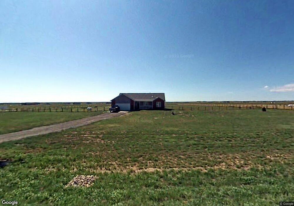
2663 Devils Tower Rd Cheyenne, WY 82009
Estimated Value: $472,000 - $554,000
--
Bed
--
Bath
1,681
Sq Ft
$312/Sq Ft
Est. Value
About This Home
This home is located at 2663 Devils Tower Rd, Cheyenne, WY 82009 and is currently estimated at $523,646, approximately $311 per square foot. 2663 Devils Tower Rd is a home located in Laramie County with nearby schools including Prairie Wind Elementary School, McCormick Junior High School, and Central High School.
Ownership History
Date
Name
Owned For
Owner Type
Purchase Details
Closed on
Nov 30, 2006
Sold by
Carter Brothers Construction Inc
Bought by
Lowe John M and Lowe Cheryl L
Current Estimated Value
Home Financials for this Owner
Home Financials are based on the most recent Mortgage that was taken out on this home.
Original Mortgage
$242,000
Outstanding Balance
$145,167
Interest Rate
6.37%
Mortgage Type
VA
Estimated Equity
$378,479
Create a Home Valuation Report for This Property
The Home Valuation Report is an in-depth analysis detailing your home's value as well as a comparison with similar homes in the area
Home Values in the Area
Average Home Value in this Area
Purchase History
| Date | Buyer | Sale Price | Title Company |
|---|---|---|---|
| Lowe John M | -- | None Available |
Source: Public Records
Mortgage History
| Date | Status | Borrower | Loan Amount |
|---|---|---|---|
| Open | Lowe John M | $242,000 |
Source: Public Records
Tax History Compared to Growth
Tax History
| Year | Tax Paid | Tax Assessment Tax Assessment Total Assessment is a certain percentage of the fair market value that is determined by local assessors to be the total taxable value of land and additions on the property. | Land | Improvement |
|---|---|---|---|---|
| 2025 | $2,583 | $32,135 | $5,682 | $26,453 |
| 2024 | $2,583 | $41,437 | $7,576 | $33,861 |
| 2023 | $2,457 | $40,392 | $6,608 | $33,784 |
| 2022 | $2,390 | $38,574 | $8,802 | $29,772 |
| 2021 | $2,216 | $35,912 | $5,190 | $30,722 |
| 2020 | $2,097 | $34,232 | $5,072 | $29,160 |
| 2019 | $1,977 | $32,420 | $5,072 | $27,348 |
| 2018 | $1,526 | $25,940 | $4,797 | $21,143 |
| 2017 | $1,497 | $25,284 | $4,797 | $20,487 |
| 2016 | $1,440 | $24,431 | $4,648 | $19,783 |
| 2015 | $1,457 | $24,673 | $4,648 | $20,025 |
| 2014 | $1,468 | $24,694 | $4,648 | $20,046 |
Source: Public Records
Map
Nearby Homes
- Lot 6 Mccrae Rd
- 2651 Ford Rd
- Tract 2 Battle Creek Blvd
- 2593 Mccrae Rd
- Tract 1 Battle Creek Blvd
- TBD Lot 9 Mccrae Rd
- 2732 Big Loop Trail
- 2533 Moonlight Ct
- 2500 Moonlight Ct
- 2918 Sitting Bull Rd
- 0 Road 215 Unit 96488
- Lot 4 Snowy Mountain Ct
- Tract 5 Jk Trail
- Tract 1 Klipstein Rd
- Tract 17 Old Faithful Way
- Tract 16 Old Faithful Way
- Tract 2 Road 215
- Tract 39 Wineglass Rd
- Tract 38 Wineglass Rd
- Tract 34 Wineglass Rd
- 2669 Devils Tower Rd
- 2659 Devils Tower Rd
- 2662 Devils Tower Rd
- 2664 Devils Tower Rd
- 2660 Devils Tower Rd
- 2670 Devils Tower Rd
- 2655 Devils Tower Rd
- 2656 Devils Tower Rd
- 1860 Split Rock Dr
- 2652 Devils Tower Rd
- 1846 Register Cliff Ct
- 2649 Devils Tower Rd
- 1868 Split Rock Dr
- 1838 Register Cliff Ct
- 1830 Register Cliff Ct
- 1827 Fossil Butte Rd
- 1843 Register Cliff Ct
- 1824 Register Cliff Ct
- 1835 Register Cliff Ct
- 1833 Fossil Butte Rd