Estimated Value: $368,313 - $658,000
--
Bed
--
Bath
--
Sq Ft
6,708
Sq Ft Lot
About This Home
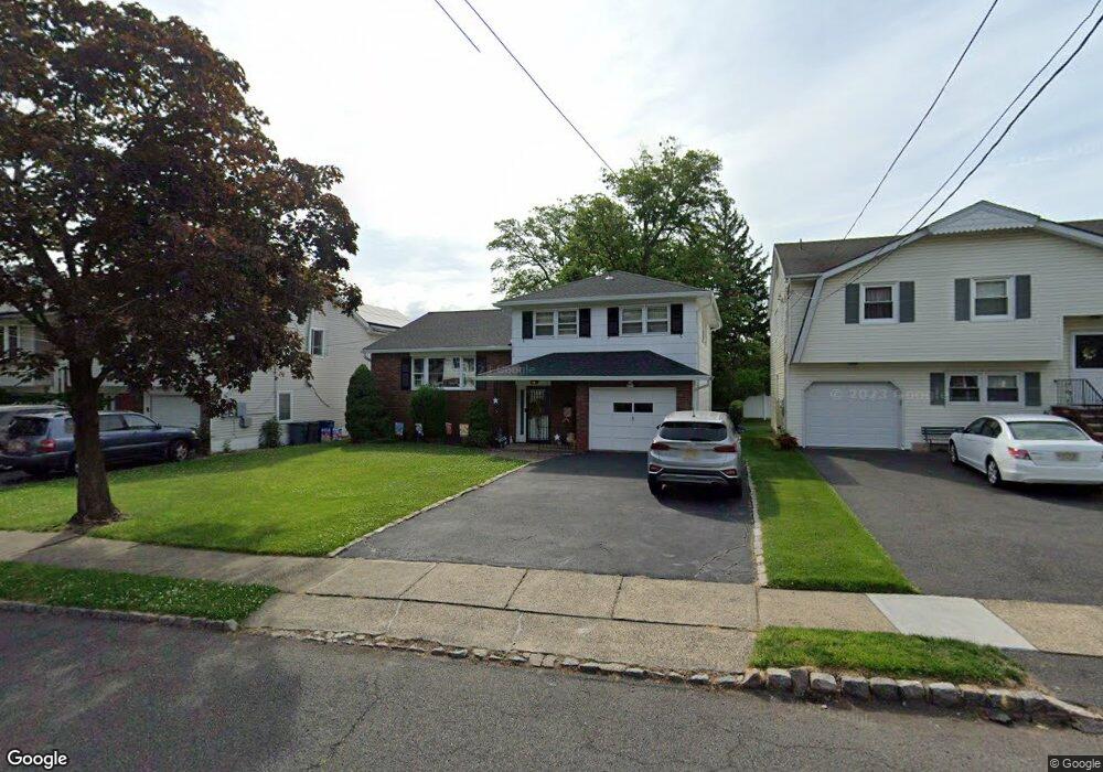
This home is located at 2664 Hawthorne Ave, Union, NJ 07083 and is currently estimated at $562,578. 2664 Hawthorne Ave is a home located in Union County with nearby schools including Hannah Caldwell Elementary School, Burnet Middle School, and Union High School.
Ownership History
Date
Name
Owned For
Owner Type
Purchase Details
Closed on
Jun 11, 1999
Sold by
Hess Leona
Bought by
Supino Bartholomew F and Supino Judith
Current Estimated Value
Home Financials for this Owner
Home Financials are based on the most recent Mortgage that was taken out on this home.
Original Mortgage
$140,000
Outstanding Balance
$36,467
Interest Rate
6.9%
Estimated Equity
$526,111
Purchase Details
Closed on
Aug 23, 1994
Sold by
Pallitto John and Pallitto Rose Marie
Bought by
Hess Ervin and Hess Leona
Create a Home Valuation Report for This Property
The Home Valuation Report is an in-depth analysis detailing your home's value as well as a comparison with similar homes in the area
Home Values in the Area
Average Home Value in this Area
Purchase History
| Date | Buyer | Sale Price | Title Company |
|---|---|---|---|
| Supino Bartholomew F | $205,000 | -- | |
| Hess Ervin | $185,000 | -- |
Source: Public Records
Mortgage History
| Date | Status | Borrower | Loan Amount |
|---|---|---|---|
| Open | Supino Bartholomew F | $140,000 |
Source: Public Records
Tax History Compared to Growth
Tax History
| Year | Tax Paid | Tax Assessment Tax Assessment Total Assessment is a certain percentage of the fair market value that is determined by local assessors to be the total taxable value of land and additions on the property. | Land | Improvement |
|---|---|---|---|---|
| 2025 | $13,053 | $58,400 | $20,900 | $37,500 |
| 2024 | $12,655 | $58,400 | $20,900 | $37,500 |
| 2023 | $12,655 | $58,400 | $20,900 | $37,500 |
| 2022 | $12,215 | $58,400 | $20,900 | $37,500 |
| 2021 | $11,919 | $58,400 | $20,900 | $37,500 |
| 2020 | $11,681 | $58,400 | $20,900 | $37,500 |
| 2019 | $11,524 | $58,400 | $20,900 | $37,500 |
| 2018 | $11,328 | $58,400 | $20,900 | $37,500 |
| 2017 | $11,160 | $58,400 | $20,900 | $37,500 |
| 2016 | $10,888 | $58,400 | $20,900 | $37,500 |
| 2015 | $10,708 | $58,400 | $20,900 | $37,500 |
| 2014 | $10,468 | $58,400 | $20,900 | $37,500 |
Source: Public Records
Map
Nearby Homes
- 2641 Burns Place
- 2615 Burns Place
- 2620 Eleanor Terrace
- 2 Bashford-B Unit B
- 2535 Standish Ave
- 8 Bashford Ave Unit 8
- 1239 Rony Rd
- 2510 Crane Place
- 1114 Elker Rd
- 1163 Burnet Ave
- 2505 Girard Place
- 1071 Battle Hill Terrace
- 1080 Gruber Ave
- 1214 Carlton Terrace
- 1042 Battle Hill Terrace
- 2785 Larchmont Rd
- 980 Moessner Ave
- 2636 Frederick Terrace
- 960 Moessner Ave
- 1270 Carlton Terrace
- 2660 Hawthorne Ave
- 2668 Hawthorne Ave
- 2633 Leslie St
- 2654 Hawthorne Ave
- 2640 Hawthorne Ave
- 2631 Leslie St
- 2632 Hawthorne Ave
- 2671 Hawthorne Ave
- 2667 Hawthorne Ave
- 2687 Hawthorne Ave
- 2663 Hawthorne Ave
- 2675 Hawthorne Ave
- 2683 Hawthorne Ave
- 2629 Leslie St
- 2691 Hawthorne Ave
- 2626 Hawthorne Ave
- 2679 Hawthorne Ave
- 2659 Hawthorne Ave
- 2621 Leslie St
- 2645 Hawthorne Ave