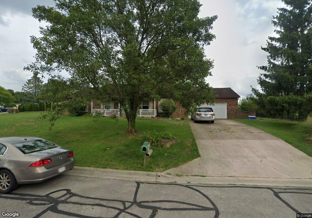
2665 Cornstalk Ave Ashville, OH 43103
Estimated Value: $294,000 - $434,000
4
Beds
3
Baths
1,560
Sq Ft
$225/Sq Ft
Est. Value
About This Home
This home is located at 2665 Cornstalk Ave, Ashville, OH 43103 and is currently estimated at $350,658, approximately $224 per square foot. 2665 Cornstalk Ave is a home located in Pickaway County.
Ownership History
Date
Name
Owned For
Owner Type
Purchase Details
Closed on
Dec 15, 1995
Sold by
Scharenberg Galen L
Bought by
Bumgarner Ronald L and Bumgarner Shannon E
Current Estimated Value
Home Financials for this Owner
Home Financials are based on the most recent Mortgage that was taken out on this home.
Original Mortgage
$65,000
Interest Rate
7.45%
Mortgage Type
New Conventional
Purchase Details
Closed on
Jul 6, 1992
Sold by
Nicholson John T
Bought by
Scharenberg Galen L
Purchase Details
Closed on
Jun 30, 1992
Create a Home Valuation Report for This Property
The Home Valuation Report is an in-depth analysis detailing your home's value as well as a comparison with similar homes in the area
Home Values in the Area
Average Home Value in this Area
Purchase History
| Date | Buyer | Sale Price | Title Company |
|---|---|---|---|
| Bumgarner Ronald L | $125,000 | -- | |
| Scharenberg Galen L | $94,500 | -- | |
| -- | $94,500 | -- |
Source: Public Records
Mortgage History
| Date | Status | Borrower | Loan Amount |
|---|---|---|---|
| Closed | Bumgarner Ronald L | $65,000 |
Source: Public Records
Tax History Compared to Growth
Tax History
| Year | Tax Paid | Tax Assessment Tax Assessment Total Assessment is a certain percentage of the fair market value that is determined by local assessors to be the total taxable value of land and additions on the property. | Land | Improvement |
|---|---|---|---|---|
| 2024 | -- | $102,820 | $12,410 | $90,410 |
| 2023 | $3,662 | $102,820 | $12,410 | $90,410 |
| 2022 | $2,872 | $75,270 | $10,160 | $65,110 |
| 2021 | $2,877 | $75,270 | $10,160 | $65,110 |
| 2020 | $2,879 | $75,270 | $10,160 | $65,110 |
| 2019 | $2,471 | $65,030 | $10,160 | $54,870 |
| 2018 | $2,566 | $65,030 | $10,160 | $54,870 |
| 2017 | $3,430 | $65,030 | $10,160 | $54,870 |
| 2016 | $2,479 | $61,730 | $10,160 | $51,570 |
| 2015 | $2,418 | $61,730 | $10,160 | $51,570 |
| 2014 | $2,420 | $61,730 | $10,160 | $51,570 |
| 2013 | $2,526 | $61,730 | $10,160 | $51,570 |
Source: Public Records
Map
Nearby Homes
- 16715 Pontiac Place
- 0 Little Walnut Rd
- 3055 Clifford Ave
- 5009 Roese Ave
- 30 Bazler Ln
- 94 Richard Ave
- 5069 Ashville Rd
- 307 Honeysuckle St
- 234 Dowler Dr
- 302 Honeysuckle St
- 77 Cromley St
- 5050 S Walnut St
- 5049 Lee Rd
- 61 Bortz St
- 5441 Morning Glory St Unit Lot 338
- 5439 Morning Glory St Unit Lot 337
- 5445 Morning Glory St Unit Lot 340
- 5435 Morning Glory St Unit Lot 335
- 5443 Morning Glory St Unit Lot 339
- 170 Jefferson Ave
- 16725 Hiawatha Ave
- 2686 Cornstalk Ave
- 2700 Cornstalk Ave
- 2652 Cornstalk Ave
- 2724 Cornstalk Ave
- 2751 Cornstalk Ave
- 2740 Cornstalk Ave
- 2771 Cornstalk Ave
- 2768 Cornstalk Ave
- 2791 Cornstalk Ave
- 2780 Cornstalk Ave
- 2815 Cornstalk Ave
- 2800 Cornstalk Ave
- 2820 Cornstalk Ave
- 2835 Cornstalk Ave
- 2840 Cornstalk Ave
- 2855 Cornstalk Ave
- 2860 Cornstalk Ave
- 2875 Cornstalk Ave
- 16705 Nokomis Cir