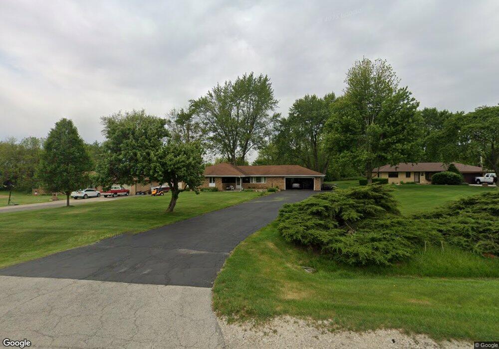
26650 S Us Highway 52 Manhattan, IL 60442
Estimated Value: $313,000 - $370,000
--
Bed
1
Bath
1,488
Sq Ft
$227/Sq Ft
Est. Value
About This Home
This home is located at 26650 S Us Highway 52, Manhattan, IL 60442 and is currently estimated at $338,482, approximately $227 per square foot. 26650 S Us Highway 52 is a home located in Will County with nearby schools including Peotone Intermediate Center, Peotone Elementary School, and Peotone Junior High School.
Ownership History
Date
Name
Owned For
Owner Type
Purchase Details
Closed on
Oct 6, 2010
Sold by
Cimino Patricia A
Bought by
First Midwest Bank and Trust #8631
Current Estimated Value
Purchase Details
Closed on
Jul 9, 2010
Sold by
Cinotto Jerome
Bought by
Cimino Patricia A and Mcdaniel Patricia A
Purchase Details
Closed on
Dec 16, 1998
Sold by
Mcdaniel Charles E
Bought by
Mcdaniel Patricia A
Create a Home Valuation Report for This Property
The Home Valuation Report is an in-depth analysis detailing your home's value as well as a comparison with similar homes in the area
Home Values in the Area
Average Home Value in this Area
Purchase History
| Date | Buyer | Sale Price | Title Company |
|---|---|---|---|
| First Midwest Bank | -- | None Available | |
| Cimino Patricia A | -- | None Available | |
| Cimino Patricia A | -- | None Available | |
| Mcdaniel Patricia A | -- | -- |
Source: Public Records
Tax History Compared to Growth
Tax History
| Year | Tax Paid | Tax Assessment Tax Assessment Total Assessment is a certain percentage of the fair market value that is determined by local assessors to be the total taxable value of land and additions on the property. | Land | Improvement |
|---|---|---|---|---|
| 2024 | $3,423 | $93,300 | $18,100 | $75,200 |
| 2023 | $3,423 | $85,700 | $16,200 | $69,500 |
| 2022 | $3,987 | $78,150 | $13,050 | $65,100 |
| 2021 | $4,112 | $75,600 | $13,050 | $62,550 |
| 2020 | $4,192 | $74,350 | $13,050 | $61,300 |
| 2019 | $4,412 | $74,350 | $13,050 | $61,300 |
| 2018 | $4,508 | $71,050 | $13,050 | $58,000 |
| 2017 | $4,535 | $71,050 | $13,050 | $58,000 |
| 2016 | $4,768 | $68,550 | $13,050 | $55,500 |
| 2015 | $4,490 | $65,650 | $12,550 | $53,100 |
| 2014 | $4,490 | $63,850 | $12,550 | $51,300 |
| 2013 | $4,490 | $63,850 | $12,550 | $51,300 |
Source: Public Records
Map
Nearby Homes
- COVENTRY Plan at Ivanhoe
- FAIRFIELD Plan at Ivanhoe
- HOLCOMBE 2 CAR Plan at Ivanhoe
- BELLAMY 2 CAR Plan at Ivanhoe
- HENLEY 2 CAR Plan at Ivanhoe
- 26010 S Rowena Dr
- 26010 Rowena Dr
- 15062 W Cambridge Ln
- 15112 W Cambridge Ln
- 15043 Oxford Ln
- 15063 Oxford Ln
- 15063 W Oxford Ln
- 15103 Oxford Ln
- 15103 W Oxford Ln
- 15113 W Oxford Ln
- 25920 S Manchester Ln
- 15040 Oxford Ln
- 15060 Oxford Ln
- 15060 W Oxford Ln
- 15100 Oxford Ln
- 26660 S Us Highway 52
- 26640 S Route 52
- 26630 S Us Highway 52
- 26620 S Us Highway 52
- 26716 S Us Highway 52
- 26727 S Us Highway 52
- 26445 S Us Highway 52
- 26665 S Us Highway 52
- 15000 W Hoff Rd
- 14944 W Hoff Rd
- 14919 W Bruns Rd
- 14841 W Hoff Rd
- 27010 S Us Highway 52
- 27025 S Us Highway 52
- 27025 S Us Highway 52
- 15002 W Hoff Rd
- 14830 W Bruns Rd
- 26260 S Castle Blvd
- 14705 W Bruns Rd
- 26250 S Castle Blvd