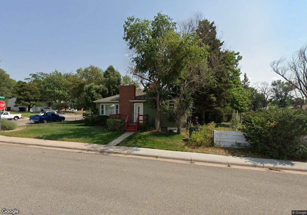
2667 Ash Cheyenne, WY 82001
Mountview Park NeighborhoodEstimated Value: $314,000 - $373,000
3
Beds
2
Baths
976
Sq Ft
$356/Sq Ft
Est. Value
About This Home
This home is located at 2667 Ash, Cheyenne, WY 82001 and is currently estimated at $347,055, approximately $355 per square foot. 2667 Ash is a home located in Laramie County with nearby schools including Henderson Elementary School, Carey Junior High School, and East High School.
Ownership History
Date
Name
Owned For
Owner Type
Purchase Details
Closed on
Mar 31, 2011
Sold by
Harper Lonnie C and Harper Barbara J
Bought by
Okamoto Norman and Okamoto Laura J
Current Estimated Value
Home Financials for this Owner
Home Financials are based on the most recent Mortgage that was taken out on this home.
Original Mortgage
$65,700
Outstanding Balance
$45,832
Interest Rate
5.04%
Mortgage Type
New Conventional
Estimated Equity
$301,223
Purchase Details
Closed on
Jul 24, 2001
Sold by
Hud
Bought by
Harper Lonnie C and Harper Barbara J
Home Financials for this Owner
Home Financials are based on the most recent Mortgage that was taken out on this home.
Original Mortgage
$93,139
Interest Rate
7.07%
Mortgage Type
FHA
Purchase Details
Closed on
Apr 27, 2001
Sold by
Casey Marcus D
Bought by
Wyoming Community Development Authority
Purchase Details
Closed on
May 15, 1998
Sold by
Casey Marcus D
Bought by
Casey Marcus D and Rose Janet
Create a Home Valuation Report for This Property
The Home Valuation Report is an in-depth analysis detailing your home's value as well as a comparison with similar homes in the area
Home Values in the Area
Average Home Value in this Area
Purchase History
| Date | Buyer | Sale Price | Title Company |
|---|---|---|---|
| Okamoto Norman | -- | None Available | |
| Harper Lonnie C | -- | -- | |
| Wyoming Community Development Authority | -- | -- | |
| Casey Marcus D | -- | -- |
Source: Public Records
Mortgage History
| Date | Status | Borrower | Loan Amount |
|---|---|---|---|
| Open | Okamoto Norman | $65,700 | |
| Previous Owner | Harper Lonnie C | $93,139 |
Source: Public Records
Tax History Compared to Growth
Tax History
| Year | Tax Paid | Tax Assessment Tax Assessment Total Assessment is a certain percentage of the fair market value that is determined by local assessors to be the total taxable value of land and additions on the property. | Land | Improvement |
|---|---|---|---|---|
| 2025 | $2,074 | $15,159 | $2,573 | $12,586 |
| 2024 | $2,074 | $29,325 | $5,146 | $24,179 |
| 2023 | $2,011 | $28,442 | $5,146 | $23,296 |
| 2022 | $1,862 | $25,803 | $5,146 | $20,657 |
| 2021 | $1,627 | $22,485 | $5,146 | $17,339 |
| 2020 | $1,536 | $21,298 | $5,146 | $16,152 |
| 2019 | $1,403 | $19,437 | $5,146 | $14,291 |
| 2018 | $1,300 | $18,176 | $4,402 | $13,774 |
| 2017 | $1,283 | $17,783 | $3,357 | $14,426 |
| 2016 | $1,162 | $16,095 | $3,098 | $12,997 |
| 2015 | $1,091 | $15,106 | $3,098 | $12,008 |
| 2014 | $1,091 | $15,007 | $3,098 | $11,909 |
Source: Public Records
Map
Nearby Homes
- 2974 Kelley Dr
- 1551 Oak Ct
- 3243 Forest Dr
- 2632 Henderson Dr
- 1509 Oak Ct
- 3241 Acacia Dr
- 1519 Hot Springs Ave
- 1869 Cherry Ct
- 3849 E Lincolnway
- 1626 Goshen Ave
- 2533 Deming Blvd
- 1125 Rosebud Rd
- 3251 Fir Dr
- 1837 Crook Ave
- 2407 E 16th St
- 2533 E 12th St
- 2521 E 12th St
- 2618 E 10th St
- 1503 Converse Ave
- 3315 Grove Dr
- 2939 Kelley Dr
- 2945 Kelley Dr
- 959 Ash Dr
- 2930 Henderson Dr
- 2938 Henderson Dr
- 2949 Kelley Dr
- 2928 Kelley Dr
- 2944 Henderson Dr
- 2932 Kelley Dr
- 2920 Kelley Dr
- 2914 Kelley Dr
- 2940 Kelley Dr
- 2948 Henderson Dr
- 2955 Kelley Dr
- 2908 Kelley Dr
- 2946 Kelley Dr
- 2954 Henderson Dr
- 2961 Kelley Dr
- 2901 Spruce Dr
- 2950 Kelley Dr