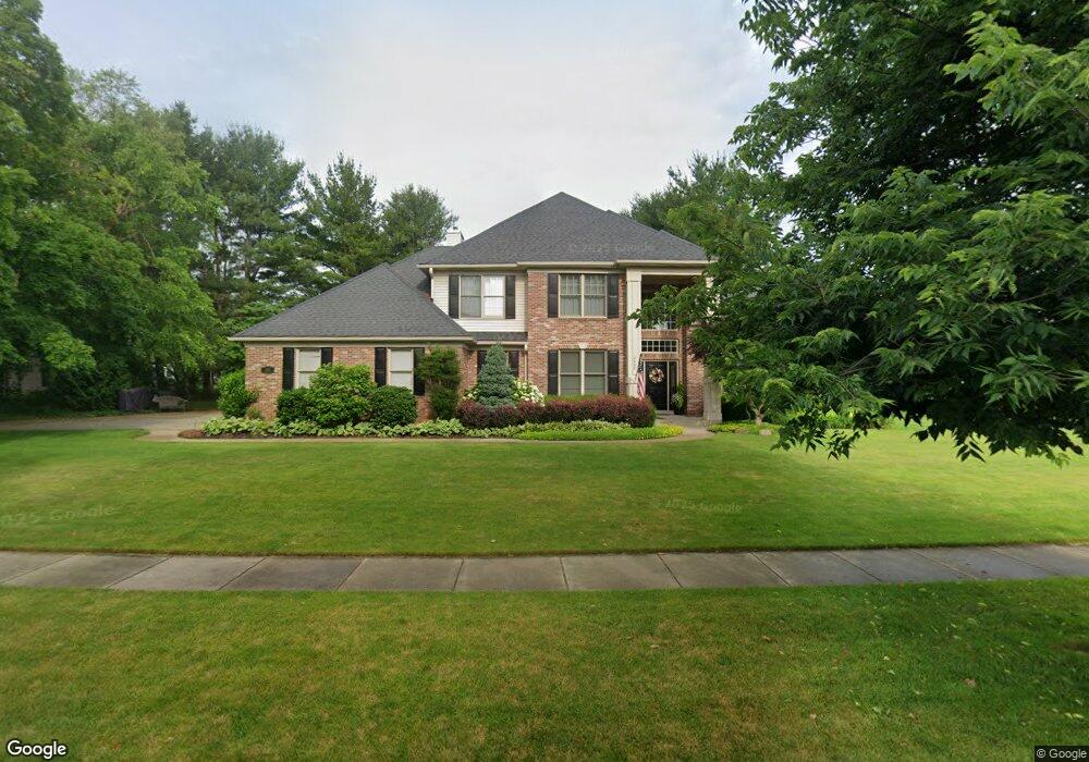
2668 Glenalmond Dr Portage, MI 49024
Estimated Value: $570,000 - $626,000
4
Beds
4
Baths
4,225
Sq Ft
$139/Sq Ft
Est. Value
About This Home
This home is located at 2668 Glenalmond Dr, Portage, MI 49024 and is currently estimated at $589,281, approximately $139 per square foot. 2668 Glenalmond Dr is a home located in Kalamazoo County with nearby schools including Moorsbridge Elementary School, Portage West Middle School, and Portage Central High School.
Ownership History
Date
Name
Owned For
Owner Type
Purchase Details
Closed on
Sep 19, 2005
Sold by
Sterling John M and Sterling Jennifer L
Bought by
Wright Ammon K and Wright Ammon
Current Estimated Value
Home Financials for this Owner
Home Financials are based on the most recent Mortgage that was taken out on this home.
Original Mortgage
$280,800
Outstanding Balance
$149,588
Interest Rate
5.88%
Mortgage Type
Fannie Mae Freddie Mac
Estimated Equity
$439,693
Purchase Details
Closed on
Dec 22, 2003
Sold by
Prudential Residential Services Lp
Bought by
Sterling John M and Sterling Jennifer L
Purchase Details
Closed on
Oct 28, 2003
Sold by
Tripathi Satish C and Potluri Jalaja
Bought by
Prudential Residential Services Lp
Create a Home Valuation Report for This Property
The Home Valuation Report is an in-depth analysis detailing your home's value as well as a comparison with similar homes in the area
Home Values in the Area
Average Home Value in this Area
Purchase History
| Date | Buyer | Sale Price | Title Company |
|---|---|---|---|
| Wright Ammon K | $351,000 | Metropolitan Title | |
| Sterling John M | $312,500 | Metro | |
| Prudential Residential Services Lp | $334,500 | Metro |
Source: Public Records
Mortgage History
| Date | Status | Borrower | Loan Amount |
|---|---|---|---|
| Open | Wright Ammon K | $280,800 |
Source: Public Records
Tax History Compared to Growth
Tax History
| Year | Tax Paid | Tax Assessment Tax Assessment Total Assessment is a certain percentage of the fair market value that is determined by local assessors to be the total taxable value of land and additions on the property. | Land | Improvement |
|---|---|---|---|---|
| 2025 | $9,146 | $262,200 | $0 | $0 |
| 2024 | $8,051 | $244,100 | $0 | $0 |
| 2023 | $7,675 | $223,000 | $0 | $0 |
| 2022 | $8,293 | $208,900 | $0 | $0 |
| 2021 | $8,015 | $207,000 | $0 | $0 |
| 2020 | $7,840 | $192,500 | $0 | $0 |
| 2019 | $706 | $190,700 | $0 | $0 |
| 2018 | $0 | $186,400 | $0 | $0 |
| 2017 | $0 | $182,500 | $0 | $0 |
| 2016 | -- | $173,700 | $0 | $0 |
| 2015 | -- | $160,400 | $0 | $0 |
| 2014 | -- | $162,600 | $0 | $0 |
Source: Public Records
Map
Nearby Homes
- 7639 Dunross Dr
- 2076 Lion Gate Dr
- 2600 W Centre Ave Unit +/- 1 Acre
- 2351 W Centre Ave
- 1902 W Centre Ave
- 7464 Saint George Cir
- 7481 Turnberry Ct
- 7922 Kilmory Cir
- 7961 Kilmory Cir
- 8030 Wimbledon Dr Unit 35
- 3653 Tartan Cir
- 7784 Primrose Ln
- 7160 Crown Pointe Cir
- 7337 Starbrook St
- 7236 Hampstead Ln Unit 18
- 1828 Woodland Dr
- 7403 Rockford St
- 1531 Redstock Ave
- 3320 Scots Pine Way Unit 2
- 1318 Ashton Woods Ct
- 2666 Glenalmond Dr
- 2610 Glenalmond Dr
- 2700 Glenalmond Dr
- 2661 Glenalmond Dr
- 2687 Glenalmond Dr
- 2633 Glenalmond Dr
- 2699 Glenalmond Dr
- 2754 Glenalmond Dr
- 2751 Innisbrook Dr
- 2601 Glenalmond Dr
- 2707 Glenalmond Dr
- 2704 Innisbrook Dr
- 2727 Glenalmond Dr
- 2787 Innisbrook Dr
- 2645 Innisbrook Dr
- 2662 Innisbrook Dr
- 2792 Glenalmond Dr
- 2740 Innisbrook Dr
- 2759 Glenalmond Dr
- 2768 Innisbrook Dr