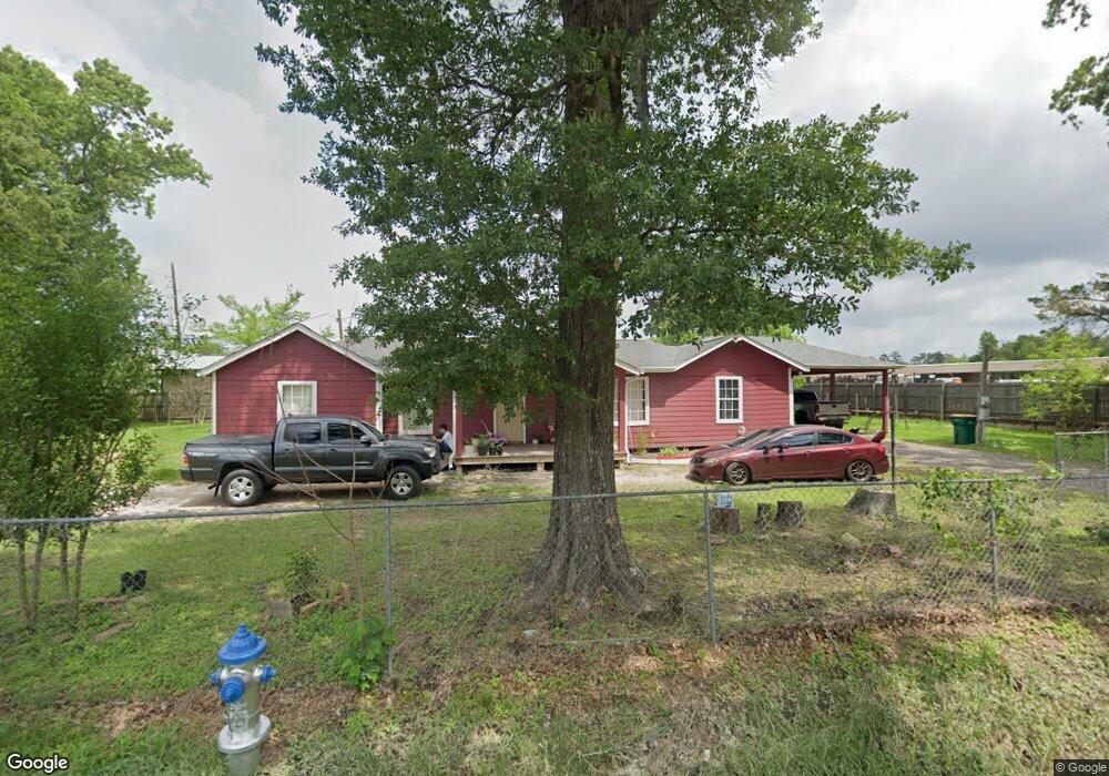
2669 Beasley Rd Conroe, TX 77301
Estimated Value: $140,662
4
Beds
2
Baths
1,694
Sq Ft
$83/Sq Ft
Est. Value
About This Home
This home is located at 2669 Beasley Rd, Conroe, TX 77301 and is currently estimated at $140,662, approximately $83 per square foot. 2669 Beasley Rd is a home located in Montgomery County with nearby schools including Patterson Elementary School, Bozman Intermediate School, and Stockton Junior High School.
Ownership History
Date
Name
Owned For
Owner Type
Purchase Details
Closed on
Jun 10, 2019
Sold by
Oidor Susana
Bought by
Rodriguez Roy
Current Estimated Value
Purchase Details
Closed on
Sep 29, 2006
Sold by
Ramirez Miguel Angel
Bought by
Oidor Susana
Purchase Details
Closed on
Aug 7, 2002
Sold by
Higgins Sherry Schmidt
Bought by
Oidor Susana
Home Financials for this Owner
Home Financials are based on the most recent Mortgage that was taken out on this home.
Original Mortgage
$67,446
Interest Rate
6.53%
Mortgage Type
FHA
Purchase Details
Closed on
Oct 8, 1998
Sold by
Mcelwee Lillie
Bought by
Oidor Susana
Purchase Details
Closed on
Jul 7, 1995
Sold by
Higgins Sherry and Higgins Lonnie
Bought by
Mcelwee W B and Mcelwee Lillie B
Create a Home Valuation Report for This Property
The Home Valuation Report is an in-depth analysis detailing your home's value as well as a comparison with similar homes in the area
Home Values in the Area
Average Home Value in this Area
Purchase History
| Date | Buyer | Sale Price | Title Company |
|---|---|---|---|
| Rodriguez Roy | -- | Old Republic Title | |
| Oidor Susana | -- | None Available | |
| Oidor Susana | -- | None Available | |
| Oidor Susana | -- | -- | |
| Ramirez Miguel Angel | -- | Chicago Title | |
| Oidor Susana | -- | -- | |
| Mcelwee W B | -- | -- |
Source: Public Records
Mortgage History
| Date | Status | Borrower | Loan Amount |
|---|---|---|---|
| Previous Owner | Ramirez Miguel Angel | $67,446 | |
| Closed | Oidor Susana | $0 |
Source: Public Records
Tax History Compared to Growth
Tax History
| Year | Tax Paid | Tax Assessment Tax Assessment Total Assessment is a certain percentage of the fair market value that is determined by local assessors to be the total taxable value of land and additions on the property. | Land | Improvement |
|---|---|---|---|---|
| 2025 | $3,276 | $171,240 | $40,830 | $130,410 |
| 2024 | $3,281 | $171,240 | $40,830 | $130,410 |
| 2023 | $3,281 | $171,240 | $40,830 | $130,410 |
| 2022 | $3,139 | $151,350 | $40,830 | $110,520 |
| 2021 | $3,309 | $151,350 | $40,830 | $110,520 |
| 2020 | $3,269 | $143,290 | $20,420 | $122,870 |
| 2019 | $612 | $26,260 | $9,840 | $48,600 |
| 2018 | $219 | $23,870 | $9,840 | $38,230 |
| 2017 | $508 | $21,700 | $9,840 | $38,230 |
| 2016 | $462 | $19,730 | $9,840 | $38,230 |
| 2015 | $187 | $17,940 | $5,160 | $38,230 |
| 2014 | $187 | $16,310 | $5,160 | $23,040 |
Source: Public Records
Map
Nearby Homes
- 2325 Shady Tree Ln
- 2325 Shady Pine Dr
- 2724 Cadiz Bay Dr
- 2741 Cadiz Bay Dr
- 2315 Shady Tree Ln
- 508 Birch Cluster Ct
- 2726 Discovery Trails Ct
- 2714 Discovery Trails Ct
- 2710 Discovery Trails Ct
- 283 Eastwood Dr
- 2213 Ivy Wall Dr
- 509 Dogwood Cluster Ct
- 1108 Miracle Dr
- 0 Beach Airport Rd
- 1251 Beach Airport Rd
- 2233 Oak Circle Dr N
- 2512 Hawks Eye Dr
- 2516 Hawks Eye Dr
- 2524 Hawks Eye Dr
- 2520 Hawks Eye Dr
- 2600 Beasley Rd
- 1233 Copal Trail
- 1205 Copal Trail
- 1217 Copal Trail
- 1237 Copal Trail
- 1109 Copal Trail
- 1121 Copal Trail
- 1113 Copal Trail
- 1141 Copal Trail
- 2326 Shady Tree Ln
- 2327 Shady Tree Ln
- 2324 Shady Tree Ln
- 2325 Shady Birch Dr
- 2323 Shady Birch Dr
- 2326 Shady Pine Dr
- 2324 Shady Pine Dr
- 281 Beach Airport Rd
- 2322 Shady Tree Ln
- 2323 Shady Tree Ln
- 2322 Shady Pine Dr