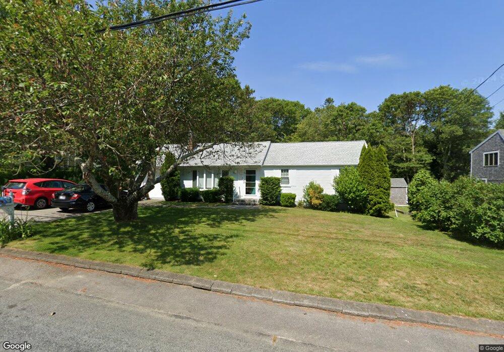
267 Buckskin Path Centerville, MA 02632
Centerville NeighborhoodEstimated Value: $600,000 - $684,000
3
Beds
2
Baths
1,235
Sq Ft
$511/Sq Ft
Est. Value
About This Home
This home is located at 267 Buckskin Path, Centerville, MA 02632 and is currently estimated at $630,564, approximately $510 per square foot. 267 Buckskin Path is a home located in Barnstable County with nearby schools including Centerville Elementary School, Barnstable United Elementary School, and Barnstable Intermediate School.
Ownership History
Date
Name
Owned For
Owner Type
Purchase Details
Closed on
Dec 11, 2017
Sold by
Fox Diane E and Fox Priscilla A
Bought by
Diane E Fox Ret
Current Estimated Value
Purchase Details
Closed on
Jul 10, 2009
Sold by
Salmon Bridget
Bought by
Fox Diane E
Home Financials for this Owner
Home Financials are based on the most recent Mortgage that was taken out on this home.
Original Mortgage
$110,000
Interest Rate
4.93%
Mortgage Type
Purchase Money Mortgage
Purchase Details
Closed on
May 14, 2009
Sold by
Nation Maureen
Bought by
Salmon Bridget
Home Financials for this Owner
Home Financials are based on the most recent Mortgage that was taken out on this home.
Original Mortgage
$110,000
Interest Rate
4.93%
Mortgage Type
Purchase Money Mortgage
Create a Home Valuation Report for This Property
The Home Valuation Report is an in-depth analysis detailing your home's value as well as a comparison with similar homes in the area
Home Values in the Area
Average Home Value in this Area
Purchase History
| Date | Buyer | Sale Price | Title Company |
|---|---|---|---|
| Diane E Fox Ret | -- | -- | |
| Fox Diane E | $250,000 | -- | |
| Salmon Bridget | -- | -- |
Source: Public Records
Mortgage History
| Date | Status | Borrower | Loan Amount |
|---|---|---|---|
| Previous Owner | Fox Diane E | $110,000 |
Source: Public Records
Tax History
| Year | Tax Paid | Tax Assessment Tax Assessment Total Assessment is a certain percentage of the fair market value that is determined by local assessors to be the total taxable value of land and additions on the property. | Land | Improvement |
|---|---|---|---|---|
| 2025 | $4,245 | $524,700 | $151,900 | $372,800 |
| 2024 | $4,074 | $521,700 | $151,900 | $369,800 |
| 2023 | $3,826 | $458,700 | $138,100 | $320,600 |
| 2022 | $3,474 | $360,400 | $102,300 | $258,100 |
| 2021 | $3,345 | $318,900 | $102,300 | $216,600 |
| 2020 | $3,389 | $309,200 | $102,300 | $206,900 |
| 2019 | $3,232 | $286,500 | $102,300 | $184,200 |
| 2018 | $2,934 | $261,500 | $107,700 | $153,800 |
| 2017 | $2,743 | $254,900 | $107,700 | $147,200 |
| 2016 | $2,787 | $255,700 | $108,500 | $147,200 |
| 2015 | $2,722 | $250,900 | $105,100 | $145,800 |
Source: Public Records
Map
Nearby Homes
- 296 Buckskin Path
- 315 Prince Hinckley Rd
- 900 Old Stage Rd
- 82 Yacht Club Rd
- 87 Foxglove Rd
- 51 Larch Ln
- 66 Tern Ln
- 62 Three Ponds Dr
- 19 Marrick Ct
- 1028 Old Falmouth Rd
- 324 Patriot Way
- 53 Meadow Farm Rd
- 52 Meadow Farm Rd
- 103 Pine Tree Dr
- 200 Lumbert Mill Rd
- 7 Ebenezer
- 40 Sachem Dr
- 74 Saddler Ln
- 481 Lakeside Dr W
- 83 Lake Dr
- 277 Buckskin Path
- 257 Buckskin Path
- 182 Skunknet Rd
- 192 Skunknet Rd
- 287 Buckskin Path
- 266 Buckskin Path
- 247 Buckskin Path
- 278 Buckskin Path
- 172 Skunknet Rd
- 202 Skunknet Rd
- 256 Buckskin Path
- 26 Skunknet Rd
- 286 Buckskin Path
- 162 Skunknet Rd
- 297 Buckskin Path
- 212 Skunknet Rd
- 237 Buckskin Path
- 244 Buckskin Path
- 201 Monomoy Cir
- 211 Monomoy Cir
Your Personal Tour Guide
Ask me questions while you tour the home.