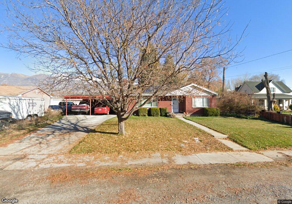
267 S 100 W American Fork, UT 84003
Estimated Value: $526,000 - $596,000
5
Beds
2
Baths
1,624
Sq Ft
$341/Sq Ft
Est. Value
About This Home
This home is located at 267 S 100 W, American Fork, UT 84003 and is currently estimated at $553,742, approximately $340 per square foot. 267 S 100 W is a home located in Utah County with nearby schools including Greenwood Elementary School, American Fork Junior High School, and American Fork High School.
Ownership History
Date
Name
Owned For
Owner Type
Purchase Details
Closed on
Sep 12, 2025
Sold by
Greening Larae Davits and Christley Larae D
Bought by
Larae Greening Family Revocable Trust and Greening
Current Estimated Value
Purchase Details
Closed on
Dec 22, 2009
Sold by
Christley Larae D
Bought by
Corporation Of The Presiding Bishop Of T
Purchase Details
Closed on
Mar 31, 1999
Sold by
Blackhurst Pharis C and Blackhurst Pamela F
Bought by
Christley Milan R and Christley Larae D
Create a Home Valuation Report for This Property
The Home Valuation Report is an in-depth analysis detailing your home's value as well as a comparison with similar homes in the area
Home Values in the Area
Average Home Value in this Area
Purchase History
| Date | Buyer | Sale Price | Title Company |
|---|---|---|---|
| Larae Greening Family Revocable Trust | -- | None Listed On Document | |
| Corporation Of The Presiding Bishop Of T | -- | Bartlett Title Insurance Ag | |
| Christley Milan R | -- | Access Title Company |
Source: Public Records
Tax History Compared to Growth
Tax History
| Year | Tax Paid | Tax Assessment Tax Assessment Total Assessment is a certain percentage of the fair market value that is determined by local assessors to be the total taxable value of land and additions on the property. | Land | Improvement |
|---|---|---|---|---|
| 2025 | $2,148 | $266,090 | $214,500 | $269,300 |
| 2024 | $2,148 | $238,645 | $0 | $0 |
| 2023 | $1,986 | $233,915 | $0 | $0 |
| 2022 | $2,239 | $260,315 | $0 | $0 |
| 2021 | $1,915 | $347,700 | $153,900 | $193,800 |
| 2020 | $1,790 | $315,200 | $137,400 | $177,800 |
| 2019 | $1,623 | $295,600 | $117,800 | $177,800 |
| 2018 | $1,496 | $260,600 | $106,000 | $154,600 |
| 2017 | $1,447 | $136,015 | $0 | $0 |
| 2016 | $1,370 | $119,625 | $0 | $0 |
| 2015 | $1,334 | $110,550 | $0 | $0 |
| 2014 | $1,325 | $108,350 | $0 | $0 |
Source: Public Records
Map
Nearby Homes