267 S 2400 W Parowan, UT 84761
Estimated payment $4,116/month
Highlights
- Ranch Style House
- No HOA
- Porch
- Cathedral Ceiling
- Fireplace
- 2 Car Attached Garage
About This Home
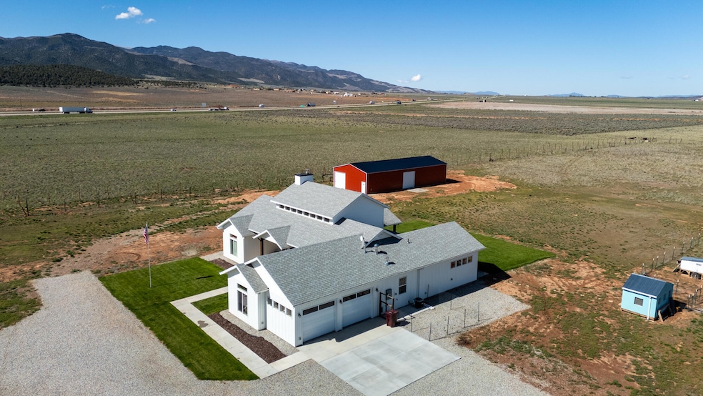
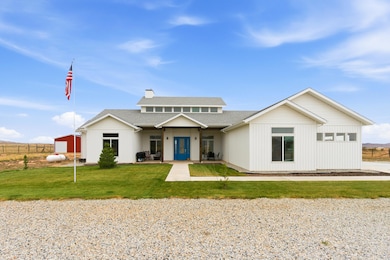
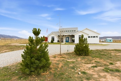
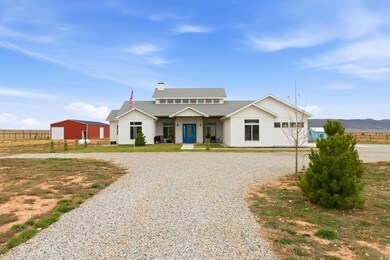
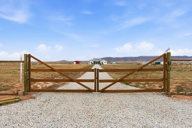
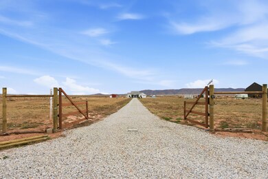
THIS HOME HAS IT ALL! Beautiful SINGLE LEVEL on 8.03 acres w/VIEWS in all directions. Includes 30' X 70' (2100 sq ft) STEEL BUILDING on engineered concrete foundation, pull through access w/4 doors, electrical outlets & lights. PRIVATE WELL w/1 ac ft underground water right (1917 PRIORITY DATE) 250 gallon water storage tank & automated rain bird irrigation system. Zoning allows for animals & agriculture. 3 bedrooms, 2 1/2 bathrooms, cathedral ceilings, open floor plan, gorgeous kitchen w/huge island, beautiful fireplace, dual water heaters, dual heating & cooling, LVP flooring, walk-in closets (2 in master). Property is FULLY FENCED, has full RV HOOKUPS w/50 amp svc. 2 car Fully finished garage w/50 amp svc. Located near Brian Head Ski Resort. PRICED TO SELL! DON'T MISS OUT! AMAZING DEAL!
Listing Agent
Century 21 1st Choice Realty License #5487663-PB00 Listed on: 11/14/2025

Home Details
Home Type
- Single Family
Est. Annual Taxes
- $1,973
Year Built
- Built in 2023
Lot Details
- 8.03 Acre Lot
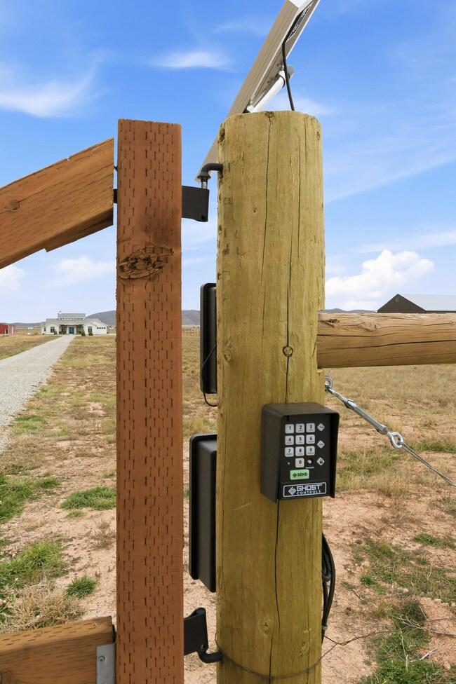
- Property is Fully Fenced
- Landscaped
- Sprinkler System
- Property is zoned A-20
Parking
- 2 Car Attached Garage
- Garage Door Opener
Home Design
- Ranch Style House
- Frame Construction
- Asphalt Shingled Roof
- Vinyl Siding
Interior Spaces
- 2,162 Sq Ft Home
- Cathedral Ceiling
- ENERGY STAR Qualified Ceiling Fan
- Ceiling Fan
- Fireplace
- Double Pane Windows
- Formal Entry
Kitchen
- Range
- Microwave
- Dishwasher
- Disposal
Flooring
- Wall to Wall Carpet
- Tile
- Luxury Vinyl Tile
Bedrooms and Bathrooms
- 3 Bedrooms
Outdoor Features
- Patio
- Porch
Schools
- Parowan Elementary And Middle School
- Parowan High School
Utilities
- Forced Air Heating and Cooling System
- Heating System Uses Propane
- Propane
- Well
- Water Softener is Owned
- Septic Tank
Community Details
- No Home Owners Association
Listing and Financial Details
- Assessor Parcel Number C-1051-0009-0000
Map
Home Values in the Area
Average Home Value in this Area
Tax History
| Year | Tax Paid | Tax Assessment Tax Assessment Total Assessment is a certain percentage of the fair market value that is determined by local assessors to be the total taxable value of land and additions on the property. | Land | Improvement |
|---|---|---|---|---|
| 2025 | $2,428 | $326,258 | $119,621 | $206,637 |
| 2023 | $2,396 | $263,035 | $91,140 | $171,895 |
| 2022 | $415 | $49,000 | $49,000 | $0 |
| 2021 | $0 | $0 | $0 | $0 |
Property History
| Date | Event | Price | List to Sale | Price per Sq Ft |
|---|---|---|---|---|
| 11/14/2025 11/14/25 | For Sale | $749,999 | -- | $347 / Sq Ft |
Purchase History
| Date | Type | Sale Price | Title Company |
|---|---|---|---|
| Warranty Deed | -- | -- | |
| Warranty Deed | -- | Security Escrow & Title |
Source: Iron County Board of REALTORS®
MLS Number: 113836
APN: C-1051-0009-0000
- 2246 W 450 S
- 2228 W 450 S
- 2239 W 475 S
- 6 Acres Commercial Land
- 20.75 Acres S of Parowan Along I-15
- 0 Pine Canyon Dr Unit 25-260421
- 403 & 404 Kari
- 680 S Heritage Hills Dr
- 701 S Heritage Hills Dr
- 0 Lot 3 Summit Valley Ranchos Unit 110908
- 0 2 35 Ac- Summit Valley Ranchos Unit 113469
- 0 Sunflower Ln
- 1521 W 950 S
- 0 W Old Highway 91 Unit 24-253616
- 0 W Old Highway 91 Unit 108031
- 1112 W 275 S
- 1065 W 275 S Unit Maple Springs Estate
- 257 S 1175 W
- 1144 375 South St
- 345 N 575 W
- 651 S Snowflake Ln Unit 203
- 4616 N Tumbleweed Dr
- 4349 Half Mile Rd Unit Apartment
- 2620 175 W
- 535 W 2530 N Unit 8
- 535 W 2530 N
- 2014 N 350 W
- 2782 N Clark Pkwy
- 1896 W Aaron Tippets Rd
- 1673 Northfield Rd Unit 1673 Northfield Rd Cedar
- 1177 Northfield Rd
- 1148 Northfield Rd
- 1260 N 650 W
- 703 W 1225 N
- 576 W 1045 N Unit B12
- 780 W 1125 N
- 2085 N 275 W
- 939 Ironwood Dr
- 333 N 400 W