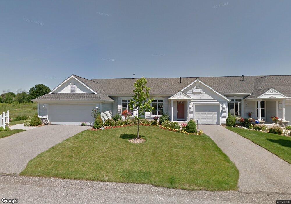
267 Shoreside Dr S Grand Rapids, MI 49548
Estimated Value: $333,000 - $367,589
2
Beds
3
Baths
1,400
Sq Ft
$247/Sq Ft
Est. Value
About This Home
This home is located at 267 Shoreside Dr S, Grand Rapids, MI 49548 and is currently estimated at $345,397, approximately $246 per square foot. 267 Shoreside Dr S is a home located in Kent County with nearby schools including Southwood Elementary, Pinewood Middle School, and East Kentwood High School.
Ownership History
Date
Name
Owned For
Owner Type
Purchase Details
Closed on
Nov 7, 2014
Sold by
Buckley Thomas J and Buckley Kathleen
Bought by
Denton Patrick L and Denton Sharon A
Current Estimated Value
Home Financials for this Owner
Home Financials are based on the most recent Mortgage that was taken out on this home.
Original Mortgage
$175,655
Outstanding Balance
$135,494
Interest Rate
4.19%
Mortgage Type
New Conventional
Estimated Equity
$209,903
Purchase Details
Closed on
Jan 20, 2006
Sold by
Gunnink & Devries Builders Inc
Bought by
Buckley Thomas J and Buckley Kathleen
Home Financials for this Owner
Home Financials are based on the most recent Mortgage that was taken out on this home.
Original Mortgage
$65,000
Interest Rate
6.46%
Mortgage Type
Fannie Mae Freddie Mac
Create a Home Valuation Report for This Property
The Home Valuation Report is an in-depth analysis detailing your home's value as well as a comparison with similar homes in the area
Home Values in the Area
Average Home Value in this Area
Purchase History
| Date | Buyer | Sale Price | Title Company |
|---|---|---|---|
| Denton Patrick L | $184,900 | None Available | |
| Buckley Thomas J | $197,083 | Fatic |
Source: Public Records
Mortgage History
| Date | Status | Borrower | Loan Amount |
|---|---|---|---|
| Open | Denton Patrick L | $175,655 | |
| Previous Owner | Buckley Thomas J | $65,000 |
Source: Public Records
Tax History Compared to Growth
Tax History
| Year | Tax Paid | Tax Assessment Tax Assessment Total Assessment is a certain percentage of the fair market value that is determined by local assessors to be the total taxable value of land and additions on the property. | Land | Improvement |
|---|---|---|---|---|
| 2025 | $2,064 | $170,000 | $0 | $0 |
| 2024 | $2,064 | $161,800 | $0 | $0 |
| 2022 | $1,882 | $131,600 | $0 | $0 |
| 2021 | $2,533 | $127,500 | $0 | $0 |
| 2020 | $1,832 | $121,700 | $0 | $0 |
| 2019 | $2,375 | $111,500 | $0 | $0 |
| 2018 | $2,375 | $104,900 | $10,500 | $94,400 |
| 2017 | $0 | $98,200 | $0 | $0 |
| 2016 | $0 | $82,200 | $0 | $0 |
| 2015 | -- | $82,200 | $0 | $0 |
| 2013 | -- | $74,900 | $0 | $0 |
Source: Public Records
Map
Nearby Homes
- 6625 Shoreside Ct SE
- 303 Shoreside South Dr SE
- 304 S Grandbrook Cir SE
- 100 Inca Dr SW
- 100 Brownell St SE
- 6403 College Ave SE
- 104 Herbert St SW
- 45 Fontenelle St SE
- 607 66th St SE
- 296 Kenlock St SE
- 6775 Union Ave SE
- 62 Kenton St SE
- 190 Trinity Ave SW
- 378 S Kenbrook St SE Unit S378
- 331 S Kenbrook St SE Unit S331
- 124 N Kenbrook St SE Unit N124
- 342 N Kenbrook St SE
- 151 N Kenbrook St SE Unit N151
- 323 Scabbard St SW
- 59 Lilly St SE
- 267 Shoreside South Dr SE Unit 53
- 267 Shoreside Dr S Unit B
- 265 Shoreside South Dr SE Unit 54
- 269 Shoreside South Dr SE Unit 52
- 271 Shoreside Dr S Unit 51
- 263 Shoreside South Dr SE
- 261 Shoreside South Dr SE Unit 56
- 273 Shoreside South Dr SE Unit 50
- 273 Shoreside Dr S
- 266 Shoreside North Dr SE Unit 66
- 266 Shoreside North Dr SE Unit 69
- 260 Shoreside Drive North SE
- 260 Shoreside Dr N Unit 66
- 260 Shoreside Dr N
- 259 Shoreside Dr S
- 268 Shoreside North Dr SE Unit 70
- 268 Shoreside North Dr SE
- 268 Shoreside North Dr SE
- 259 Shoreside South Dr SE Unit 57
- 264 Shoreside North Dr SE Unit 68