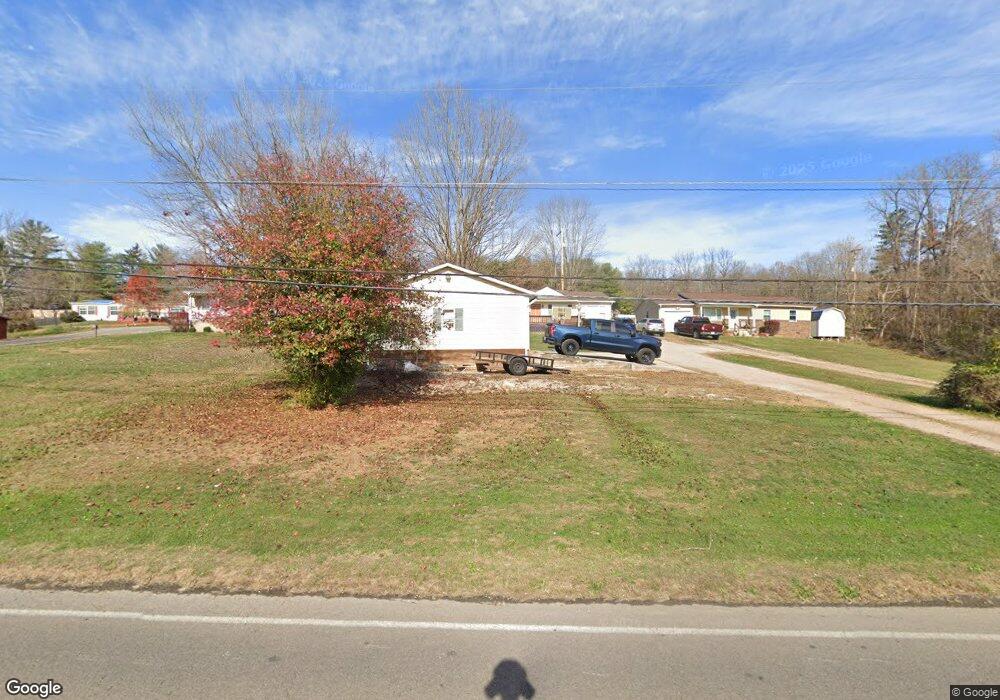
267 W 13th St Wellston, OH 45692
Estimated Value: $136,558 - $209,000
3
Beds
1
Bath
1,296
Sq Ft
$124/Sq Ft
Est. Value
About This Home
This home is located at 267 W 13th St, Wellston, OH 45692 and is currently estimated at $160,390, approximately $123 per square foot. 267 W 13th St is a home located in Jackson County with nearby schools including Bundy Elementary School, Wellston Intermediate School, and Wellston Middle School.
Ownership History
Date
Name
Owned For
Owner Type
Purchase Details
Closed on
Jul 28, 2017
Sold by
Kuhn Tracy
Bought by
Kuhn Tracy and Kuhn Merle A
Current Estimated Value
Purchase Details
Closed on
Aug 6, 2015
Sold by
Jones Ronald D
Bought by
Kuhn Tracy
Purchase Details
Closed on
Jun 28, 2013
Sold by
The First National Bank Of Wellston
Bought by
Jones Ronald D and Kuhn Tracy
Purchase Details
Closed on
Jan 4, 2013
Sold by
Bocook Steven A
Bought by
The First National Bank Of Wellston Ohio
Purchase Details
Closed on
Jun 14, 2007
Sold by
Storms Marcella and Bocook Marcella
Bought by
Bocook Steve and Bocook Steven A
Purchase Details
Closed on
Feb 10, 1997
Sold by
Fouts Donald
Bought by
Bocook Steve and Bocook Marcella
Create a Home Valuation Report for This Property
The Home Valuation Report is an in-depth analysis detailing your home's value as well as a comparison with similar homes in the area
Home Values in the Area
Average Home Value in this Area
Purchase History
| Date | Buyer | Sale Price | Title Company |
|---|---|---|---|
| Kuhn Tracy | -- | Northwest Title | |
| Kuhn Tracy | -- | None Available | |
| Jones Ronald D | $55,000 | Arrow Title Agency Llc | |
| The First National Bank Of Wellston Ohio | $60,000 | None Available | |
| Bocook Steve | -- | None Available | |
| Bocook Steve | $29,500 | -- |
Source: Public Records
Tax History Compared to Growth
Tax History
| Year | Tax Paid | Tax Assessment Tax Assessment Total Assessment is a certain percentage of the fair market value that is determined by local assessors to be the total taxable value of land and additions on the property. | Land | Improvement |
|---|---|---|---|---|
| 2024 | $1,076 | $29,110 | $4,030 | $25,080 |
| 2023 | $1,075 | $29,110 | $4,030 | $25,080 |
| 2022 | $1,135 | $24,000 | $3,460 | $20,540 |
| 2021 | $938 | $24,000 | $3,460 | $20,540 |
| 2020 | $961 | $24,000 | $3,460 | $20,540 |
| 2019 | $959 | $23,250 | $3,360 | $19,890 |
| 2018 | $930 | $23,250 | $3,360 | $19,890 |
| 2017 | $887 | $23,250 | $3,360 | $19,890 |
| 2016 | $964 | $24,980 | $3,850 | $21,130 |
| 2015 | $962 | $24,980 | $3,850 | $21,130 |
| 2013 | $927 | $24,600 | $3,850 | $20,750 |
| 2012 | $5,157 | $24,600 | $3,850 | $20,750 |
Source: Public Records
Map
Nearby Homes
- 374 Exline Rd
- 0 Womeldorf Ln
- 1040 W Broadway St
- 616 S Michigan Ave
- 224 W 4th St
- 238 S Wisconsin Ave
- 360 Hayes Ln
- 21 S Michigan Ave
- 552 W B St
- 103 Meadow Run Rd
- 103&103B Meadow Run
- 0 Ohio 327
- 1433 S Pennsylvania Ave
- 1254 S New York Ave
- 16 E Broadway St
- 416 S New York Ave
- 629 W D St
- 222 N Michigan Ave
- 224 E 2nd St
- 303 E 9th St