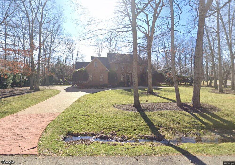
2670 Kentford Rd Midlothian, VA 23113
Salisbury NeighborhoodEstimated Value: $1,078,000 - $1,311,000
5
Beds
5
Baths
4,839
Sq Ft
$249/Sq Ft
Est. Value
About This Home
This home is located at 2670 Kentford Rd, Midlothian, VA 23113 and is currently estimated at $1,206,473, approximately $249 per square foot. 2670 Kentford Rd is a home located in Chesterfield County with nearby schools including Bettie Weaver Elementary School, Midlothian Middle School, and Midlothian High School.
Ownership History
Date
Name
Owned For
Owner Type
Purchase Details
Closed on
Mar 2, 1998
Sold by
O'Konek Joseph H
Bought by
Schaffernoth Andrew H and Schaffernoth Susan M
Current Estimated Value
Home Financials for this Owner
Home Financials are based on the most recent Mortgage that was taken out on this home.
Original Mortgage
$300,000
Outstanding Balance
$54,059
Interest Rate
6.85%
Mortgage Type
New Conventional
Estimated Equity
$1,152,414
Purchase Details
Closed on
Aug 6, 1996
Sold by
Crete Construction Inc
Bought by
Okonek Joseph K and Okonek Linda P
Home Financials for this Owner
Home Financials are based on the most recent Mortgage that was taken out on this home.
Original Mortgage
$325,000
Interest Rate
8.27%
Mortgage Type
New Conventional
Create a Home Valuation Report for This Property
The Home Valuation Report is an in-depth analysis detailing your home's value as well as a comparison with similar homes in the area
Home Values in the Area
Average Home Value in this Area
Purchase History
| Date | Buyer | Sale Price | Title Company |
|---|---|---|---|
| Schaffernoth Andrew H | $430,000 | -- | |
| Okonek Joseph K | $425,000 | -- |
Source: Public Records
Mortgage History
| Date | Status | Borrower | Loan Amount |
|---|---|---|---|
| Open | Okonek Joseph K | $300,000 | |
| Previous Owner | Okonek Joseph K | $325,000 |
Source: Public Records
Tax History Compared to Growth
Tax History
| Year | Tax Paid | Tax Assessment Tax Assessment Total Assessment is a certain percentage of the fair market value that is determined by local assessors to be the total taxable value of land and additions on the property. | Land | Improvement |
|---|---|---|---|---|
| 2025 | $10,376 | $1,163,000 | $131,000 | $1,032,000 |
| 2024 | $10,376 | $1,069,900 | $111,000 | $958,900 |
| 2023 | $8,893 | $977,300 | $106,000 | $871,300 |
| 2022 | $8,237 | $895,300 | $103,000 | $792,300 |
| 2021 | $7,746 | $808,400 | $101,000 | $707,400 |
| 2020 | $7,406 | $779,600 | $101,000 | $678,600 |
| 2019 | $7,406 | $779,600 | $101,000 | $678,600 |
| 2018 | $7,121 | $749,600 | $101,000 | $648,600 |
| 2017 | $6,852 | $713,800 | $100,000 | $613,800 |
| 2016 | $6,836 | $712,100 | $96,000 | $616,100 |
| 2015 | $6,538 | $678,400 | $96,000 | $582,400 |
| 2014 | $6,019 | $624,400 | $96,000 | $528,400 |
Source: Public Records
Map
Nearby Homes
- 13901 Dunkeld Terrace
- 2540 Kentford Rd
- 14110 Netherfield Dr
- 14100 Worchester Ct
- 3020 Mount Hill Dr
- 2360 Castlebridge Rd
- 2725 Stonegate Ct
- 13449 Glendower Rd
- 2303 Bream Dr
- 3231 Queens Grant Dr
- 3200 Queens Grant Dr
- 16037 Aspect Way
- 16033 Aspect Way
- 16112 Esteem Way
- 1175 Cardinal Crest Terrace
- 16116 Esteem Way
- 1813 Gildenborough Ct
- 14335 Lander Rd
- 16106 Swallowtail Place
- 14124 Rigney Dr
- 2660 Kentford Rd
- 2710 W Brigstock Rd
- 2700 E Brigstock Rd
- 2701 E Brigstock Rd
- 2650 Kentford Rd
- 2621 Arrandell Rd
- 2671 Kentford Rd
- 2720 W Brigstock Rd
- 2631 Arrandell Rd
- 2715 W Brigstock Rd
- 2655 Kentford Rd
- 2611 Arrandell Rd
- 2643 Kentford Rd
- 2641 Arrandell Rd
- 2716 E Brigstock Rd
- 2730 W Brigstock Rd
- 2630 Kentford Rd
- 2641 Kentford Rd
- 2711 E Brigstock Rd
- 2729 W Brigstock Rd