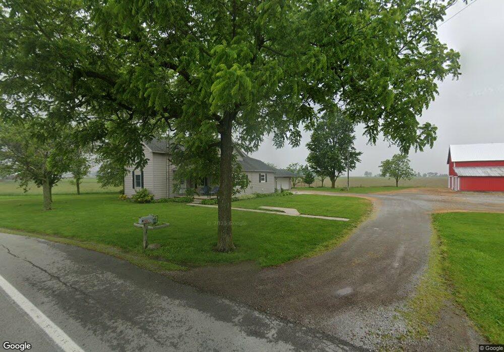
2670 State Route 235 Mc Comb, OH 45858
McComb NeighborhoodEstimated Value: $212,000 - $350,000
4
Beds
2
Baths
2,752
Sq Ft
$93/Sq Ft
Est. Value
About This Home
This home is located at 2670 State Route 235, Mc Comb, OH 45858 and is currently estimated at $255,036, approximately $92 per square foot. 2670 State Route 235 is a home located in Hancock County with nearby schools including McComb Elementary School, McComb Middle School, and Mccomb Local High School.
Ownership History
Date
Name
Owned For
Owner Type
Purchase Details
Closed on
Mar 24, 2025
Sold by
Fenstermaker Steve D and Fenstermaker Melissa L
Bought by
Melissa L Fenstermaker Revocable Trust and Fenstermaker
Current Estimated Value
Purchase Details
Closed on
May 30, 2014
Sold by
Bryan J Kenneth
Bought by
Fenstermaker Steve D and Fenstermaker Melissa L
Purchase Details
Closed on
Jul 2, 1996
Sold by
Bryan J Kenneth
Bought by
Fenstermaker Steve and Fenstermaker Melissa
Create a Home Valuation Report for This Property
The Home Valuation Report is an in-depth analysis detailing your home's value as well as a comparison with similar homes in the area
Home Values in the Area
Average Home Value in this Area
Purchase History
| Date | Buyer | Sale Price | Title Company |
|---|---|---|---|
| Melissa L Fenstermaker Revocable Trust | -- | None Listed On Document | |
| Fenstermaker Steve D | $90,000 | None Available | |
| Fenstermaker Steve | $90,000 | -- |
Source: Public Records
Tax History Compared to Growth
Tax History
| Year | Tax Paid | Tax Assessment Tax Assessment Total Assessment is a certain percentage of the fair market value that is determined by local assessors to be the total taxable value of land and additions on the property. | Land | Improvement |
|---|---|---|---|---|
| 2024 | $2,057 | $60,720 | $14,720 | $46,000 |
| 2023 | $2,044 | $60,720 | $14,720 | $46,000 |
| 2022 | $2,095 | $60,720 | $14,720 | $46,000 |
| 2021 | $1,732 | $44,320 | $14,350 | $29,970 |
| 2020 | $1,723 | $44,320 | $14,350 | $29,970 |
| 2019 | $1,642 | $44,320 | $14,350 | $29,970 |
| 2018 | $1,413 | $40,220 | $12,480 | $27,740 |
| 2017 | $1,423 | $40,220 | $12,480 | $27,740 |
| 2016 | $1,323 | $40,220 | $12,480 | $27,740 |
| 2015 | $1,276 | $38,240 | $12,480 | $25,760 |
| 2014 | $1,459 | $43,330 | $12,480 | $30,850 |
| 2012 | $1,222 | $43,330 | $12,480 | $30,850 |
Source: Public Records
Map
Nearby Homes
- 3019 Ohio 235
- 4134 County Road 203
- 223 Cherry St
- 223 N Church St
- 0 Joshua Rd Unit 6126475
- 102 Meadowshire Dr
- 687 State Route 235
- 3699 State Route 613
- 5330 State Route 186
- 1381 County Road 5
- 358 State Route 613
- D273 Co Rd 1
- 8922 Township Road 94
- 0 Rock Candy Rd Unit Lot 159
- 0 Rock Candy Rd Unit Lot 170
- 0 Rock Candy Rd Unit Lot 172 206819
- 0 Rock Candy Rd Unit Lot 162
- 0 Rock Candy Rd Unit Lot 171
- 0 Rock Candy Rd Unit Lot 168
- 0 Bearcat Way Or Rock Candy Rd Unit Lot 167
- 2484 Ohio 235
- 2484 State Route 235
- 3019 State Route 235
- 2326 State Route 235
- 3231 State Route 235
- 3231 Ohio 235
- 5434 Township Road 110
- 3385 State Route 235
- 5549 Township Road 110
- 3470 State Route 235
- 3470 Ohio 235
- 5360 Township Road 21
- 5394 Township Road 21
- 3405 Ohio 235
- 1972 State Route 235
- 5258 County Road 203
- 5258 County Road 203
- 2512 County Road 126
- 3413 Ohio 235
- 3413 State Route 235