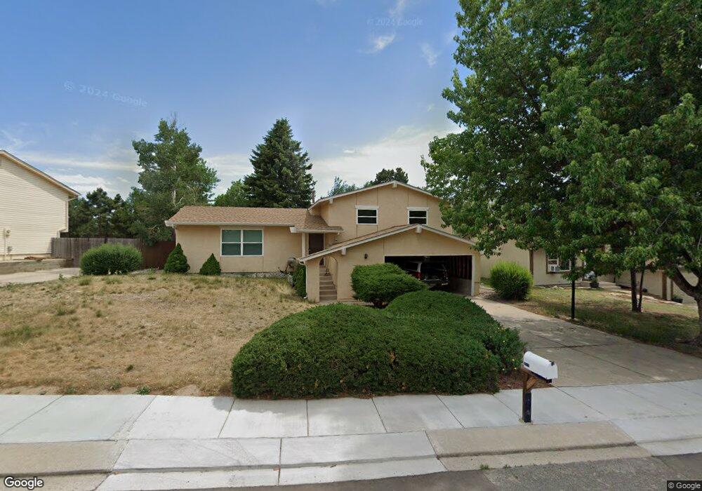
2670 Sunbird Dr Colorado Springs, CO 80918
Pulpit Rock NeighborhoodEstimated Value: $490,000 - $542,000
4
Beds
4
Baths
2,427
Sq Ft
$209/Sq Ft
Est. Value
About This Home
This home is located at 2670 Sunbird Dr, Colorado Springs, CO 80918 and is currently estimated at $506,850, approximately $208 per square foot. 2670 Sunbird Dr is a home located in El Paso County with nearby schools including King Elementary School, Russell Middle School, and Coronado High School.
Ownership History
Date
Name
Owned For
Owner Type
Purchase Details
Closed on
Jan 15, 2020
Sold by
Buckner Michael J
Bought by
Buckner Michael J and Buckner Kristy Storm
Current Estimated Value
Home Financials for this Owner
Home Financials are based on the most recent Mortgage that was taken out on this home.
Original Mortgage
$208,773
Outstanding Balance
$143,218
Interest Rate
3.73%
Mortgage Type
New Conventional
Estimated Equity
$363,632
Purchase Details
Closed on
Sep 6, 2013
Sold by
Makings Dean Morgan and Makings Tari Ann
Bought by
Buckner Michael J
Home Financials for this Owner
Home Financials are based on the most recent Mortgage that was taken out on this home.
Original Mortgage
$192,000
Interest Rate
4.36%
Mortgage Type
New Conventional
Purchase Details
Closed on
Feb 13, 1990
Bought by
Buckner Michael J
Purchase Details
Closed on
Dec 1, 1978
Bought by
Buckner Michael J
Create a Home Valuation Report for This Property
The Home Valuation Report is an in-depth analysis detailing your home's value as well as a comparison with similar homes in the area
Home Values in the Area
Average Home Value in this Area
Purchase History
| Date | Buyer | Sale Price | Title Company |
|---|---|---|---|
| Buckner Michael J | -- | Unified Title Co | |
| Buckner Michael J | $240,000 | Stewart Title | |
| Buckner Michael J | $95,000 | -- | |
| Buckner Michael J | -- | -- |
Source: Public Records
Mortgage History
| Date | Status | Borrower | Loan Amount |
|---|---|---|---|
| Open | Buckner Michael J | $208,773 | |
| Closed | Buckner Michael J | $192,000 |
Source: Public Records
Tax History Compared to Growth
Tax History
| Year | Tax Paid | Tax Assessment Tax Assessment Total Assessment is a certain percentage of the fair market value that is determined by local assessors to be the total taxable value of land and additions on the property. | Land | Improvement |
|---|---|---|---|---|
| 2025 | $1,756 | $36,140 | -- | -- |
| 2024 | $1,638 | $36,030 | $4,840 | $31,190 |
| 2022 | $1,453 | $25,960 | $4,300 | $21,660 |
| 2021 | $1,577 | $26,720 | $4,430 | $22,290 |
| 2020 | $1,600 | $23,570 | $3,850 | $19,720 |
| 2019 | $1,591 | $23,570 | $3,850 | $19,720 |
| 2018 | $1,465 | $19,960 | $3,240 | $16,720 |
| 2017 | $1,387 | $19,960 | $3,240 | $16,720 |
| 2016 | $1,108 | $19,110 | $3,340 | $15,770 |
| 2015 | $1,104 | $19,110 | $3,340 | $15,770 |
| 2014 | $1,015 | $16,870 | $3,300 | $13,570 |
Source: Public Records
Map
Nearby Homes
- 6205 MacH 1 Dr
- 2810 Downhill Dr
- 2815 Downhill Dr
- 2690 Maroon Bells Ave
- 6215 Lange Dr
- 6035 Tuckerman Ln
- 2840 Purgatory Dr
- 6447 Jonathan Ct Unit E1
- 2642 Lynbarton Point
- 2714 Avalanche Heights
- 2860 Purgatory Dr
- 6041 Kingdom View
- 2910 Downhill Dr
- 2940 Purgatory Dr
- 5803 New Crossings Point
- 2920 Garmish Place
- 2635 Canton Ln
- 2970 Banjo Dr
- 6655 Sproul Ln
- 3045 Dublin Blvd
- 2680 Sunbird Dr
- 2675 Roundtop Dr
- 2685 Roundtop Dr
- 2715 Roundtop Dr
- 2690 Sunbird Dr
- 2650 Sunbird Dr
- 2725 Roundtop Dr
- 2655 Roundtop Dr
- 2710 Sunbird Dr
- 2735 Roundtop Dr
- 6050 Eagles Nest Ct
- 6040 Eagles Nest Ct
- 2640 Sunbird Dr
- 2655 Sunbird Dr
- 2645 Roundtop Dr
- 2695 Sunbird Dr
- 2680 Roundtop Dr
- 2670 Roundtop Dr
- 2710 Roundtop Dr
- 2745 Roundtop Dr