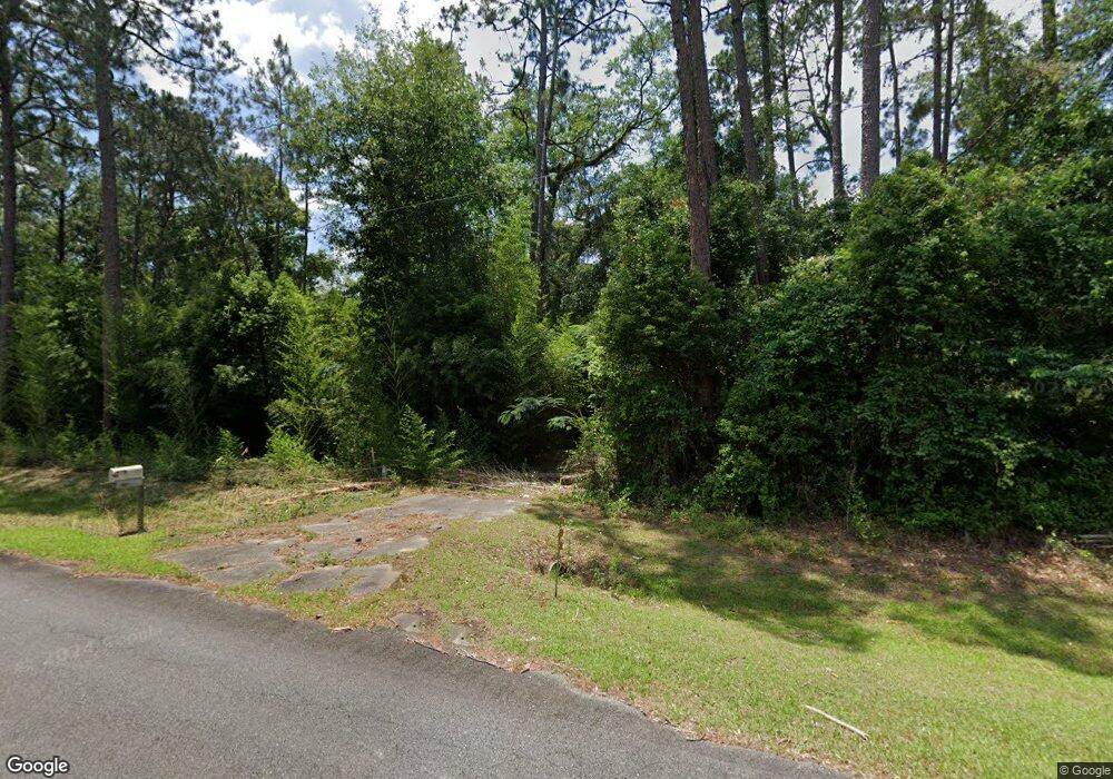
2671 Grooverville Rd Boston, GA 31626
Estimated Value: $119,000 - $760,506
--
Bed
1
Bath
1,978
Sq Ft
$201/Sq Ft
Est. Value
About This Home
This home is located at 2671 Grooverville Rd, Boston, GA 31626 and is currently estimated at $397,377, approximately $200 per square foot. 2671 Grooverville Rd is a home located in Thomas County with nearby schools including Hand in Hand Primary School, Garrison-Pilcher Elementary School, and Cross Creek Elementary School.
Ownership History
Date
Name
Owned For
Owner Type
Purchase Details
Closed on
Jul 9, 2025
Sold by
Maxwell Mary
Bought by
Maxwell Richard A
Current Estimated Value
Purchase Details
Closed on
Jan 24, 2024
Sold by
Maxwell Mary
Bought by
Searcy Amber Milam and Searcy Rhett Andrew
Purchase Details
Closed on
Jan 5, 2012
Sold by
Maxwell Mary Maxwell
Bought by
Wilson Jeffery L
Purchase Details
Closed on
Apr 30, 2002
Sold by
Engel Conrad A and Linda Shelton
Bought by
Maxwell Mary Maxwell
Purchase Details
Closed on
Apr 3, 1994
Bought by
Maxwell Mary Maxwell
Create a Home Valuation Report for This Property
The Home Valuation Report is an in-depth analysis detailing your home's value as well as a comparison with similar homes in the area
Home Values in the Area
Average Home Value in this Area
Purchase History
| Date | Buyer | Sale Price | Title Company |
|---|---|---|---|
| Maxwell Richard A | -- | -- | |
| Searcy Amber Milam | -- | -- | |
| Wilson Jeffery L | -- | -- | |
| Wilson Jeffery L | -- | -- | |
| Maxwell Mary Maxwell | -- | -- | |
| Maxwell Mary Maxwell | -- | -- |
Source: Public Records
Tax History Compared to Growth
Tax History
| Year | Tax Paid | Tax Assessment Tax Assessment Total Assessment is a certain percentage of the fair market value that is determined by local assessors to be the total taxable value of land and additions on the property. | Land | Improvement |
|---|---|---|---|---|
| 2024 | $1,041 | $225,672 | $219,353 | $6,319 |
| 2023 | $946 | $203,565 | $197,454 | $6,111 |
| 2022 | $1,010 | $202,928 | $197,454 | $5,474 |
| 2021 | $1,342 | $201,400 | $171,169 | $30,231 |
| 2020 | $1,538 | $203,665 | $171,169 | $32,496 |
| 2019 | $1,025 | $183,663 | $171,169 | $12,494 |
| 2018 | $1,016 | $183,318 | $171,169 | $12,149 |
| 2017 | $1,043 | $184,562 | $171,169 | $13,393 |
| 2016 | $1,021 | $184,229 | $171,169 | $13,060 |
| 2015 | $1,030 | $184,780 | $171,169 | $13,611 |
| 2014 | -- | $184,567 | $171,169 | $13,398 |
| 2013 | -- | $0 | $0 | $0 |
Source: Public Records
Map
Nearby Homes
- 130 E Adams St
- 682 Salem Rd
- 146 Old Highway 84 W
- 185 Community Ln
- 2815 Parker Rd
- 2156 County Road 78
- 9900 Ozell Rd
- 431 Dry Lake Rd
- 8820 Grooverville Rd
- 2818 Dry Lake Rd
- 0 Spencer Rd
- 4311 Ozell Rd
- 5199 U S 84
- 00 Summer Hill Rd Unit 1
- 842 Crabapple Dr
- 7402 Coffee Rd
- 7500 U S 19
- 00 Cone Road & Beulah Church Rd
- 454 Fox Meadow Ln
- 138
- 2710 Grooverville Rd
- 2505 Grooverville Rd
- 2877 Grooverville Rd
- 2075 Grooverville Rd
- 671 Martin Rd
- 671 Martin Rd
- 1101 Martin Rd
- 1635 Martin Rd
- 1686 Martin Rd
- 6558 Whitney Camp Rd
- 3294 Grooverville Rd
- 6608 Whitney Camp Rd
- 1918 Grooverville Rd
- 6658 Whitney Camp Rd
- 1835 Grooversville Rd
- 1851 Grooverville Rd
- 892 Washington Rd
- 1835 Grooverville Rd
- 1556 Martin Rd
- 240 Brown Rd
