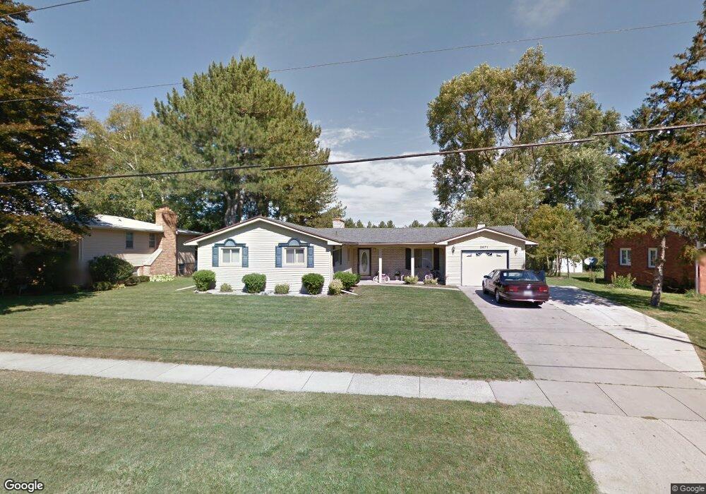
2671 Larry Tim Dr Saginaw, MI 48601
Bridgeport NeighborhoodEstimated Value: $144,000 - $167,000
3
Beds
2
Baths
1,411
Sq Ft
$108/Sq Ft
Est. Value
About This Home
This home is located at 2671 Larry Tim Dr, Saginaw, MI 48601 and is currently estimated at $151,887, approximately $107 per square foot. 2671 Larry Tim Dr is a home located in Saginaw County with nearby schools including Thomas White School, Martin G. Atkins Elementary School, and Bridgeport High School.
Ownership History
Date
Name
Owned For
Owner Type
Purchase Details
Closed on
Jul 29, 2000
Sold by
Hud
Bought by
Liles Terrence D
Current Estimated Value
Home Financials for this Owner
Home Financials are based on the most recent Mortgage that was taken out on this home.
Original Mortgage
$59,950
Outstanding Balance
$21,691
Interest Rate
8.19%
Mortgage Type
FHA
Estimated Equity
$130,196
Purchase Details
Closed on
Oct 15, 1999
Sold by
Firstar Bank Na
Bought by
Hud
Purchase Details
Closed on
Feb 25, 1999
Sold by
Arnett William R and Arnett Virginia L
Bought by
Star Bank Na and Great Financial Bank Fsb
Create a Home Valuation Report for This Property
The Home Valuation Report is an in-depth analysis detailing your home's value as well as a comparison with similar homes in the area
Home Values in the Area
Average Home Value in this Area
Purchase History
| Date | Buyer | Sale Price | Title Company |
|---|---|---|---|
| Liles Terrence D | $60,000 | -- | |
| Hud | -- | -- | |
| Star Bank Na | $71,136 | -- |
Source: Public Records
Mortgage History
| Date | Status | Borrower | Loan Amount |
|---|---|---|---|
| Open | Liles Terrence D | $59,950 |
Source: Public Records
Tax History Compared to Growth
Tax History
| Year | Tax Paid | Tax Assessment Tax Assessment Total Assessment is a certain percentage of the fair market value that is determined by local assessors to be the total taxable value of land and additions on the property. | Land | Improvement |
|---|---|---|---|---|
| 2025 | $2,054 | $62,400 | $0 | $0 |
| 2024 | $431 | $57,800 | $0 | $0 |
| 2023 | $410 | $49,600 | $0 | $0 |
| 2022 | $1,783 | $44,400 | $0 | $0 |
| 2021 | $1,674 | $41,300 | $0 | $0 |
| 2020 | $1,642 | $39,200 | $0 | $0 |
| 2019 | $4,378 | $35,300 | $3,200 | $32,100 |
| 2018 | $358 | $33,900 | $0 | $0 |
| 2017 | $1,507 | $34,200 | $0 | $0 |
| 2016 | $1,558 | $34,000 | $0 | $0 |
| 2014 | -- | $31,100 | $0 | $28,900 |
| 2013 | -- | $32,800 | $0 | $0 |
Source: Public Records
Map
Nearby Homes
- 2820 Greenbriar Dr
- 3531 Creekwood Dr
- 2840 Greenbriar Dr
- 3482 Creekwood Dr
- 2846 Briarwood Dr
- 3565 Diamondale Dr E
- 2516 Kansas Ave
- 3615 Bernice Dr
- 2441 Indiana Ave
- 3197 Studor Rd
- 3195 Dixie Ct
- 0 Dixie Unit 50157060
- 2500 Oregon Ave
- 2258 California Ave
- 3706 Olive St
- 2645 Tatham Rd
- 2631 Tatham Rd
- 3780 Mack Rd
- 2108 California Ave
- 3605 Orange St
- 2691 Larry Tim Dr
- 2655 Larry Tim Dr
- 2664 Larry Tim Dr
- 2635 Larry Tim Dr
- 2711 Larry Tim Dr
- 2692 Larry Tim Dr
- 3449 Melody Ln
- 2619 Larry Tim Dr
- 2725 Larry Tim Dr
- 3440 Melody Ln
- 3486 Hialeah Ln
- 3467 Melody Ln
- 2728 Larry Tim Dr
- 3450 Melody Ln
- 2601 Larry Tim Dr
- 3496 Hialeah Ln
- 2741 Larry Tim Dr
- 3345 Linger Ln
- 3251 Murray Hill Dr
- 2600 Larry Tim Dr