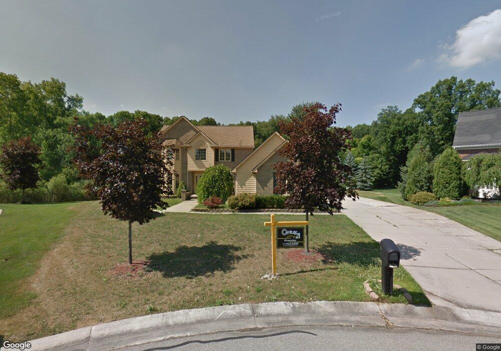
2672 Emily Ct Canton, MI 48188
Estimated Value: $574,000 - $600,000
3
Beds
3
Baths
2,843
Sq Ft
$205/Sq Ft
Est. Value
About This Home
This home is located at 2672 Emily Ct, Canton, MI 48188 and is currently estimated at $582,778, approximately $204 per square foot. 2672 Emily Ct is a home located in Wayne County with nearby schools including Canton High School, Salem High School, and Plymouth High School.
Ownership History
Date
Name
Owned For
Owner Type
Purchase Details
Closed on
Jun 29, 2011
Sold by
The Bank Of New York Mellon
Bought by
Resovsy Andrew C
Current Estimated Value
Purchase Details
Closed on
Jul 21, 2010
Sold by
Hachem Ahmad and Koussan Ferial
Bought by
The Bank Of New York Mellon and The Bank Of New York
Purchase Details
Closed on
Nov 13, 2006
Sold by
Reid Johnnie O and Reid Tina
Bought by
Hachem Ahmad
Purchase Details
Closed on
Jul 22, 1998
Sold by
Classic Home Builders In
Bought by
Reid Connie J
Create a Home Valuation Report for This Property
The Home Valuation Report is an in-depth analysis detailing your home's value as well as a comparison with similar homes in the area
Home Values in the Area
Average Home Value in this Area
Purchase History
| Date | Buyer | Sale Price | Title Company |
|---|---|---|---|
| Resovsy Andrew C | $235,000 | Etitle Agency Inc | |
| The Bank Of New York Mellon | $217,038 | None Available | |
| Hachem Ahmad | $295,000 | Multiple | |
| Reid Connie J | $278,245 | -- |
Source: Public Records
Tax History Compared to Growth
Tax History
| Year | Tax Paid | Tax Assessment Tax Assessment Total Assessment is a certain percentage of the fair market value that is determined by local assessors to be the total taxable value of land and additions on the property. | Land | Improvement |
|---|---|---|---|---|
| 2025 | $3,464 | $275,500 | $0 | $0 |
| 2024 | $3,464 | $276,600 | $0 | $0 |
| 2023 | $3,303 | $247,800 | $0 | $0 |
| 2022 | $7,138 | $219,000 | $0 | $0 |
| 2021 | $6,895 | $204,500 | $0 | $0 |
| 2020 | $6,793 | $205,700 | $0 | $0 |
| 2019 | $6,667 | $190,650 | $0 | $0 |
| 2018 | $2,786 | $188,690 | $0 | $0 |
| 2017 | $6,777 | $189,000 | $0 | $0 |
| 2016 | $6,114 | $192,000 | $0 | $0 |
| 2015 | $15,461 | $168,880 | $0 | $0 |
| 2013 | $14,953 | $155,420 | $0 | $0 |
| 2010 | -- | $142,450 | $88,570 | $53,880 |
Source: Public Records
Map
Nearby Homes
- 2435 S Haggerty Rd
- 2340 S Lilley Rd
- 2855 Tall Oak Ln
- 2942 Tall Oak Ln
- 2006 S Lilley Rd
- 41481 Cumberland Dr
- 41441 Cumberland Dr
- 000 S Lotz Rd
- 2322 Arcadia Dr Unit 254
- 1803 Pinecroft Dr Unit 171
- 40488 Glen Eagle Ln Unit 75
- 41928 Old Bridge Rd
- 50519 Rockingham Dr
- 2098 Preserve Cir W Unit 80
- 41021 Old Michigan Ave
- 1530 Fairfax Dr
- 41021 Lot 46 Old Michigan Ave
- 1834 Maple Park Dr W Unit 9
- 43538 Arbor Way W Unit 152
- 42272 Beechwood Ct
- 2662 Emily Ct
- 2663 Daleview Ct
- 2671 Emily Ct
- 41673 Singh Dr
- 2661 Emily Ct
- 2674 Daleview Ct
- 41713 Singh Dr
- 41595 Singh Dr
- 41569 Singh Dr
- 2664 Daleview Ct
- 2660 Woodsboro Ct
- 41543 Singh Dr
- 41765 Singh Dr
- 41660 Singh Dr
- 41634 Singh Dr
- 41686 Singh Dr
- 41608 Singh Dr
- 2670 Woodsboro Ct
- 41712 Singh Dr
- 41582 Singh Dr