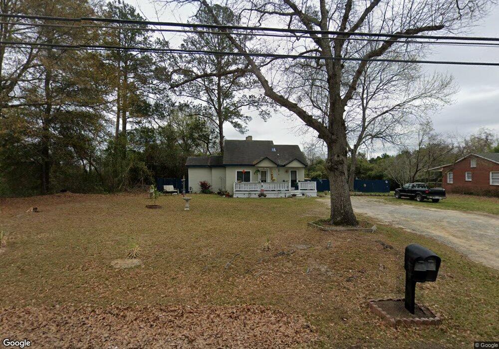
2674 Reese Rd Columbus, GA 31907
Eastern Columbus NeighborhoodEstimated Value: $58,000 - $128,000
1
Bed
2
Baths
906
Sq Ft
$104/Sq Ft
Est. Value
About This Home
This home is located at 2674 Reese Rd, Columbus, GA 31907 and is currently estimated at $93,994, approximately $103 per square foot. 2674 Reese Rd is a home located in Muscogee County with nearby schools including Reese Road Leadership Academy, Fort Middle School, and Hardaway High School.
Ownership History
Date
Name
Owned For
Owner Type
Purchase Details
Closed on
Sep 27, 2017
Sold by
Brock Lonnie W
Bought by
Wright Bonnie
Current Estimated Value
Home Financials for this Owner
Home Financials are based on the most recent Mortgage that was taken out on this home.
Original Mortgage
$25,000
Outstanding Balance
$6,022
Interest Rate
3.82%
Mortgage Type
New Conventional
Estimated Equity
$87,972
Purchase Details
Closed on
Jun 21, 2011
Sold by
Dauphin Charles Coleman
Bought by
Brock Lonnie W
Create a Home Valuation Report for This Property
The Home Valuation Report is an in-depth analysis detailing your home's value as well as a comparison with similar homes in the area
Home Values in the Area
Average Home Value in this Area
Purchase History
| Date | Buyer | Sale Price | Title Company |
|---|---|---|---|
| Wright Bonnie | $25,000 | -- | |
| Brock Lonnie W | $16,500 | -- |
Source: Public Records
Mortgage History
| Date | Status | Borrower | Loan Amount |
|---|---|---|---|
| Open | Wright Bonnie | $25,000 |
Source: Public Records
Tax History Compared to Growth
Tax History
| Year | Tax Paid | Tax Assessment Tax Assessment Total Assessment is a certain percentage of the fair market value that is determined by local assessors to be the total taxable value of land and additions on the property. | Land | Improvement |
|---|---|---|---|---|
| 2025 | $9 | $21,612 | $7,960 | $13,652 |
| 2024 | $8 | $21,612 | $7,960 | $13,652 |
| 2023 | $8 | $21,612 | $7,960 | $13,652 |
| 2022 | $8 | $22,112 | $7,960 | $14,152 |
| 2021 | $3 | $12,076 | $7,960 | $4,116 |
| 2020 | $3 | $12,076 | $7,960 | $4,116 |
| 2019 | $5 | $12,076 | $7,960 | $4,116 |
| 2018 | $5 | $10,000 | $3,000 | $7,000 |
| 2017 | $427 | $10,400 | $3,120 | $7,280 |
| 2016 | $372 | $9,024 | $2,703 | $6,321 |
| 2015 | $373 | $9,024 | $2,703 | $6,321 |
| 2014 | $373 | $9,024 | $2,703 | $6,321 |
| 2013 | -- | $9,024 | $2,703 | $6,321 |
Source: Public Records
Map
Nearby Homes
- 2661 Fernwood Ave
- 4312 Old MacOn Rd Unit 6
- 4332 Fay Dr
- 4330 Wilson St
- 2622 Natchez Dr
- 4268 Yates Dr
- 2821 Barbara Rd
- 4503 Melborne Dr
- 4248 Yates Dr
- 4237 Fort St
- 2879 Grant Rd
- 2871 Barbara Rd
- 4355 Byron St
- 4317 Byron St
- 911 Lamore St
- 2608 Juniper Ave
- 3409 Ambassador Dr
- 4161 Althea Dr
- 5225 Orange Dr
- 4160 Spirea Dr
- 2658 Reese Rd
- 4394 Reesewood Ct
- 2674 Shawnee Ave
- 4398 Reesewood Ct
- 4390 Reesewood Ct
- 4399 Reesewood Ct
- 2652 Reese Rd
- 4415 Lapaloma Dr
- 4386 Reesewood Ct
- 2680 Shawnee Ave
- 4395 Reesewood Ct
- 2659 Reese Rd
- 2655 Fernwood Ave
- 4382 Reesewood Ct
- 2651 Reese Rd
- 4391 Reesewood Ct
- 2648 Reese Rd
- 4387 Reesewood Ct
- 2688 Shawnee Ave
- 4375 Reesewood Ct