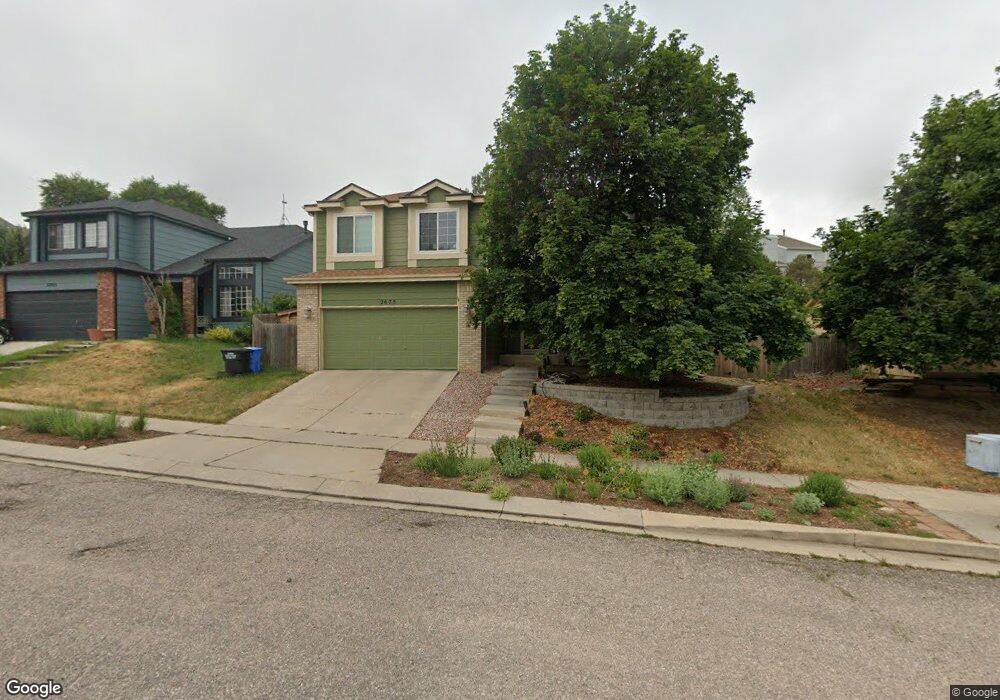
2675 Lear Dr Colorado Springs, CO 80920
Briargate NeighborhoodEstimated Value: $537,000 - $597,000
5
Beds
4
Baths
2,544
Sq Ft
$224/Sq Ft
Est. Value
About This Home
This home is located at 2675 Lear Dr, Colorado Springs, CO 80920 and is currently estimated at $570,089, approximately $224 per square foot. 2675 Lear Dr is a home located in El Paso County with nearby schools including High Plains Elementary School, Mountain Ridge Middle School, and Rampart High School.
Ownership History
Date
Name
Owned For
Owner Type
Purchase Details
Closed on
Oct 14, 2022
Sold by
Thompson Matthew D and Thompson Kristina M
Bought by
Thompson Family Trust and Thompson
Current Estimated Value
Purchase Details
Closed on
Aug 13, 2020
Sold by
Neighbors Ira J and Neighbors Dawn Marie
Bought by
Thompson Matthew D and Thompson Kristina M
Home Financials for this Owner
Home Financials are based on the most recent Mortgage that was taken out on this home.
Original Mortgage
$220,000
Interest Rate
3%
Mortgage Type
New Conventional
Purchase Details
Closed on
Mar 31, 2008
Sold by
Rufin J Pierre and Rufin Mary Beth
Bought by
Neighbors Ira J and Neighbors Dawn Marie
Home Financials for this Owner
Home Financials are based on the most recent Mortgage that was taken out on this home.
Original Mortgage
$294,405
Interest Rate
5.72%
Mortgage Type
VA
Purchase Details
Closed on
Apr 30, 2003
Sold by
Meisinger James R and Meisinger Shannon
Bought by
Rufin J Pierre and Rufin Mary Beth
Home Financials for this Owner
Home Financials are based on the most recent Mortgage that was taken out on this home.
Original Mortgage
$200,000
Interest Rate
5.8%
Mortgage Type
Balloon
Purchase Details
Closed on
May 30, 2000
Sold by
Hart Anthony R and Hart June E
Bought by
Meisinger James R and Meisinger Shannon
Home Financials for this Owner
Home Financials are based on the most recent Mortgage that was taken out on this home.
Original Mortgage
$176,000
Interest Rate
8.17%
Purchase Details
Closed on
Aug 5, 1998
Sold by
Hart Anthony R
Bought by
Wilson June E
Home Financials for this Owner
Home Financials are based on the most recent Mortgage that was taken out on this home.
Original Mortgage
$121,000
Interest Rate
7.09%
Purchase Details
Closed on
Jul 13, 1998
Sold by
Household Financial Services Inc
Bought by
Hart Anthony R
Home Financials for this Owner
Home Financials are based on the most recent Mortgage that was taken out on this home.
Original Mortgage
$121,000
Interest Rate
7.09%
Purchase Details
Closed on
Feb 17, 1998
Sold by
Holt Donald T and Suk Yoon Suk
Bought by
Household Financial Services Inc
Purchase Details
Closed on
Mar 29, 1995
Sold by
Richmond Homes Inc Ii
Bought by
Holt Donald T and Holt Yoon Suk
Home Financials for this Owner
Home Financials are based on the most recent Mortgage that was taken out on this home.
Original Mortgage
$126,400
Interest Rate
8.72%
Purchase Details
Closed on
Aug 26, 1992
Bought by
Neighbors Ira J
Create a Home Valuation Report for This Property
The Home Valuation Report is an in-depth analysis detailing your home's value as well as a comparison with similar homes in the area
Home Values in the Area
Average Home Value in this Area
Purchase History
| Date | Buyer | Sale Price | Title Company |
|---|---|---|---|
| Thompson Family Trust | -- | None Listed On Document | |
| Thompson Matthew D | $417,000 | None Available | |
| Neighbors Ira J | $285,000 | North Amer Title Co Of Co | |
| Rufin J Pierre | $250,000 | First American | |
| Meisinger James R | $220,000 | Stewart Title | |
| Wilson June E | -- | -- | |
| Hart Anthony R | $176,400 | -- | |
| Household Financial Services Inc | $136,226 | -- | |
| Holt Donald T | $158,000 | Land Title | |
| Neighbors Ira J | -- | -- |
Source: Public Records
Mortgage History
| Date | Status | Borrower | Loan Amount |
|---|---|---|---|
| Previous Owner | Thompson Matthew D | $220,000 | |
| Previous Owner | Neighbors Ira J | $294,405 | |
| Previous Owner | Rufin J Pierre | $200,000 | |
| Previous Owner | Meisinger James R | $176,000 | |
| Previous Owner | Hart Anthony R | $121,000 | |
| Previous Owner | Holt Donald T | $126,400 |
Source: Public Records
Tax History Compared to Growth
Tax History
| Year | Tax Paid | Tax Assessment Tax Assessment Total Assessment is a certain percentage of the fair market value that is determined by local assessors to be the total taxable value of land and additions on the property. | Land | Improvement |
|---|---|---|---|---|
| 2025 | $2,372 | $39,030 | -- | -- |
| 2024 | $2,343 | $40,660 | $5,360 | $35,300 |
| 2022 | $1,990 | $28,190 | $4,340 | $23,850 |
| 2021 | $2,200 | $29,000 | $4,460 | $24,540 |
| 2020 | $2,166 | $26,610 | $3,720 | $22,890 |
| 2019 | $2,144 | $26,610 | $3,720 | $22,890 |
| 2018 | $1,946 | $23,760 | $2,880 | $20,880 |
| 2017 | $1,939 | $23,760 | $2,880 | $20,880 |
| 2016 | $1,856 | $22,710 | $2,930 | $19,780 |
| 2015 | $1,852 | $22,710 | $2,930 | $19,780 |
| 2014 | $1,670 | $20,460 | $2,930 | $17,530 |
Source: Public Records
Map
Nearby Homes
- 2615 Thrush Grove
- 2512 Elite Terrace
- 7849 Flicker Grove
- 8146 Horizon Dr
- 2768 Thrush Grove
- 8135 Portsmouth Ct
- 2553 Legend Dr
- 2650 Bannister Ct
- 7640 Gibralter Dr
- 3142 Soaring Bird Cir
- 2340 Winstead View
- 3326 Soaring Bird Cir
- 2270 Cloverdale Dr
- 8335 Sutterfield Dr
- 8161 Regiment Ct
- 2110 Whitehorn Dr N
- 2644 Marston Heights
- 2656 Marston Heights
- 7420 Lomas Ct
- 7530 Madrid Ct