Estimated Value: $645,000 - $766,952
3
Beds
4
Baths
1,798
Sq Ft
$402/Sq Ft
Est. Value
About This Home
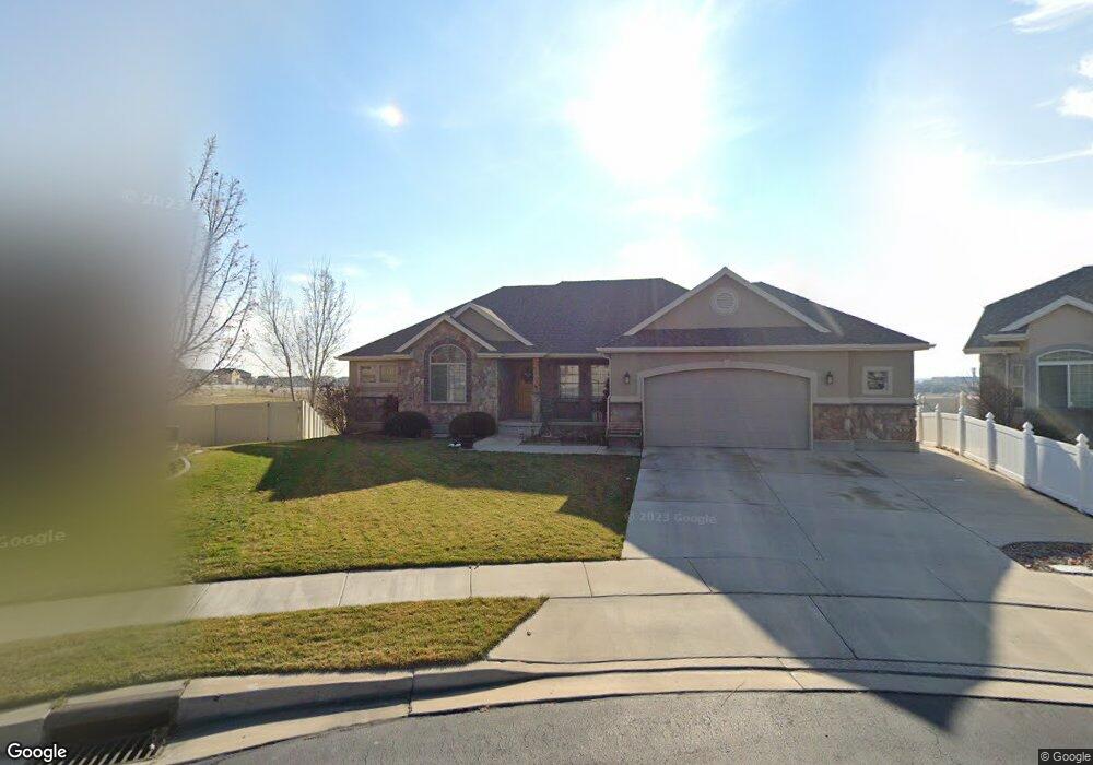
This home is located at 2675 W 2400 N, Lehi, UT 84043 and is currently estimated at $723,488, approximately $402 per square foot. 2675 W 2400 N is a home located in Utah County with nearby schools including Liberty Hills Elementary School, Skyridge High School, and Ascent Academies of Utah - Lehi Campus.
Ownership History
Date
Name
Owned For
Owner Type
Purchase Details
Closed on
Apr 12, 2021
Sold by
Gabriel Edward S
Bought by
Gabriel Edward S and Gabriel Liesa
Current Estimated Value
Home Financials for this Owner
Home Financials are based on the most recent Mortgage that was taken out on this home.
Original Mortgage
$343,200
Outstanding Balance
$309,868
Interest Rate
3%
Mortgage Type
New Conventional
Estimated Equity
$413,620
Purchase Details
Closed on
Sep 16, 2008
Sold by
Gabriel Edward S
Bought by
Gabriel Edward S and Gabriel Liesa
Home Financials for this Owner
Home Financials are based on the most recent Mortgage that was taken out on this home.
Original Mortgage
$319,224
Interest Rate
6.51%
Mortgage Type
Purchase Money Mortgage
Create a Home Valuation Report for This Property
The Home Valuation Report is an in-depth analysis detailing your home's value as well as a comparison with similar homes in the area
Home Values in the Area
Average Home Value in this Area
Purchase History
| Date | Buyer | Sale Price | Title Company |
|---|---|---|---|
| Gabriel Edward S | -- | Utah First Ins Agency | |
| Gabriel Edward S | -- | Utah First Title Ins Agency | |
| Gabriel Edward S | -- | Cottonwood Title Insurance | |
| Gabriel Edward S | -- | Cottonwood Title Insurance | |
| Ivory Homes Ltd | -- | Cottonwood Title Insurance |
Source: Public Records
Mortgage History
| Date | Status | Borrower | Loan Amount |
|---|---|---|---|
| Open | Gabriel Edward S | $343,200 | |
| Closed | Gabriel Edward S | $319,224 |
Source: Public Records
Tax History Compared to Growth
Tax History
| Year | Tax Paid | Tax Assessment Tax Assessment Total Assessment is a certain percentage of the fair market value that is determined by local assessors to be the total taxable value of land and additions on the property. | Land | Improvement |
|---|---|---|---|---|
| 2025 | $2,947 | $670,800 | $233,000 | $437,800 |
| 2024 | $2,947 | $344,905 | $0 | $0 |
| 2023 | $2,750 | $349,470 | $0 | $0 |
| 2022 | $2,922 | $359,975 | $0 | $0 |
| 2021 | $2,356 | $438,800 | $134,900 | $303,900 |
| 2020 | $2,221 | $408,900 | $124,900 | $284,000 |
| 2019 | $2,096 | $401,200 | $124,900 | $276,300 |
| 2018 | $1,979 | $358,100 | $117,800 | $240,300 |
| 2017 | $1,945 | $187,110 | $0 | $0 |
| 2016 | $1,974 | $176,165 | $0 | $0 |
| 2015 | $1,998 | $169,235 | $0 | $0 |
| 2014 | $1,953 | $164,450 | $0 | $0 |
Source: Public Records
Map
Nearby Homes
- 2693 W 2400 N
- 2189 N 2600 W
- 2464 W 2400 N
- 2546 N Elm Dr
- 2191 N 2350 W
- 2280 N 2350 W
- 1453 W Linen Way
- 2433 N 3130 W
- 2998 Crooked Stick Dr
- 3185 W 2400 N
- 2673 N Double Eagle Dr
- 2669 N Turnberry Ct
- 2424 N Lazy j Ln
- 2012 N 2040 W
- 1990 N 2040 W
- 2013 N 2040 W
- 1968 N 2040 W
- 1991 N 2040 St W
- 1969 N 2040 St W
- Palisade Plan at Pioneer Meadows