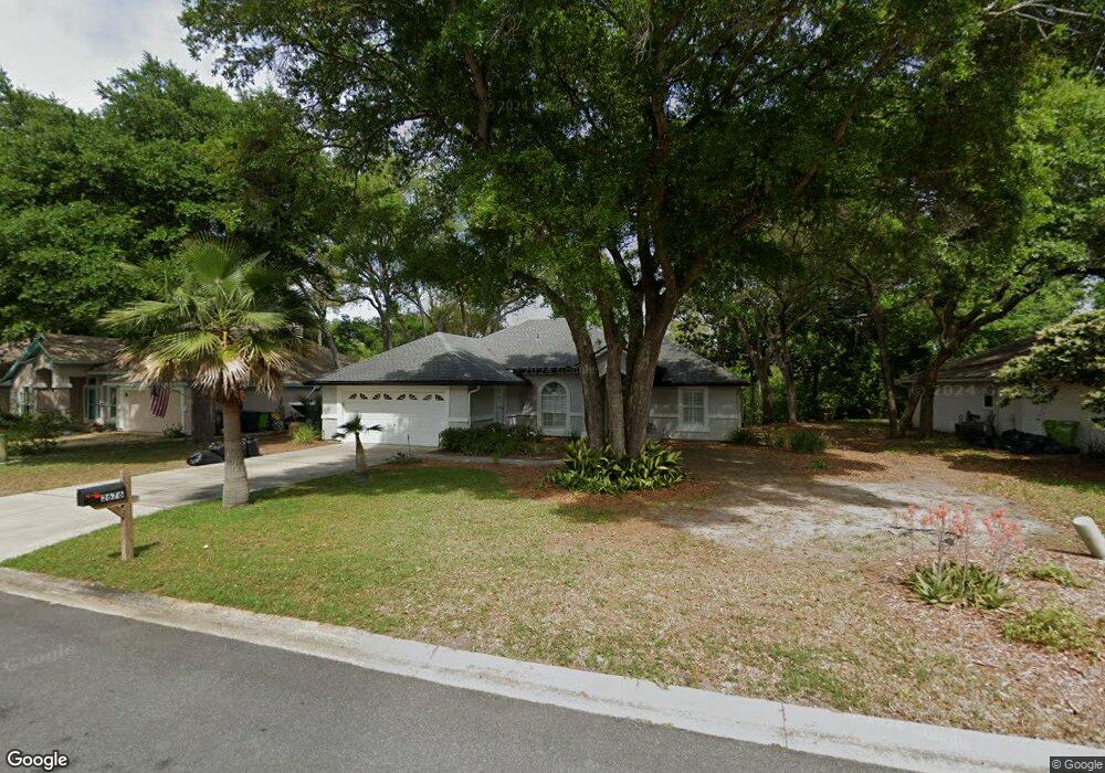
2676 Le Sabre Place Fernandina Beach, FL 32034
Estimated Value: $552,876 - $598,000
3
Beds
2
Baths
1,594
Sq Ft
$363/Sq Ft
Est. Value
About This Home
This home is located at 2676 Le Sabre Place, Fernandina Beach, FL 32034 and is currently estimated at $578,219, approximately $362 per square foot. 2676 Le Sabre Place is a home located in Nassau County with nearby schools including Southside Elementary School, Emma Love Hardee Elementary School, and Fernandina Beach Middle School.
Ownership History
Date
Name
Owned For
Owner Type
Purchase Details
Closed on
Feb 25, 2013
Sold by
Burlingame Bryan M
Bought by
Ruggiero Donald and Ruggiero Tylene
Current Estimated Value
Purchase Details
Closed on
Sep 1, 2005
Sold by
Gillespie Cornelia J
Bought by
Burlingame Bryan M and Butler Paul A
Home Financials for this Owner
Home Financials are based on the most recent Mortgage that was taken out on this home.
Original Mortgage
$169,000
Interest Rate
5%
Mortgage Type
Fannie Mae Freddie Mac
Create a Home Valuation Report for This Property
The Home Valuation Report is an in-depth analysis detailing your home's value as well as a comparison with similar homes in the area
Home Values in the Area
Average Home Value in this Area
Purchase History
| Date | Buyer | Sale Price | Title Company |
|---|---|---|---|
| Ruggiero Donald | $238,000 | Guardian Title & Trust Inc | |
| Burlingame Bryan M | -- | None Available | |
| Burlingame Bryan M | $260,000 | -- |
Source: Public Records
Mortgage History
| Date | Status | Borrower | Loan Amount |
|---|---|---|---|
| Previous Owner | Burlingame Bryan M | $169,000 |
Source: Public Records
Tax History Compared to Growth
Tax History
| Year | Tax Paid | Tax Assessment Tax Assessment Total Assessment is a certain percentage of the fair market value that is determined by local assessors to be the total taxable value of land and additions on the property. | Land | Improvement |
|---|---|---|---|---|
| 2024 | $3,078 | $237,240 | -- | -- |
| 2023 | $3,078 | $230,330 | $0 | $0 |
| 2022 | $2,786 | $223,621 | $0 | $0 |
| 2021 | $2,813 | $217,108 | $0 | $0 |
| 2020 | $2,806 | $214,110 | $0 | $0 |
| 2019 | $2,764 | $209,296 | $0 | $0 |
| 2018 | $2,735 | $205,394 | $0 | $0 |
| 2017 | $2,492 | $201,169 | $0 | $0 |
| 2016 | $2,897 | $181,844 | $0 | $0 |
| 2015 | $2,624 | $165,313 | $0 | $0 |
| 2014 | $2,418 | $151,563 | $0 | $0 |
Source: Public Records
Map
Nearby Homes
- 2133 Taurus Ct
- 2674 Robert Oliver Ave
- 2700 Mizell Ave Unit 203B
- 2700 Mizell Ave Unit 504A
- 2700 Mizell Ave Unit 403A
- 2552 Pirates Bay Dr
- 2583 Forest Ridge Dr Unit 3
- 2563 Forest Ridge Dr Unit P3
- 2696 Forest Ridge Dr Unit A6
- 2588 Forest Ridge Dr Unit N-8
- 2888 Forest Ridge Dr Unit U-8
- 1918 Sea Oats Ave
- 2490 Captain Hook Dr
- 2723 Forest Ridge Dr Unit K3
- 2774 Forest Ridge Dr Unit F4
- 2636 1st Ave
- 2625 Long Boat Dr
- 2105 Purcell Dr
- 2666 Long Boat Dr
- 2657 Long Boat Dr
- 2668 Le Sabre Place
- 2692 Le Sabre Place
- 2692 Le Sabre Place Unit 1 Bed Unit
- 2692 Le Sabre Place
- 2660 Le Sabre Place
- 2186 Taurus Ct
- 2673 Le Sabre Place
- 2702 Le Sabre Place
- 2685 Le Sabre Place
- 2652 Le Sabre Place
- 2659 Le Sabre Place
- 2178 Taurus Ct
- 2651 Le Sabre Place
- 2714 Le Sabre Place
- 2189 Calais Ln
- 2658 Caprice Ln
- 2638 Le Sabre Place
- 2701 Le Sabre Place
- 2637 Le Sabre Place
- 2175 Calais Ln