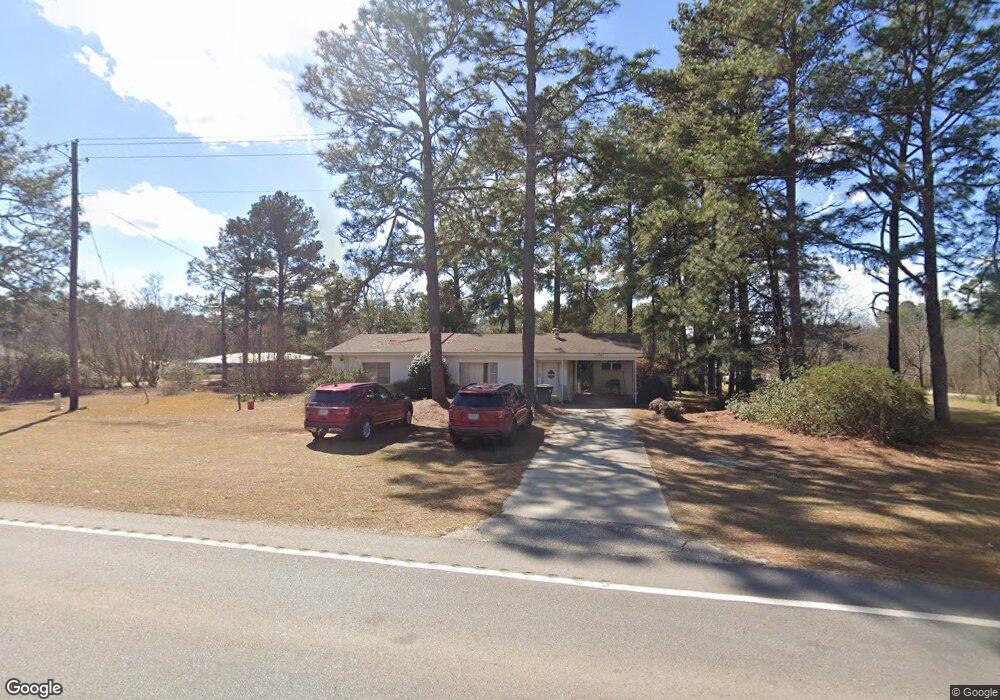
26787 Us Highway 80 W Portal, GA 30450
Estimated Value: $89,388 - $159,000
2
Beds
1
Bath
1,104
Sq Ft
$112/Sq Ft
Est. Value
About This Home
This home is located at 26787 Us Highway 80 W, Portal, GA 30450 and is currently estimated at $123,347, approximately $111 per square foot. 26787 Us Highway 80 W is a home located in Bulloch County with nearby schools including Portal Elementary School and Portal Middle/High School.
Ownership History
Date
Name
Owned For
Owner Type
Purchase Details
Closed on
Sep 15, 2011
Sold by
Banks Susan A
Bought by
Lanier Eunice B
Current Estimated Value
Home Financials for this Owner
Home Financials are based on the most recent Mortgage that was taken out on this home.
Original Mortgage
$41,600
Interest Rate
4.24%
Mortgage Type
Purchase Money Mortgage
Purchase Details
Closed on
Feb 14, 2005
Sold by
Alverson I Ray
Bought by
Banks Susan A
Purchase Details
Closed on
Feb 1, 1992
Bought by
Alverson I Ray
Create a Home Valuation Report for This Property
The Home Valuation Report is an in-depth analysis detailing your home's value as well as a comparison with similar homes in the area
Home Values in the Area
Average Home Value in this Area
Purchase History
| Date | Buyer | Sale Price | Title Company |
|---|---|---|---|
| Lanier Eunice B | $50,600 | -- | |
| Lanier Eunice B | $50,600 | -- | |
| Banks Susan A | -- | -- | |
| Alverson I Ray | -- | -- |
Source: Public Records
Mortgage History
| Date | Status | Borrower | Loan Amount |
|---|---|---|---|
| Closed | Lanier Eunice B | $41,600 |
Source: Public Records
Tax History Compared to Growth
Tax History
| Year | Tax Paid | Tax Assessment Tax Assessment Total Assessment is a certain percentage of the fair market value that is determined by local assessors to be the total taxable value of land and additions on the property. | Land | Improvement |
|---|---|---|---|---|
| 2024 | $647 | $22,240 | $3,240 | $19,000 |
| 2023 | $498 | $20,480 | $3,240 | $17,240 |
| 2022 | $384 | $17,814 | $3,240 | $14,574 |
| 2021 | $345 | $15,599 | $3,240 | $12,359 |
| 2020 | $345 | $15,177 | $3,240 | $11,937 |
| 2019 | $344 | $15,058 | $3,240 | $11,818 |
| 2018 | $373 | $14,699 | $3,240 | $11,459 |
| 2017 | $364 | $14,102 | $3,240 | $10,862 |
| 2016 | $361 | $13,625 | $3,240 | $10,385 |
| 2015 | $354 | $13,256 | $3,240 | $10,016 |
| 2014 | $329 | $13,256 | $3,240 | $10,016 |
Source: Public Records
Map
Nearby Homes
- 126 Woods Ave S
- 132 Woods Ave S
- 130 Woods Ave S
- 124 Woods Ave
- 128 Woods Ave S
- 218 Turpentine Dr
- 1717 Grady Saunders Rd
- 0 U S 80 Unit 10535643
- 525 Horsefly Rd
- 529 College Heights
- 28022 U S 80
- 2120 Banks Dairy Rd
- 569 Anderson Parrish Rd
- 567 Anderson Parrish Rd
- 296 Pleasant Hill Rd
- 788 Dean Nichols Rd
- 0 Ben Grady Collins Rd Unit LOT 3 10534788
- 0 Ben Grady Collins Rd Unit LOT 1 10534784
- 3969 Ben Grady Collins Rd Unit LOT 2
- 3035 Cowboy Way
- 26787 U S 80
- 4 Forest Ave
- 26779 Us Highway 80 W
- 26784 Us Highway 80 W
- 6 Forest Ave
- 888 Bonnett Rd
- 26788 Us Highway 80 W
- 5 Forest Ave
- 7 Forest Ave
- 26780 Us Highway 80 W
- 26870 U S 80
- 26870 Us Highway 80 W
- 26780 U S 80
- 12 Forest Ave
- 26775 Us Highway 80 W
- 26775 Us Highway 80 W
- 9 Forest Ave
- 26874 Us Highway 80 W
- 26878 Us Highway 80 W
- 750 Bonnett Rd