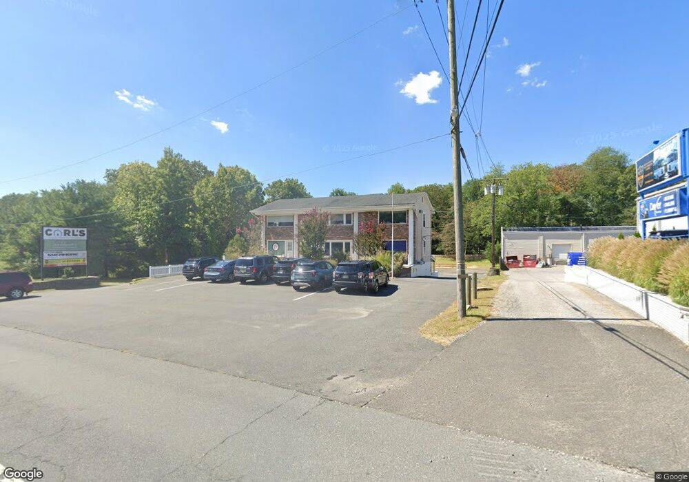
2679 Route 70 Manasquan, NJ 08736
Estimated Value: $749,546
--
Bed
--
Bath
1,350
Sq Ft
$555/Sq Ft
Est. Value
About This Home
This home is located at 2679 Route 70, Manasquan, NJ 08736 and is currently estimated at $749,546, approximately $555 per square foot. 2679 Route 70 is a home located in Monmouth County with nearby schools including Wall High School, The Brookside School, and St Dominic School.
Ownership History
Date
Name
Owned For
Owner Type
Purchase Details
Closed on
Oct 15, 2015
Sold by
Union Hill Redevelopment Limited Liabilt
Bought by
2679 Highway 70 Limited Liabilty Company
Current Estimated Value
Home Financials for this Owner
Home Financials are based on the most recent Mortgage that was taken out on this home.
Original Mortgage
$240,000
Outstanding Balance
$189,086
Interest Rate
3.92%
Mortgage Type
Commercial
Estimated Equity
$560,460
Purchase Details
Closed on
Jun 18, 2015
Sold by
Kearny Federal Savings Bank
Bought by
Union Hill Redevelopment Llc
Purchase Details
Closed on
Sep 23, 1997
Sold by
Shield Ralph
Bought by
New Jersey Capital Group
Home Financials for this Owner
Home Financials are based on the most recent Mortgage that was taken out on this home.
Original Mortgage
$225,000
Interest Rate
7.31%
Mortgage Type
Commercial
Purchase Details
Closed on
Mar 1, 1995
Sold by
4 M Data Systems Inc
Bought by
Replay Inc
Create a Home Valuation Report for This Property
The Home Valuation Report is an in-depth analysis detailing your home's value as well as a comparison with similar homes in the area
Home Values in the Area
Average Home Value in this Area
Purchase History
| Date | Buyer | Sale Price | Title Company |
|---|---|---|---|
| 2679 Highway 70 Limited Liabilty Company | $390,000 | Attorney | |
| Union Hill Redevelopment Llc | $300,000 | First American Title Ins Co | |
| New Jersey Capital Group | $300,000 | -- | |
| Replay Inc | $75,000 | -- |
Source: Public Records
Mortgage History
| Date | Status | Borrower | Loan Amount |
|---|---|---|---|
| Open | 2679 Highway 70 Limited Liabilty Company | $240,000 | |
| Previous Owner | New Jersey Capital Group | $225,000 |
Source: Public Records
Tax History Compared to Growth
Tax History
| Year | Tax Paid | Tax Assessment Tax Assessment Total Assessment is a certain percentage of the fair market value that is determined by local assessors to be the total taxable value of land and additions on the property. | Land | Improvement |
|---|---|---|---|---|
| 2025 | $8,803 | $417,200 | $139,300 | $277,900 |
| 2024 | $8,540 | $417,200 | $139,300 | $277,900 |
| 2023 | $8,540 | $417,200 | $139,300 | $277,900 |
| 2022 | $8,331 | $417,200 | $139,300 | $277,900 |
| 2021 | $8,331 | $417,200 | $139,300 | $277,900 |
| 2020 | $8,231 | $417,200 | $139,300 | $277,900 |
| 2019 | $8,131 | $417,200 | $139,300 | $277,900 |
| 2018 | $8,060 | $417,200 | $139,300 | $277,900 |
| 2017 | $7,902 | $417,200 | $139,300 | $277,900 |
| 2016 | $7,735 | $417,200 | $139,300 | $277,900 |
| 2015 | $10,555 | $357,800 | $89,700 | $268,100 |
| 2014 | $10,455 | $362,500 | $94,400 | $268,100 |
Source: Public Records
Map
Nearby Homes
- 651 Oceanview Rd
- 664 Valley Rd
- 1582 Horseshoe Dr
- 2575 Morningstar Rd
- 21 N Tamarack Dr
- 29 Mulberry Ct Unit D
- 1004 Cedar Ln
- 931 Birch Dr
- 924 Birch Dr
- 846 William Dr
- 20 Maple Ln Unit D
- 41 Poplar Ct Unit C
- 2578 Collier Rd
- 2639 River Rd
- 2567 River Rd
- 1105 Shore Dr
- 816 Rathjen Rd
- Kensington Plan at The Monmouth - The Villas 55+
- 917 Riverview Dr
- 907 Riverview Dr
- 2679 New Jersey 70 Unit Suite 2
- 2679 New Jersey 70 Unit Left
- 2679 New Jersey 70 Unit (Left Side)
- 2679 New Jersey 70 Unit (Middle Office)
- 2679 New Jersey 70 Unit Lower Level
- 2679 New Jersey 70 Unit Suite 1
- 2677 Highway 70
- 651 Holly Hill Dr
- 2 Mariners Bend Unit 2
- 3 Mariners Bend Unit 3
- 5 Mariners Bend
- 4 Mariners Bend
- 6 Mariners Bend
- 7 Mariners Bend
- 8 Mariners Bend
- 649 Holly Hill Dr
- 9 Mariners Bend
- 1 Mariners Bend
- 10 Mariners Bend
- 650 Holly Hill Dr