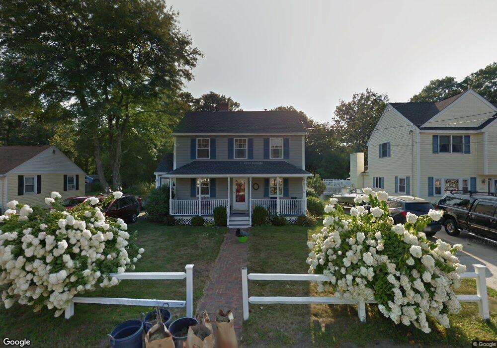
268 Burnham Rd Lowell, MA 01852
Belvidere NeighborhoodEstimated Value: $565,000 - $645,000
4
Beds
2
Baths
1,456
Sq Ft
$417/Sq Ft
Est. Value
About This Home
This home is located at 268 Burnham Rd, Lowell, MA 01852 and is currently estimated at $607,241, approximately $417 per square foot. 268 Burnham Rd is a home located in Middlesex County with nearby schools including Moody Elementary School, Abraham Lincoln Elementary School, and Greenhalge Elementary School.
Ownership History
Date
Name
Owned For
Owner Type
Purchase Details
Closed on
Oct 28, 2005
Sold by
Lombard Jesse Boyd and Lombard Jill Anne
Bought by
Cargill Timothy F and Cargill Catherine E
Current Estimated Value
Home Financials for this Owner
Home Financials are based on the most recent Mortgage that was taken out on this home.
Original Mortgage
$252,000
Interest Rate
5.79%
Mortgage Type
Purchase Money Mortgage
Purchase Details
Closed on
Jan 25, 2002
Sold by
Romano John and Romano Charleen A
Bought by
Lombard Jesse and Haney Jill
Purchase Details
Closed on
Apr 22, 1997
Sold by
Est Godfrey Rita S and Audet Martha June
Bought by
Construct Decarroll
Create a Home Valuation Report for This Property
The Home Valuation Report is an in-depth analysis detailing your home's value as well as a comparison with similar homes in the area
Home Values in the Area
Average Home Value in this Area
Purchase History
| Date | Buyer | Sale Price | Title Company |
|---|---|---|---|
| Cargill Timothy F | $315,000 | -- | |
| Cargill Timothy F | $315,000 | -- | |
| Lombard Jesse | $240,000 | -- | |
| Lombard Jesse | $240,000 | -- | |
| Construct Decarroll | $56,000 | -- | |
| Decarroll Construct | $56,000 | -- |
Source: Public Records
Mortgage History
| Date | Status | Borrower | Loan Amount |
|---|---|---|---|
| Open | Decarroll Construct | $237,000 | |
| Closed | Cargill Timothy F | $252,000 |
Source: Public Records
Tax History
| Year | Tax Paid | Tax Assessment Tax Assessment Total Assessment is a certain percentage of the fair market value that is determined by local assessors to be the total taxable value of land and additions on the property. | Land | Improvement |
|---|---|---|---|---|
| 2025 | $5,763 | $502,000 | $242,700 | $259,300 |
| 2024 | $5,789 | $486,100 | $226,800 | $259,300 |
| 2023 | $5,424 | $436,700 | $197,200 | $239,500 |
| 2022 | $4,863 | $383,200 | $173,700 | $209,500 |
| 2021 | $4,642 | $344,900 | $150,900 | $194,000 |
| 2020 | $4,525 | $338,700 | $150,900 | $187,800 |
| 2019 | $4,181 | $297,800 | $144,200 | $153,600 |
| 2018 | $4,064 | $282,400 | $137,300 | $145,100 |
| 2017 | $3,870 | $259,400 | $121,900 | $137,500 |
| 2016 | $3,846 | $253,700 | $116,200 | $137,500 |
| 2015 | $3,709 | $239,600 | $116,200 | $123,400 |
| 2013 | $3,523 | $234,700 | $119,700 | $115,000 |
Source: Public Records
Map
Nearby Homes
- 206 Burnham Rd
- 194 River Rd
- 11 Joseph Ave
- 89 Newbury St
- 100 Merrimack Ave Unit 9
- 45 Clark Rd
- 935 Methuen St Unit 13
- 164 Bradley St
- 81 Reservoir St
- Lots 1-12 Christian Hill Dev
- 42 Christian St
- 52 Christian St
- Lot 11 Christian St
- Lot 12 Christian St
- Lot 9 Christian St
- Lot 10 Christian St
- 43 Oheir Way
- 20 Mount Pleasant St
- 251 Clark Rd
- 84 Tellier Way
- 274 Burnham Rd
- 262 Burnham Rd
- 280 Burnham Rd
- 256 Burnham Rd
- 257 Burnham Rd
- 286 Burnham Rd
- 250 Burnham Rd
- 271 Burnham Rd
- 265 Burnham Rd
- 277 Burnham Rd
- 283 Burnham Rd
- 283 Burnham Rd Unit 283
- 294 Burnham Rd
- 244 Burnham Rd
- 251 Burnham Rd
- 289 Burnham Rd
- 171 Fetherston Ave
- 177 Fetherston Ave
- 163 Fetherston Ave
- 245 Burnham Rd
Your Personal Tour Guide
Ask me questions while you tour the home.