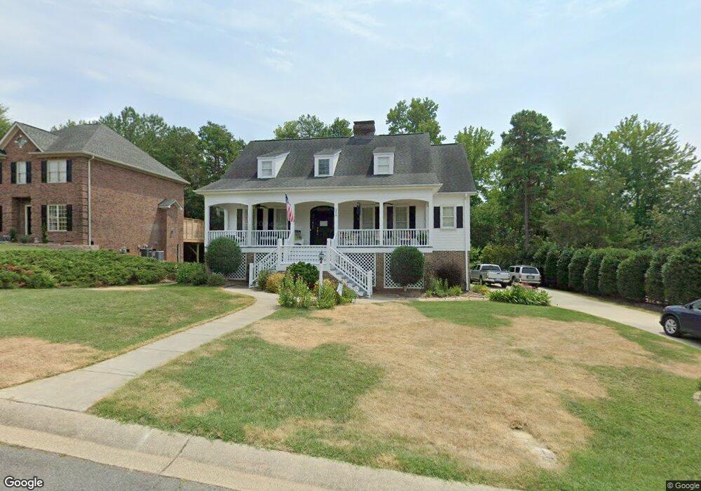
268 Charter Ct SE Concord, NC 28025
Estimated Value: $558,458 - $834,000
4
Beds
4
Baths
3,166
Sq Ft
$203/Sq Ft
Est. Value
About This Home
This home is located at 268 Charter Ct SE, Concord, NC 28025 and is currently estimated at $643,615, approximately $203 per square foot. 268 Charter Ct SE is a home located in Cabarrus County with nearby schools including W.M. Irvin Elementary School, Concord Middle School, and Concord High School.
Ownership History
Date
Name
Owned For
Owner Type
Purchase Details
Closed on
Jul 21, 2014
Sold by
Harrold Roger Dale and Harrold Starr Stewart
Bought by
Mozingo Joseph M and Mozingo Cora L
Current Estimated Value
Home Financials for this Owner
Home Financials are based on the most recent Mortgage that was taken out on this home.
Original Mortgage
$264,000
Outstanding Balance
$195,999
Interest Rate
3.5%
Mortgage Type
Adjustable Rate Mortgage/ARM
Estimated Equity
$447,616
Purchase Details
Closed on
Jun 14, 2002
Sold by
White Park Llc
Bought by
Harrold Roger Dale and Harrold Starr Stewart
Home Financials for this Owner
Home Financials are based on the most recent Mortgage that was taken out on this home.
Original Mortgage
$220,000
Interest Rate
6.77%
Create a Home Valuation Report for This Property
The Home Valuation Report is an in-depth analysis detailing your home's value as well as a comparison with similar homes in the area
Home Values in the Area
Average Home Value in this Area
Purchase History
| Date | Buyer | Sale Price | Title Company |
|---|---|---|---|
| Mozingo Joseph M | $339,500 | None Available | |
| Harrold Roger Dale | $300,000 | -- |
Source: Public Records
Mortgage History
| Date | Status | Borrower | Loan Amount |
|---|---|---|---|
| Open | Mozingo Joseph M | $264,000 | |
| Previous Owner | Harrold Roger Dale | $220,000 |
Source: Public Records
Tax History Compared to Growth
Tax History
| Year | Tax Paid | Tax Assessment Tax Assessment Total Assessment is a certain percentage of the fair market value that is determined by local assessors to be the total taxable value of land and additions on the property. | Land | Improvement |
|---|---|---|---|---|
| 2025 | $5,283 | $530,400 | $98,000 | $432,400 |
| 2024 | $5,283 | $530,400 | $98,000 | $432,400 |
| 2023 | $4,110 | $336,880 | $45,000 | $291,880 |
| 2022 | $4,110 | $336,880 | $45,000 | $291,880 |
| 2021 | $4,110 | $336,880 | $45,000 | $291,880 |
| 2020 | $4,110 | $336,880 | $45,000 | $291,880 |
| 2019 | $4,087 | $335,030 | $40,000 | $295,030 |
| 2018 | $4,020 | $335,030 | $40,000 | $295,030 |
| 2017 | $3,953 | $335,030 | $40,000 | $295,030 |
| 2016 | $2,345 | $299,820 | $40,000 | $259,820 |
| 2015 | $3,538 | $299,820 | $40,000 | $259,820 |
| 2014 | $3,538 | $299,820 | $40,000 | $259,820 |
Source: Public Records
Map
Nearby Homes
- 428 Spruce Place SE
- 335 Summit Ct SE
- 230 Ravine Cir SE
- 315 Crestside Dr SE
- 467 Countrywood Place SE
- TBD Countrywood Place SE Unit 28
- 192, 188, 196, 197 & Riverbirch Dr SE
- 208 Corban Ave SE
- 121 Louise Dr SE
- 65 Glendale Ave SE
- 301 Rosemont Ave SE
- 209 Gene Ct SE
- 522 Sunnyside Dr SE
- 448 Union St S
- 60 Patton Ct SE
- 374 Union St S
- 347 Valley Brook Ln SE Unit 39
- 135 Corban Ave SE
- 123 Corban Ave SE
- 145 Deal St SE
- 272 Charter Ct SE
- 264 Charter Ct SE
- 247 Brook Ave SE
- 247 Brook Ave SE Unit 49
- 243 Brook Ave SE
- 243 Brook Ave SE Unit 50
- 243 Brook Ave SE
- 276 Charter Ct SE
- 258 Charter Ct SE
- 267 Charter Ct SE
- 251 Brook Ave SE Unit 48
- 251 Brook Ave SE
- 271 Charter Ct SE
- 263 Charter Ct SE
- 239 Brook Ave SE Unit 51
- 239 Brook Ave SE
- 275 Charter Ct SE
- 257 Charter Ct SE
- 257 Charter Ct SE Unit 5
- Lot 2 Charter Ct