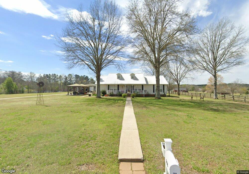
268 Curtis Richey Rd Locust Fork, AL 35097
Estimated Value: $269,000 - $359,841
--
Bed
--
Bath
1,920
Sq Ft
$168/Sq Ft
Est. Value
About This Home
This home is located at 268 Curtis Richey Rd, Locust Fork, AL 35097 and is currently estimated at $322,460, approximately $167 per square foot. 268 Curtis Richey Rd is a home located in Blount County with nearby schools including Locust Fork Elementary School and Locust Fork High School.
Ownership History
Date
Name
Owned For
Owner Type
Purchase Details
Closed on
Jul 30, 2018
Bought by
Osment Je and Osment Debra L
Current Estimated Value
Home Financials for this Owner
Home Financials are based on the most recent Mortgage that was taken out on this home.
Original Mortgage
$193,500
Outstanding Balance
$168,194
Interest Rate
4.54%
Estimated Equity
$154,266
Purchase Details
Closed on
Jul 27, 2005
Sold by
Relocation Advantage Llc
Bought by
Osment J E and Osment Debra L
Home Financials for this Owner
Home Financials are based on the most recent Mortgage that was taken out on this home.
Original Mortgage
$200,000
Interest Rate
5.48%
Mortgage Type
Purchase Money Mortgage
Create a Home Valuation Report for This Property
The Home Valuation Report is an in-depth analysis detailing your home's value as well as a comparison with similar homes in the area
Home Values in the Area
Average Home Value in this Area
Purchase History
| Date | Buyer | Sale Price | Title Company |
|---|---|---|---|
| Osment Je | -- | -- | |
| Osment J E | $202,500 | -- |
Source: Public Records
Mortgage History
| Date | Status | Borrower | Loan Amount |
|---|---|---|---|
| Open | Osment Je | $193,500 | |
| Closed | Osment Je | -- | |
| Previous Owner | Osment J E | $200,000 |
Source: Public Records
Tax History Compared to Growth
Tax History
| Year | Tax Paid | Tax Assessment Tax Assessment Total Assessment is a certain percentage of the fair market value that is determined by local assessors to be the total taxable value of land and additions on the property. | Land | Improvement |
|---|---|---|---|---|
| 2024 | -- | $30,180 | $5,500 | $24,680 |
| 2023 | $0 | $28,300 | $5,500 | $22,800 |
| 2022 | $749 | $25,180 | $5,500 | $19,680 |
| 2021 | $0 | $22,000 | $5,780 | $16,220 |
| 2020 | $619 | $19,580 | $5,500 | $14,080 |
| 2019 | $578 | $19,580 | $5,500 | $14,080 |
| 2018 | $697 | $20,120 | $5,500 | $14,620 |
| 2017 | $743 | $21,360 | $0 | $0 |
| 2015 | $750 | $21,360 | $0 | $0 |
| 2014 | -- | $21,360 | $0 | $0 |
| 2013 | -- | $20,840 | $0 | $0 |
Source: Public Records
Map
Nearby Homes
- 89 Pine Tree Dr
- 55 Honeycutt Rd
- 496 Tawbush Rd
- 25942 Alabama 79
- 4540 Spunky Hollow Rd
- 0 Center Hill Rd
- 159 Ray Dr
- 25465 Alabama 79
- 29542 Alabama 79
- 25335 Alabama 79
- 25335 State Highway 79
- 312 Lehigh Rd
- 87 Youngblood Ln
- 63 Avery Hancock Dr
- #0 Shady Point Rd Unit 18, 18 & 19
- 3251 County Highway 13
- 60 Wortham Rd
- 178 Jerry Marsh Rd
- 4216 Sand Valley Rd
- 380 Jerry Marsh Rd
- 271 Curtis Richey Rd
- 220 Curtis Richey Rd
- 296 Curtis Richey Rd
- 141 Curtis Richey Rd
- 330 Curtis Richey Rd
- 491 Payton Ln
- 164 Curtis Richey Rd
- 142 Curtis Richey Rd
- 142 Curtis Richey Rd
- 142 Curtis Richey Rd
- 455 Payton Ln
- 00 Payton Ln Unit 3
- 501 Curtis Richey Rd
- 490 Payton Ln
- 40 Curtis Richey Rd
- 1257 Honeycutt Rd
- 386 Payton Ln
- 27628 State Highway 79
- 27628 State Highway 79
- 27420 State Highway 79