Estimated Value: $359,296 - $450,000
Studio
2
Baths
1,248
Sq Ft
$317/Sq Ft
Est. Value
About This Home
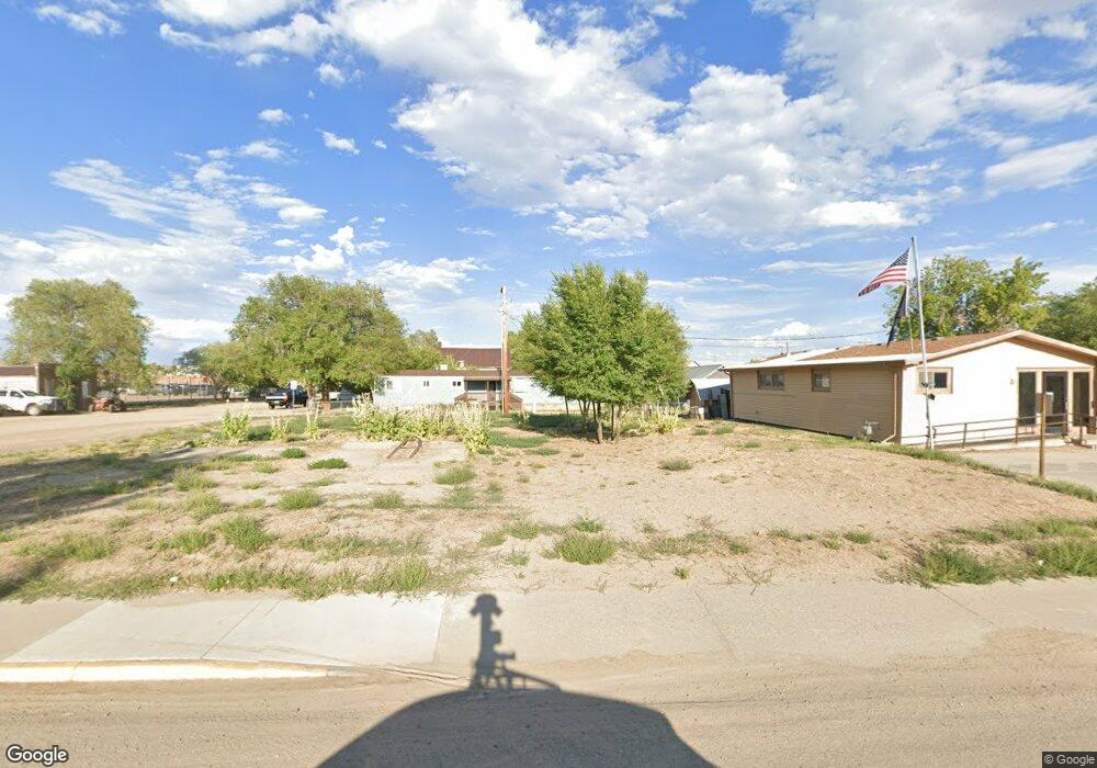
This home is located at 268 E Highway 70, Baggs, WY 82321 and is currently estimated at $396,099, approximately $317 per square foot. 268 E Highway 70 is a home with nearby schools including Little Snake River Valley School.
Ownership History
Date
Name
Owned For
Owner Type
Purchase Details
Closed on
Nov 1, 2021
Sold by
Dennis Erroll Shorma and Dennis Beth Louise
Bought by
Little Snake River Ranch Llc
Current Estimated Value
Home Financials for this Owner
Home Financials are based on the most recent Mortgage that was taken out on this home.
Original Mortgage
$1,100,000
Outstanding Balance
$1,000,918
Interest Rate
2.8%
Mortgage Type
New Conventional
Estimated Equity
-$604,819
Create a Home Valuation Report for This Property
The Home Valuation Report is an in-depth analysis detailing your home's value as well as a comparison with similar homes in the area
Purchase History
| Date | Buyer | Sale Price | Title Company |
|---|---|---|---|
| Little Snake River Ranch Llc | -- | First American Title | |
| Little Snake River Ranch Llc | -- | First American Title |
Source: Public Records
Mortgage History
| Date | Status | Borrower | Loan Amount |
|---|---|---|---|
| Open | Little Snake River Ranch Llc | $1,100,000 | |
| Closed | Little Snake River Ranch Llc | $1,100,000 |
Source: Public Records
Tax History
| Year | Tax Paid | Tax Assessment Tax Assessment Total Assessment is a certain percentage of the fair market value that is determined by local assessors to be the total taxable value of land and additions on the property. | Land | Improvement |
|---|---|---|---|---|
| 2025 | $2,237 | $21,536 | $11,378 | $10,158 |
| 2024 | $22 | $24,560 | $11,787 | $12,773 |
| 2023 | $2,110 | $23,348 | $10,552 | $12,796 |
| 2022 | $1,855 | $20,475 | $9,161 | $11,314 |
| 2021 | $1,480 | $18,342 | $8,004 | $10,338 |
| 2020 | $971 | $47,320 | $38,125 | $9,195 |
| 2019 | $952 | $9,350 | $7,407 | $1,943 |
| 2018 | $963 | $9,443 | $7,517 | $1,926 |
| 2017 | $1,053 | $10,735 | $8,748 | $1,987 |
| 2016 | $1,070 | $11,058 | $9,083 | $1,975 |
| 2015 | -- | $10,620 | $8,562 | $2,058 |
| 2014 | -- | $10,029 | $7,942 | $2,087 |
Source: Public Records
Map
Nearby Homes
- 00 Highway 789
- Baggs Unit Wyoming 82321
- 109 Boxelder St
- 20347 County Road 3
- 638 Little Willow Rd
- 8316 Boulder Dr
- TBD Boulder Drive Lot 397
- 2004 Boulder Drive Lot 396
- 1351 Fiddleneck Dr
- 544 Timberlane Loop Unit 318
- 1750 Fiddleneck Drive Lot 44
- 276 Sycamore Rd Unit Lot 288
- 851 Falcon Dr
- 2950 Timberlane Dr Unit Lots 554 & 555
- 943 Routt Forest Dr
- 51978 Highway 13
- 0 Tbd County Road 109
- TBD County Road 11
- 0 Tbd Cr 11
- TBD Cr 19
- 290 W Osborne St
- 285 Osborne St
- 95 S Penland St
- 270 North St
- 260 North St
- 0 Lower Four Mile Ranch Unit 57542
- 370 S Penland St
- 20 S Penland St
- 210 Penland St
- 131 N Miles St
- 45 S Miles St
- 91 S Miles St
- 175 N Miles St
- 191 N Miles St
- 225 S Miles St
- 250 S Miles St
- 120 N Miles St
- 145 Magar St
- 80 S Miles
- 101 North St
Your Personal Tour Guide
Ask me questions while you tour the home.