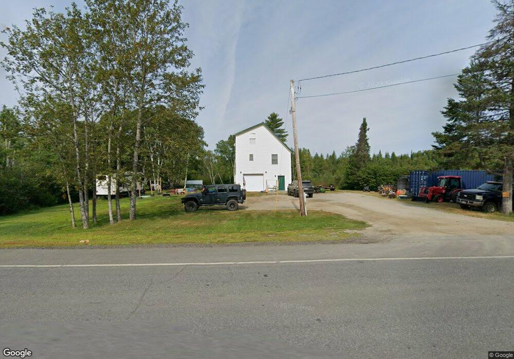
268 Main St Eustis, ME 04936
Estimated Value: $281,000 - $578,000
2
Beds
2
Baths
2,040
Sq Ft
$189/Sq Ft
Est. Value
About This Home
This home is located at 268 Main St, Eustis, ME 04936 and is currently estimated at $386,069, approximately $189 per square foot. 268 Main St is a home located in Franklin County with nearby schools including Stratton Elementary School.
Ownership History
Date
Name
Owned For
Owner Type
Purchase Details
Closed on
Jul 2, 2019
Sold by
Vangeli Peter J
Bought by
Lojas Anthony D and Stone Alivia V
Current Estimated Value
Home Financials for this Owner
Home Financials are based on the most recent Mortgage that was taken out on this home.
Original Mortgage
$128,282
Outstanding Balance
$112,386
Interest Rate
3.82%
Mortgage Type
New Conventional
Estimated Equity
$273,683
Purchase Details
Closed on
Feb 12, 2019
Sold by
Eustis Town Of
Bought by
Vangeli Peter
Create a Home Valuation Report for This Property
The Home Valuation Report is an in-depth analysis detailing your home's value as well as a comparison with similar homes in the area
Purchase History
| Date | Buyer | Sale Price | Title Company |
|---|---|---|---|
| Lojas Anthony D | -- | -- | |
| Vangeli Peter | -- | -- |
Source: Public Records
Mortgage History
| Date | Status | Borrower | Loan Amount |
|---|---|---|---|
| Open | Lojas Anthony D | $128,282 |
Source: Public Records
Tax History
| Year | Tax Paid | Tax Assessment Tax Assessment Total Assessment is a certain percentage of the fair market value that is determined by local assessors to be the total taxable value of land and additions on the property. | Land | Improvement |
|---|---|---|---|---|
| 2024 | $1,867 | $213,400 | $53,300 | $160,100 |
| 2023 | $1,897 | $211,900 | $49,800 | $162,100 |
| 2022 | $1,812 | $190,700 | $49,800 | $140,900 |
| 2021 | $1,900 | $147,300 | $38,800 | $108,500 |
| 2020 | $1,856 | $148,500 | $38,800 | $109,700 |
| 2019 | $1,811 | $149,700 | $38,800 | $110,900 |
| 2018 | $1,962 | $149,800 | $38,800 | $111,000 |
| 2017 | $1,963 | $151,000 | $38,800 | $112,200 |
| 2016 | $1,930 | $151,100 | $38,800 | $112,300 |
| 2015 | $2,010 | $152,300 | $38,800 | $113,500 |
| 2014 | $1,707 | $155,200 | $38,800 | $116,400 |
| 2009 | -- | $150,800 | $48,800 | $102,000 |
Source: Public Records
Map
Nearby Homes
- 9 Tranquility Ln
- 186 Main St
- 27 Peabody Rd
- 14 Dam Rd
- 12 Bog Rd
- 11 Porcupine Trail
- 27 Reed Rd
- 81 B Red Pine Ln
- 6-01 Eustis Ridge Rd
- 60&66 Gravel Pit Rd
- 484 Eustis Ridge Rd
- 233 Porter Nadeau Rd
- 95-4 Lot D Porter Nadeau Rd
- 64 Ip Rd
- 54 Eustis Village Rd
- 59 Eustis Village Rd
- 118 Glidden Rd
- 1480 Arnold Trail
- 42 Rabbit Hollow Rd
- 4004 Bigelow Station
- 20 Vaughn Rd
- 14 Vaughn Rd
- 260 Main Street State Hwy
- 260 Main St
- 14 lots Off Vaughn Rd
- 291 Main St
- Lot16A12 Off Vaughn Rd
- 256 Main St
- 6 Grant Cove Community
- 295 Main St
- 7 Grant Cove Community
- Lot 16A+ Off Vaughn Rd
- Lot 16A Off Vaughn Rd
- 9&10 Tranquility Ln
- 9 Tranquillity
- 9 & 10 Tranquility Ln
- 314 Main St
- 244 Main St
- 236 Main St
- 47 Hawks Bluff Rd
Your Personal Tour Guide
Ask me questions while you tour the home.