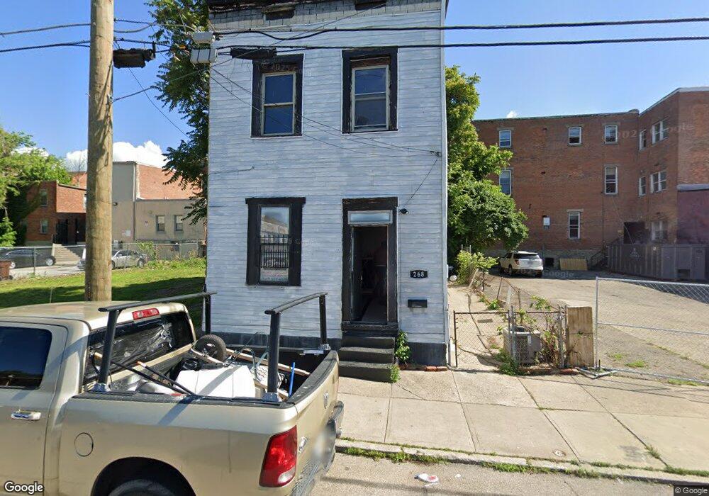
268 Stark St Cincinnati, OH 45214
Over-The-Rhine NeighborhoodEstimated Value: $58,000 - $74,129
4
Beds
4
Baths
1,428
Sq Ft
$48/Sq Ft
Est. Value
About This Home
This home is located at 268 Stark St, Cincinnati, OH 45214 and is currently estimated at $68,782, approximately $48 per square foot. 268 Stark St is a home located in Hamilton County with nearby schools including Rothenberg Preparatory Academy, Robert A. Taft Information Technology High School, and Gilbert A. Dater High School.
Ownership History
Date
Name
Owned For
Owner Type
Purchase Details
Closed on
Jul 15, 2025
Sold by
Tyson Shawn J
Bought by
Cincinnati Capital Partners 626 Llc
Current Estimated Value
Purchase Details
Closed on
Jun 24, 2008
Sold by
Rogers Clifton J
Bought by
Tyson Shawn J
Purchase Details
Closed on
Jul 16, 2007
Sold by
Tyson Shawn J
Bought by
Rogers Clifton J
Purchase Details
Closed on
Jul 12, 2007
Sold by
Funk Jeffery A
Bought by
Tyson Shawn J
Purchase Details
Closed on
Mar 2, 2004
Sold by
Paskal Fotis and Paskal Donna L
Bought by
Funk Jeffrey A
Purchase Details
Closed on
Oct 11, 1993
Sold by
Dechristopher Inc
Bought by
Paskal Fotis and Paskal Donna L
Create a Home Valuation Report for This Property
The Home Valuation Report is an in-depth analysis detailing your home's value as well as a comparison with similar homes in the area
Home Values in the Area
Average Home Value in this Area
Purchase History
| Date | Buyer | Sale Price | Title Company |
|---|---|---|---|
| Cincinnati Capital Partners 626 Llc | $62,500 | None Listed On Document | |
| Cincinnati Capital Partners 626 Llc | $62,500 | None Listed On Document | |
| Tyson Shawn J | $17,500 | None Available | |
| Rogers Clifton J | $17,000 | None Available | |
| Tyson Shawn J | -- | None Available | |
| Funk Jeffrey A | $13,000 | -- | |
| Paskal Fotis | -- | -- |
Source: Public Records
Tax History
| Year | Tax Paid | Tax Assessment Tax Assessment Total Assessment is a certain percentage of the fair market value that is determined by local assessors to be the total taxable value of land and additions on the property. | Land | Improvement |
|---|---|---|---|---|
| 2025 | $1,701 | $25,113 | $6,300 | $18,813 |
| 2024 | $1,504 | $25,113 | $6,300 | $18,813 |
| 2023 | $1,538 | $25,113 | $6,300 | $18,813 |
| 2022 | $792 | $11,550 | $5,040 | $6,510 |
| 2021 | $761 | $11,550 | $5,040 | $6,510 |
| 2020 | $783 | $11,550 | $5,040 | $6,510 |
| 2019 | $590 | $7,945 | $2,520 | $5,425 |
| 2018 | $591 | $7,945 | $2,520 | $5,425 |
| 2017 | $562 | $7,945 | $2,520 | $5,425 |
| 2016 | $383 | $5,334 | $1,512 | $3,822 |
| 2015 | $346 | $5,334 | $1,512 | $3,822 |
| 2014 | $349 | $5,334 | $1,512 | $3,822 |
| 2013 | $351 | $5,282 | $1,498 | $3,784 |
Source: Public Records
Map
Nearby Homes
- 1913 Central Ave
- 279 Renner St
- 320 Mohawk St
- 422 Dayton St
- 444 Dayton St
- 407 Mohawk St
- 411 W McMicken Ave
- 305 Klotter Ave
- 421 W McMicken Ave
- 2123 Renner Place
- 2171 Sohn St
- 2125 Renner Place
- 266 Klotter Ave
- 306 Klotter Ave
- 310 Klotter Ave
- 2128 Ravine St
- 209 Hastings St
- 1916 Linn St
- 532 York St
- 454 W McMicken Ave
- 262 Stark St
- 271 W McMicken Ave
- 267 W McMicken Ave
- 261 W McMicken Ave
- 259 W McMicken Ave
- 278 Stark St
- 280 Stark St
- 279 W McMicken Ave
- 281 W McMicken Ave
- 248 Stark St
- 2026 Central Pkwy
- 262 W McMicken Ave
- 2024 Mohawk Place
- 2014 Mohawk Place
- 272 W McMicken Ave
- 2016 Mohawk Place
- 2022 Mohawk Place
- 274 W McMicken Ave
- 2022 Mohawk Place
- 270 W McMicken Ave
Your Personal Tour Guide
Ask me questions while you tour the home.