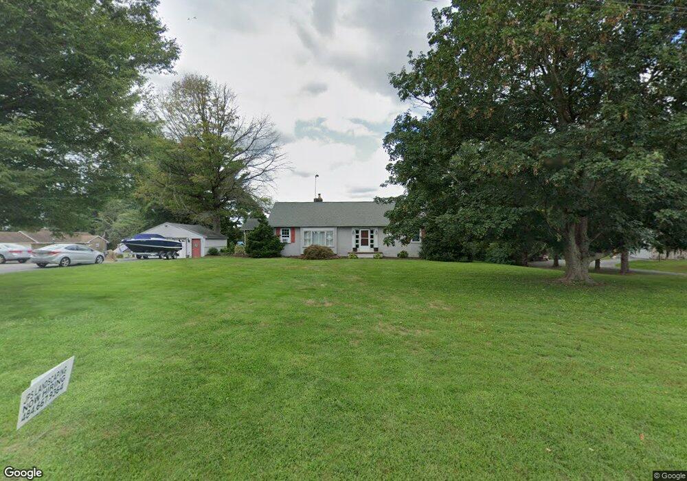
268 State Rd West Grove, PA 19390
Estimated Value: $373,000 - $466,000
5
Beds
2
Baths
1,787
Sq Ft
$226/Sq Ft
Est. Value
About This Home
This home is located at 268 State Rd, West Grove, PA 19390 and is currently estimated at $402,984, approximately $225 per square foot. 268 State Rd is a home located in Chester County with nearby schools including Penn London Elementary School, Avon Grove Intermediate School, and Fred S Engle Middle School.
Ownership History
Date
Name
Owned For
Owner Type
Purchase Details
Closed on
Jul 17, 1998
Sold by
Slutter Ronald J and Slutter Nancy G
Bought by
Slutter Ronald J and Slutter Dorothy T
Current Estimated Value
Home Financials for this Owner
Home Financials are based on the most recent Mortgage that was taken out on this home.
Original Mortgage
$135,000
Outstanding Balance
$27,435
Interest Rate
6.92%
Estimated Equity
$375,549
Purchase Details
Closed on
Apr 30, 1996
Sold by
Barnes Katherine S and Dunn Norma J
Bought by
Slutter Ronald J and Slutter Nancy G
Home Financials for this Owner
Home Financials are based on the most recent Mortgage that was taken out on this home.
Original Mortgage
$235,000
Outstanding Balance
$12,988
Interest Rate
7.67%
Estimated Equity
$389,996
Create a Home Valuation Report for This Property
The Home Valuation Report is an in-depth analysis detailing your home's value as well as a comparison with similar homes in the area
Home Values in the Area
Average Home Value in this Area
Purchase History
| Date | Buyer | Sale Price | Title Company |
|---|---|---|---|
| Slutter Ronald J | -- | -- | |
| Slutter Ronald J | $143,000 | -- |
Source: Public Records
Mortgage History
| Date | Status | Borrower | Loan Amount |
|---|---|---|---|
| Open | Slutter Ronald J | $135,000 | |
| Open | Slutter Ronald J | $235,000 |
Source: Public Records
Tax History Compared to Growth
Tax History
| Year | Tax Paid | Tax Assessment Tax Assessment Total Assessment is a certain percentage of the fair market value that is determined by local assessors to be the total taxable value of land and additions on the property. | Land | Improvement |
|---|---|---|---|---|
| 2025 | $3,482 | $85,450 | $51,360 | $34,090 |
| 2024 | $3,482 | $85,450 | $51,360 | $34,090 |
| 2023 | $3,410 | $85,450 | $51,360 | $34,090 |
| 2022 | $3,360 | $85,450 | $51,360 | $34,090 |
| 2021 | $3,291 | $85,450 | $51,360 | $34,090 |
| 2020 | $3,181 | $85,450 | $51,360 | $34,090 |
| 2019 | $3,103 | $85,450 | $51,360 | $34,090 |
| 2018 | $3,024 | $85,450 | $51,360 | $34,090 |
| 2017 | $2,962 | $85,450 | $51,360 | $34,090 |
| 2016 | $2,235 | $85,450 | $51,360 | $34,090 |
| 2015 | $2,235 | $85,450 | $51,360 | $34,090 |
| 2014 | $2,235 | $85,450 | $51,360 | $34,090 |
Source: Public Records
Map
Nearby Homes
- 286 State Rd
- 9 Morningside Ct
- 25 Holly Dr
- 381 Rosehill Rd
- 504 Prospect Ave
- 117 Railroad Ave Unit 10
- 17 Nottingham Dr
- 135 Jackson Ave
- 8 Prospect Ave
- 6 Merigold Ct
- 607 Martin Dr
- 512 Finn Way
- 603 Lamborn Ridge Dr
- 24 Caversham Dr
- 622 Martin Dr
- 26 Inniscrone Dr
- 263 Schoolhouse Rd
- 423 Westview Dr
- 274 Schoolhouse Rd
- 400 N Guernsey Rd
- 272 State Rd
- 260 State Rd
- 276 State Rd
- 255 State Rd
- 250 State Rd
- 251 State Rd
- 336 Welcome Ave
- 334 Welcome Ave
- 338 Welcome Ave
- 332 Welcome Ave
- 340 Welcome Ave
- 330 Welcome Ave
- 328 Welcome Ave
- 342 Welcome Ave
- 326 Welcome Ave
- 324 Welcome Ave
- 325 Welcome Ave
- 323 Welcome Ave
- 344 Welcome Ave
- 252 Rosehill Rd