Estimated Value: $193,726 - $326,000
4
Beds
2
Baths
1,430
Sq Ft
$179/Sq Ft
Est. Value
About This Home
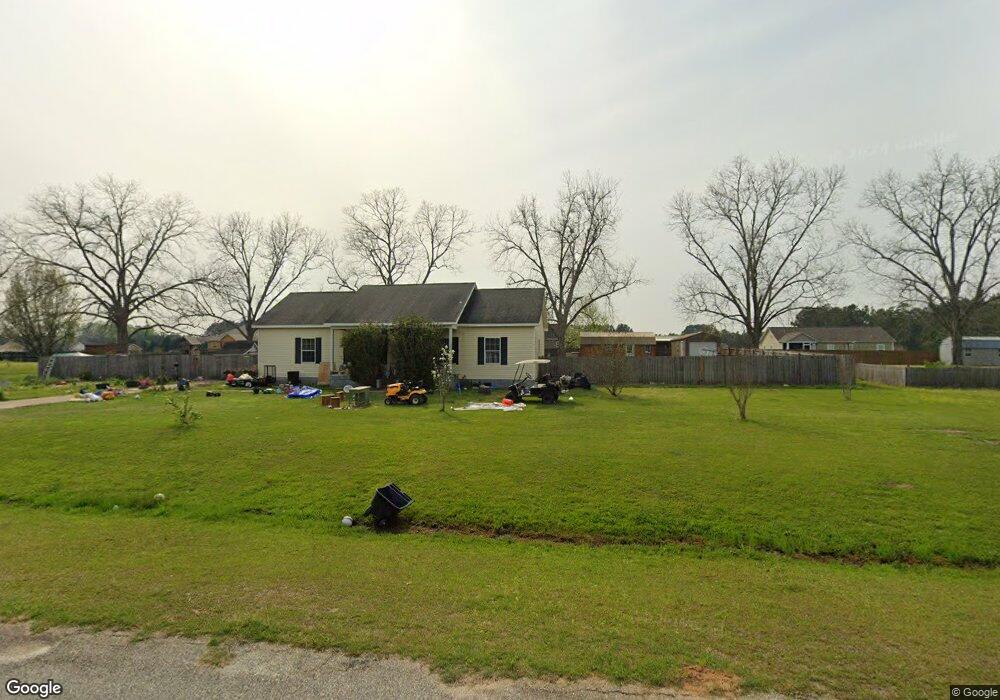
This home is located at 268 Virginia Cir, Cairo, GA 39828 and is currently estimated at $255,432, approximately $178 per square foot. 268 Virginia Cir is a home located in Grady County.
Ownership History
Date
Name
Owned For
Owner Type
Purchase Details
Closed on
Oct 31, 2011
Sold by
Fannie Mae
Bought by
Johnson Samuel L
Current Estimated Value
Home Financials for this Owner
Home Financials are based on the most recent Mortgage that was taken out on this home.
Original Mortgage
$79,591
Outstanding Balance
$54,456
Interest Rate
4.09%
Mortgage Type
New Conventional
Estimated Equity
$200,976
Purchase Details
Closed on
Apr 5, 2011
Sold by
Wells Fargo Bank Na
Bought by
Federal National Mortgage Association
Purchase Details
Closed on
Jun 2, 2006
Sold by
Brock Tony
Bought by
Meades Henry and Meades Carolyn P
Home Financials for this Owner
Home Financials are based on the most recent Mortgage that was taken out on this home.
Original Mortgage
$115,200
Interest Rate
6.51%
Mortgage Type
New Conventional
Purchase Details
Closed on
Jun 24, 2005
Sold by
M & S Properties Of Grady Ll
Bought by
Brock Tony
Purchase Details
Closed on
Jul 7, 2004
Bought by
M & S Properties
Create a Home Valuation Report for This Property
The Home Valuation Report is an in-depth analysis detailing your home's value as well as a comparison with similar homes in the area
Home Values in the Area
Average Home Value in this Area
Purchase History
| Date | Buyer | Sale Price | Title Company |
|---|---|---|---|
| Johnson Samuel L | $78,000 | -- | |
| Federal National Mortgage Association | $134,065 | -- | |
| Wells Fargo Bank Na | $134,065 | -- | |
| Meades Henry | $144,000 | -- | |
| Brock Tony | $21,000 | -- | |
| M & S Properties | -- | -- |
Source: Public Records
Mortgage History
| Date | Status | Borrower | Loan Amount |
|---|---|---|---|
| Open | Johnson Samuel L | $79,591 | |
| Previous Owner | Meades Henry | $115,200 | |
| Previous Owner | Meades Henry | $29,000 | |
| Closed | Brock Tony | $0 |
Source: Public Records
Tax History Compared to Growth
Tax History
| Year | Tax Paid | Tax Assessment Tax Assessment Total Assessment is a certain percentage of the fair market value that is determined by local assessors to be the total taxable value of land and additions on the property. | Land | Improvement |
|---|---|---|---|---|
| 2024 | $1,981 | $64,402 | $4,424 | $59,978 |
| 2023 | $1,768 | $57,426 | $3,400 | $54,026 |
| 2022 | $1,768 | $57,426 | $3,400 | $54,026 |
| 2021 | $1,774 | $57,426 | $3,400 | $54,026 |
| 2020 | $1,780 | $57,426 | $3,400 | $54,026 |
| 2019 | $1,780 | $57,426 | $3,400 | $54,026 |
| 2018 | $1,671 | $57,426 | $3,400 | $54,026 |
| 2017 | $1,590 | $57,426 | $3,400 | $54,026 |
| 2016 | $1,486 | $53,346 | $12,000 | $41,346 |
| 2015 | $993 | $36,085 | $4,400 | $31,685 |
| 2014 | $994 | $36,085 | $4,400 | $31,685 |
| 2013 | -- | $40,622 | $4,400 | $36,222 |
Source: Public Records
Map
Nearby Homes
- 4164 U S 84 Unit Lot Q
- 161 Evergreen Ln
- 142 Naomi Ln
- 144 Mount Nebo Ln
- 3109 U S 84
- 3109 U S 84
- 00 #10 Oak Bend Circle 4 38 Acres
- 88 Ruby Ln
- 0 NE Airport Rd Unit 145784
- 78.6 Ac Strickland Rd
- 2427 Pierce Chapel Rd
- 2600 U S 84
- 21 24th St NE
- 66 22nd St NE
- 3136 State Route 188
- 1457 Stewart Rd
- 236 Helton Ln
- 0 20th St NE
- 00 20th St NE
- 225 Helton Ln
- 198 Virginia Cir
- 282 Virginia Cir
- 254 Virginia Cir
- 212 Virginia Cir
- 184 Virginia Cir
- 104 Poplar Ln
- 281 Virginia Cir
- 296 Virginia Cir
- 105 Poplar Ln
- 295 Virginia Cir
- 211 Virginia Cir
- 189 Virginia Cir
- 245 Virginia Cir
- 116 Poplar Ln
- 175 Virginia Cir
- 310 Virginia Cir
- Lot 52 Virginia Cir
- Lot 18 Virginia Cir Unit 18
- Lot 23 Virginia Cir Unit 23
- Lot 21 Virginia Cir Unit 21