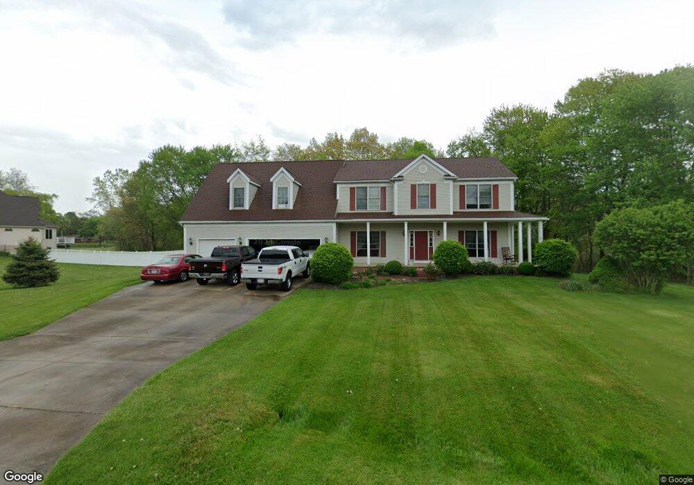
2681 Watervale Dr Uniontown, OH 44685
Estimated Value: $397,000 - $509,463
4
Beds
3
Baths
2,611
Sq Ft
$172/Sq Ft
Est. Value
About This Home
This home is located at 2681 Watervale Dr, Uniontown, OH 44685 and is currently estimated at $448,866, approximately $171 per square foot. 2681 Watervale Dr is a home located in Summit County with nearby schools including Greenwood Elementary School, Green Primary School, and Green Intermediate Elementary School.
Ownership History
Date
Name
Owned For
Owner Type
Purchase Details
Closed on
Nov 4, 1998
Sold by
Charles P Temple Inc
Bought by
Brant Ronald C and Brant Rebecca J
Current Estimated Value
Home Financials for this Owner
Home Financials are based on the most recent Mortgage that was taken out on this home.
Original Mortgage
$2,650
Outstanding Balance
$585
Interest Rate
6.72%
Mortgage Type
Seller Take Back
Estimated Equity
$448,281
Create a Home Valuation Report for This Property
The Home Valuation Report is an in-depth analysis detailing your home's value as well as a comparison with similar homes in the area
Purchase History
| Date | Buyer | Sale Price | Title Company |
|---|---|---|---|
| Brant Ronald C | $33,650 | Northeast Title Agency Inc |
Source: Public Records
Mortgage History
| Date | Status | Borrower | Loan Amount |
|---|---|---|---|
| Open | Brant Ronald C | $2,650 |
Source: Public Records
Tax History
| Year | Tax Paid | Tax Assessment Tax Assessment Total Assessment is a certain percentage of the fair market value that is determined by local assessors to be the total taxable value of land and additions on the property. | Land | Improvement |
|---|---|---|---|---|
| 2024 | $6,709 | $143,095 | $34,087 | $109,008 |
| 2023 | $6,709 | $143,095 | $34,087 | $109,008 |
| 2022 | $5,536 | $106,152 | $25,249 | $80,903 |
| 2021 | $5,189 | $106,152 | $25,249 | $80,903 |
| 2020 | $5,088 | $106,150 | $25,250 | $80,900 |
| 2019 | $4,856 | $94,640 | $31,640 | $63,000 |
| 2018 | $4,966 | $94,640 | $31,640 | $63,000 |
| 2017 | $4,627 | $94,640 | $31,640 | $63,000 |
| 2016 | $4,605 | $82,740 | $31,640 | $51,100 |
| 2015 | $4,627 | $82,740 | $31,640 | $51,100 |
| 2014 | $4,597 | $82,740 | $31,640 | $51,100 |
| 2013 | $4,757 | $85,140 | $31,640 | $53,500 |
Source: Public Records
Map
Nearby Homes
- 2771 Superior Dr
- 2941 Sweitzer Rd
- 2512 Twin Lakes Dr
- 2958 E Turkeyfoot Lake Rd
- 3771 Edison St NW
- 13675 Cleveland Ave NW Unit 41
- 3788 Carl St NW
- 3411 Sweitzer St NW
- 2667 Spade Rd
- 3540 Bushwillow Dr
- 3544 Bushwillow Dr
- 2898 Canton Rd
- 3290 Sweitzer St NW
- 3680 Timber Lake St NW
- 13526 Glenvale Ave NW
- 3025 Killian Rd
- 2390 Auberry Dr
- 2190 Waterbury Dr
- 2575 Myersville Rd
- 0 E Turkeyfoot Lake Rd Unit 5181695
- 2673 Watervale Dr
- 2573 Serenity Ln
- 3435 Bushwillow Dr
- 3439 Alder Ave
- 3440 Alder Ave
- 3436 Alder Ave
- 3439 Bushwillow Dr
- 3428 Bushwillow Dr
- 3438 Bushwillow Dr
- 2672 Watervale Dr
- 2664 Watervale Dr
- 2656 Watervale Dr
- 2648 Watervale Dr
- 2538 Woodview Rd
- 2559 Serenity Ln
- 2541 Serenity Ln
- 2698 Watervale Dr
- 2574 Serenity Ln
- 2699 Watervale Dr
- V/L Woodview Rd
Your Personal Tour Guide
Ask me questions while you tour the home.