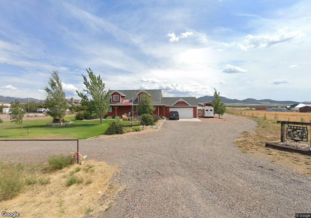
2682 E Bench Rd N Enterprise, UT 84725
Estimated Value: $560,000 - $676,000
4
Beds
3
Baths
2,533
Sq Ft
$241/Sq Ft
Est. Value
About This Home
This home is located at 2682 E Bench Rd N, Enterprise, UT 84725 and is currently estimated at $610,691, approximately $241 per square foot. 2682 E Bench Rd N is a home with nearby schools including Enterprise School and Enterprise High School.
Ownership History
Date
Name
Owned For
Owner Type
Purchase Details
Closed on
Jun 23, 2016
Sold by
Gardner Belva S
Bought by
Barlow Deanna Lynn and Barlow Jeffrey D
Current Estimated Value
Purchase Details
Closed on
Jun 18, 2016
Sold by
Barlow Deanna Lynn and Barlow Jeffrey D
Bought by
Reber Ranon T and Reber Rayna L
Purchase Details
Closed on
Dec 26, 2006
Sold by
Gardner Melvin H and Gardner Belva S
Bought by
Barlow Deanna Lynn and Barlow Jeffrey D
Create a Home Valuation Report for This Property
The Home Valuation Report is an in-depth analysis detailing your home's value as well as a comparison with similar homes in the area
Purchase History
| Date | Buyer | Sale Price | Title Company |
|---|---|---|---|
| Barlow Deanna Lynn | -- | Southern Utah Title | |
| Reed Duncan M | -- | Southern Utah Title | |
| Reber Ranon T | -- | Southern Utah Title | |
| Barlow Deanna Lynn | -- | None Available |
Source: Public Records
Tax History
| Year | Tax Paid | Tax Assessment Tax Assessment Total Assessment is a certain percentage of the fair market value that is determined by local assessors to be the total taxable value of land and additions on the property. | Land | Improvement |
|---|---|---|---|---|
| 2025 | $1,935 | $292,325 | $58,355 | $233,970 |
| 2023 | $1,864 | $293,590 | $51,755 | $241,835 |
| 2022 | $1,865 | $276,980 | $35,200 | $241,780 |
| 2021 | $1,715 | $380,300 | $44,000 | $336,300 |
| 2020 | $1,342 | $283,800 | $20,000 | $263,800 |
| 2019 | $1,264 | $260,100 | $20,000 | $240,100 |
| 2018 | $1,209 | $126,775 | $0 | $0 |
| 2017 | $1,061 | $111,235 | $0 | $0 |
| 2016 | $124 | $12,100 | $0 | $0 |
| 2015 | $160 | $15,000 | $0 | $0 |
| 2014 | $158 | $15,000 | $0 | $0 |
Source: Public Records
Map
Nearby Homes
- 1165 2800 E
- 0 2600 E
- 1300 2600 E Unit 8
- TBD N 2800 E
- TBD N 2800 E Unit Lot 18
- 1380 2800 E
- TBD 15 N 3000 E
- 2925 Juniper Rd
- 9600 Utah 18
- 950 E 100 N
- 775 E 100 N Unit 56
- 775 E 100 N Unit 48
- 900 E Main St
- 900 E Main St Unit lot 3
- 0 1 21 Acre Parcel #E-Cwr-2-10 Unit 110695
- 0 1 21 Acre Parcel #E-Cwr-2-10 Unit 25-259941
- 925 E Main St Unit lot 4
- 711 E Main St
- 925 E Main St
- 762 E 300 S
- 2716 E Bench Rd
- 2687 E Bench Rd
- 1252 N 2600 E
- 2618 E 1200 N
- 1324 E 1200 N
- 2200 Bench Rd
- 1324 N 2600 E
- 1187 N 2800 E
- 2735 E 1200 N
- 2735 E Bench Rd
- 2761 Bench Rd
- 1143 N 2800 E
- 2789 E Bench Rd
- 1224 N 2800 E
- 1268 2800 E
- 1188 N 2800 E
- 1368 N 2600 E
- 1121 N 2800 E
- 2823 E 1200 N
- 4 Miles W On Hell's Backbone Rd
Your Personal Tour Guide
Ask me questions while you tour the home.