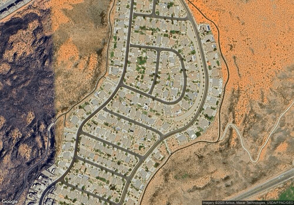
2682 E Rock Land Dr Washington, UT 84780
Highland Park NeighborhoodEstimated Value: $554,000 - $622,000
3
Beds
2
Baths
1,739
Sq Ft
$333/Sq Ft
Est. Value
About This Home
This home is located at 2682 E Rock Land Dr, Washington, UT 84780 and is currently estimated at $578,763, approximately $332 per square foot. 2682 E Rock Land Dr is a home with nearby schools including Coral Canyon School, Pine View Middle School, and Fossil Ridge Intermediate School.
Ownership History
Date
Name
Owned For
Owner Type
Purchase Details
Closed on
Apr 11, 2018
Sold by
Lauermann Patricia Ann
Bought by
Jaynes Michael D and Jaynes Kelli
Current Estimated Value
Purchase Details
Closed on
Aug 30, 2017
Sold by
Hollibaugh Ronald D and Hollibaugh Jane M
Bought by
Lauremann Patricia Ann
Home Financials for this Owner
Home Financials are based on the most recent Mortgage that was taken out on this home.
Original Mortgage
$109,900
Interest Rate
3.96%
Mortgage Type
New Conventional
Purchase Details
Closed on
May 7, 2013
Sold by
Montamble Philip and Montamble Linda S
Bought by
Hollibaugh Ronald D and Hollibaugh Jane M
Home Financials for this Owner
Home Financials are based on the most recent Mortgage that was taken out on this home.
Original Mortgage
$216,000
Interest Rate
3.54%
Mortgage Type
New Conventional
Purchase Details
Closed on
Apr 22, 2011
Sold by
Coral Canyon Builders Llc
Bought by
Montamble Philip and Montamble Linda S
Create a Home Valuation Report for This Property
The Home Valuation Report is an in-depth analysis detailing your home's value as well as a comparison with similar homes in the area
Home Values in the Area
Average Home Value in this Area
Purchase History
| Date | Buyer | Sale Price | Title Company |
|---|---|---|---|
| Jaynes Michael D | -- | Infinity Title Ins Agcy Llc | |
| Lauremann Patricia Ann | -- | Southern Utah Title Co | |
| Hollibaugh Ronald D | -- | Southern Utah Title | |
| Montamble Philip | -- | Southern Utah Title |
Source: Public Records
Mortgage History
| Date | Status | Borrower | Loan Amount |
|---|---|---|---|
| Previous Owner | Lauremann Patricia Ann | $109,900 | |
| Previous Owner | Hollibaugh Ronald D | $216,000 |
Source: Public Records
Tax History Compared to Growth
Tax History
| Year | Tax Paid | Tax Assessment Tax Assessment Total Assessment is a certain percentage of the fair market value that is determined by local assessors to be the total taxable value of land and additions on the property. | Land | Improvement |
|---|---|---|---|---|
| 2025 | $2,279 | $302,115 | $69,300 | $232,815 |
| 2023 | $2,338 | $294,910 | $55,000 | $239,910 |
| 2022 | $2,276 | $265,815 | $46,750 | $219,065 |
| 2021 | $2,084 | $368,000 | $70,000 | $298,000 |
| 2020 | $3,646 | $332,500 | $65,000 | $267,500 |
| 2019 | $3,625 | $318,200 | $60,000 | $258,200 |
| 2018 | $3,430 | $274,400 | $0 | $0 |
| 2017 | $1,872 | $141,295 | $0 | $0 |
| 2016 | $1,969 | $139,920 | $0 | $0 |
| 2015 | $1,993 | $137,390 | $0 | $0 |
| 2014 | $1,895 | $131,340 | $0 | $0 |
Source: Public Records
Map
Nearby Homes
- 1007 N Mountainside Ave
- 1163 N Crown King Ave
- 1624 N Crown King Ave Unit 121
- 1624 N Crown King Ave Unit 133
- 1624 N Crown King Ave Unit 134
- 1210 N Mistico Alley
- 1189 N Bello Alley
- 1231 N Mistico Alley
- 1235 N Mistico Alley
- 1162 N Riviera Alley
- 2343 E Escondido Dr
- 2323 E Escondido Dr
- Atlas Plan at Solis
- Sonoran Plan at Solis
- Mesa Plan at Solis
- Orion Plan at Solis
- Mojave Plan at Solis
- Highland Plan at Solis
- Apollo Plan at Solis
- Upland at Solis
- 2670 E Rock Land Dr
- 2694 E Rock Land Dr
- 2656 E Rock Land Dr
- 2706 E Rock Land Dr
- 2653 E Clear Point Dr
- 2663 E Clear Point Dr
- 2642 E Rock Land Dr
- 961 N Silver Lode Ave
- 2673 E Clear Point Dr
- 2641 E Clear Point Dr
- 2629 E Clear Point Dr Unit Lot 188
- 2629 E Clear Point Dr
- 2683 E Clear Point Dr
- 2711 E Rock Land Dr Unit 234
- 970 N Silver Lode Ave
- 2720 E Rock Land Dr
- 2695 E Clear Point Dr
- 2615 E Clear Point Dr
- 2628 E Rock Land Dr
- 979 N Silver Lode Ave
